خانه / مشخصات زلزله
Magnitude |
:3 |
| Date & Time (UTC) | 2017-11-14 04:47:56.1 |
| Date & Time (Local) | 1396/8/23 08:17:56.1 |
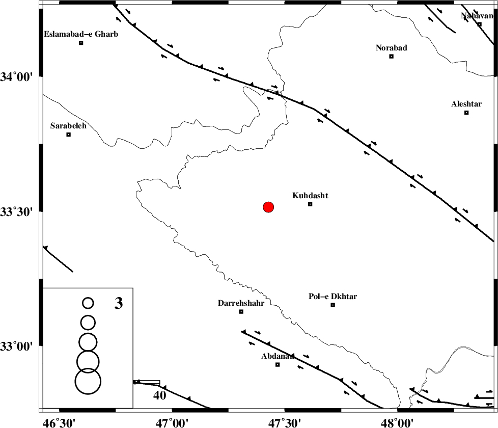
| Location | Lat:33.516 Lon: 47.427 |
| Region | Lorestan Province, 17 km -West of Kuhdasht |
Nearest Cities |
|
| 6 km North of Ashtarheh golgol, Lorestan Province | |
| 15 km North of Kunani, Lorestan Province | |
| 17 km North East of Garab, Lorestan Province | |
| 17 km West of Kuhdasht, Lorestan Province | |
| 21 km North of Suri, Lorestan Province | |
| Depth | 18 km |
| Agency | |
Faults within 150 km: |
|
| HZF4 (Length: 492 km) , Distance to epicenter: 45 km | |
| BALARUD_F_Z1 (Length: 87 km) , Distance to epicenter: 53 km | |
| MFF7 (Length: 99 km) , Distance to epicenter: 85 km | |
| Number of Phases | 6 |
| RMS | 0.1 |
| Number of Stations | 5 |
| Error in Latitude | >3 km |
| Error in Longitude | 5.2 km |
| Error in Depth | 8.7 km |
Download waveform in seisan format
to download seisan software Click here
to access information about IIEES stations Click here
Amplitude | ||||||||
| UID | Agency | Station | Component | Amplitude | Period | Arrival Time | Proccessing Time | Signal Clip |
| 121541 | IIEES | ILBA | N | 312.9 | 0.34 | 2017-11-14 04:48:35 | 2017-11-14 06:25:00 | n |
| 121542 | IIEES | SNGE | E | 152.9 | 0.43 | 2017-11-14 04:48:50 | 2017-11-14 06:25:00 | n |
| 121543 | IIEES | SNGE | N | 198.8 | 0.73 | 2017-11-14 04:48:52 | 2017-11-14 06:25:00 | n |
Phase | ||||||||||||
| Agency | Station | Component | Phase Type | Phase Quality | First Motion | Observed Arrival Time | Time Residual | Loc. Flag | Input Weight | Distance | Azimuth | |
| IIEES | ILBA | Z | Pg | E | 2017-11-14 04:48:15 | -0.05 | y | 114 | 276 | |||
| IIEES | SNGE | Z | Pg | E | 2017-11-14 04:48:25 | 0.29 | y | 175 | 358 | |||
| IIEES | SNGE | N | Sg | E | 2017-11-14 04:48:46 | -0.14 | y | 175 | 358 | |||
| IIEES | ASAO | Z | Pn | E | 2017-11-14 04:48:36 | -0.03 | y | 266 | 64 | |||
| IIEES | ZNJK | Z | Pn | E | 2017-11-14 04:48:49 | -0.04 | y | 368 | 18 | |||
| IIEES | GHVR | Z | Pn | E | 2017-11-14 04:48:49 | -0.04 | y | 369 | 72 | |||
کلیه حقوق مادی و معنوی این سایت متعلق به پژوهشگاه بین المللی زلزله شناسی و مهندسی زلزله می باشد.
