خانه / مشخصات زلزله
Magnitude |
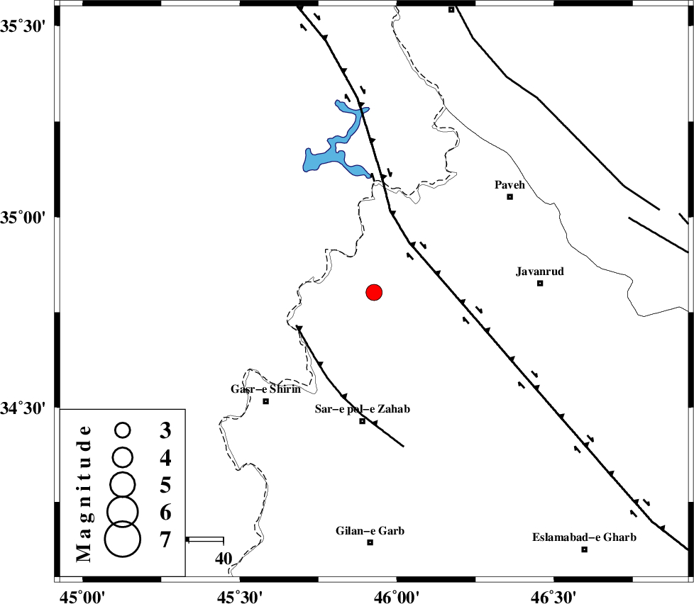
:3.3 |
| Date & Time (UTC) | 2018-02-10 03:02:44.8 |
| Date & Time (Local) | 1396/11/21 06:32:44.8 |
| Location | Lat:34.802 Lon: 45.927 |
| Region | Kermanshah Province, 10 km of Tazehabad |
Nearest Cities |
|
| 7 km of Dehsheykh, Kermanshah Province | |
| 10 km North of Tazehabad, Kermanshah Province | |
| 15 km North East of Gardehnu, Kermanshah Province | |
| 19 km North of Bazmirabad, Kermanshah Province | |
| 19 km North East of Tappeh rash, Kermanshah Province | |
| Depth | 27 km |
| Agency | |
Faults within 150 km: |
|
| HZF4 (Length: 492 km) , Distance to epicenter: 18 km | |
| MFF8 (Length: 48 km) , Distance to epicenter: 25 km | |
| PIRANSHAHR_F (Length: 253 km) , Distance to epicenter: 74 km | |
| Number of Phases | 9 |
| RMS | 0.2 |
| Number of Stations | 7 |
| Error in Latitude | >5.1 km |
| Error in Longitude | 4.5 km |
| Error in Depth | 5.3 km |
Download waveform in seisan format
to download seisan software Click here
to access information about IIEES stations Click here
Amplitude | ||||||||
| UID | Agency | Station | Component | Amplitude | Period | Arrival Time | Proccessing Time | Signal Clip |
| 128055 | IIEES | SNGE | N | 442.3 | 0.49 | 2018-02-10 03:03:29 | 2018-02-10 09:22:00 | n |
| 128056 | IIEES | SRSL | E | 439.8 | 0.4 | 2018-02-10 03:03:33 | 2018-02-10 09:22:00 | n |
| 128057 | IIEES | SRSL | N | 518.3 | 0.59 | 2018-02-10 03:03:36 | 2018-02-10 09:22:00 | n |
Phase | ||||||||||||
| Agency | Station | Component | Phase Type | Phase Quality | First Motion | Observed Arrival Time | Time Residual | Loc. Flag | Input Weight | Distance | Azimuth | |
| IIEES | SNGE | Z | Pg | E | 2018-02-10 03:03:07 | 0.45 | y | 134 | 76 | |||
| IIEES | SNGE | N | S | E | 2018-02-10 03:03:22 | -0.25 | y | 134 | 76 | |||
| IIEES | SRSL | Z | Pg | E | 2018-02-10 03:03:11 | -0.07 | y | 163 | 344 | |||
| IIEES | SRSL | N | Sg | E | 2018-02-10 03:03:30 | -0.1 | y | 163 | 344 | |||
| IIEES | ZNJK | Z | Pn | E | 2018-02-10 03:03:32 | 0.24 | y | 324 | 49 | |||
| IIEES | ASAO | Z | Pn | E | 2018-02-10 03:03:38 | -0.1 | y | 377 | 93 | |||
| IIEES | KHMZ | Z | Pn | E | 2018-02-10 03:03:39 | -0.32 | y | 390 | 106 | |||
| IIEES | GIDE | Z | Pn | E | 2018-02-10 03:03:44 | 0.06 | y | 430 | 56 | |||
| IIEES | GRMI | Z | Pn | E | 2018-02-10 03:03:50 | 0.08 | y | 478 | 21 | |||
کلیه حقوق مادی و معنوی این سایت متعلق به پژوهشگاه بین المللی زلزله شناسی و مهندسی زلزله می باشد.
