خانه / مشخصات زلزله
Magnitude |
:2.6 |
| Date & Time (UTC) | 2018-04-20 15:45:18.0 |
| Date & Time (Local) | 1397/1/31 20:15:18.0 |
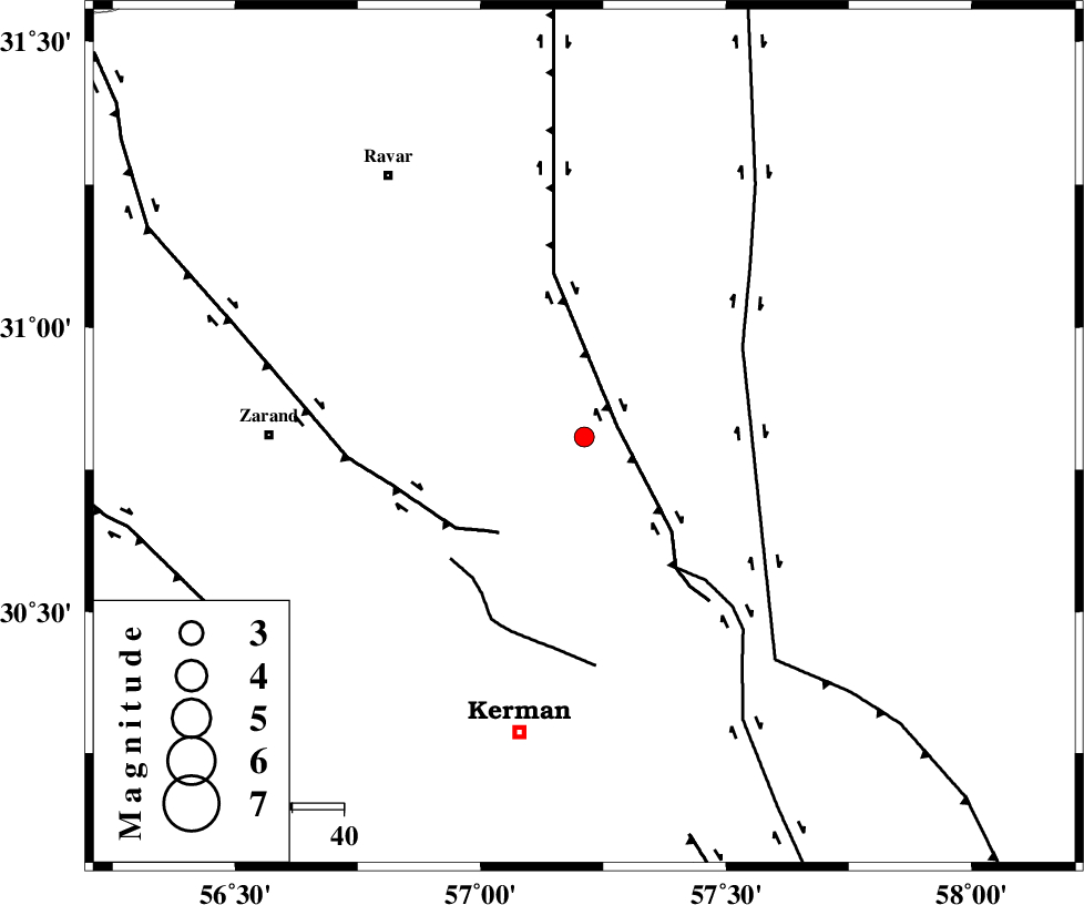
| Location | Lat:30.807 Lon: 57.211 |
| Region | Kerman Province, 61 km -East of Zarand |
Nearest Cities |
|
| 18 km North of Harjand, Kerman Province | |
| 23 km North East of Hejdak, Kerman Province | |
| 34 km North of Dehlulu, Kerman Province | |
| 37 km North East of Chatrud, Kerman Province | |
| 37 km North East of Hutak, Kerman Province | |
| Depth | 14 km |
| Agency | |
Faults within 150 km: |
|
| LAKARKUH_F (Length: 138 km) , Distance to epicenter: 7 km | |
| KUHBANAN_F (Length: 189 km) , Distance to epicenter: 25 km | |
| GOLBAF_SIRCH_F (Length: 114 km) , Distance to epicenter: 31 km | |
| Number of Phases | 7 |
| RMS | 0.4 |
| Number of Stations | 5 |
| Error in Latitude | >3.4 km |
| Error in Longitude | 5.9 km |
| Error in Depth | 9.1 km |
Download waveform in seisan format
to download seisan software Click here
to access information about IIEES stations Click here
Amplitude | ||||||||
| UID | Agency | Station | Component | Amplitude | Period | Arrival Time | Proccessing Time | Signal Clip |
| 131616 | IIEES | TABS | N | 15.7 | 0.83 | 2018-04-20 15:47:02 | 2018-05-14 07:03:00 | n |
Phase | ||||||||||||
| Agency | Station | Component | Phase Type | Phase Quality | First Motion | Observed Arrival Time | Time Residual | Loc. Flag | Input Weight | Distance | Azimuth | |
| IIEES | KRBR | Z | Pg | E | 2018-04-20 15:45:34 | -0.48 | y | 101 | 205 | |||
| IIEES | YZKH | Z | Pn | E | 2018-04-20 15:46:04 | 0.6 | y | 304 | 306 | |||
| IIEES | YZKH | N | Sg | E | 2018-04-20 15:46:43 | -0.27 | y | 304 | 306 | |||
| IIEES | TABS | Z | Pn | E | 2018-04-20 15:46:04 | 0.05 | y | 315 | 358 | |||
| IIEES | TABS | N | Sg | E | 2018-04-20 15:46:46 | -0.44 | y | 315 | 358 | |||
| IIEES | SHRT | Z | Pn | E | 2018-04-20 15:46:19 | 0.15 | y | 428 | 42 | |||
| IIEES | NASN | Z | Pn | E | 2018-04-20 15:46:25 | 0.6 | y | 472 | 299 | |||
کلیه حقوق مادی و معنوی این سایت متعلق به پژوهشگاه بین المللی زلزله شناسی و مهندسی زلزله می باشد.
