خانه / مشخصات زلزله
Magnitude |
:2.3 |
| Date & Time (UTC) | 2018-04-01 06:23:47.4 |
| Date & Time (Local) | 1397/1/12 10:53:47.4 |
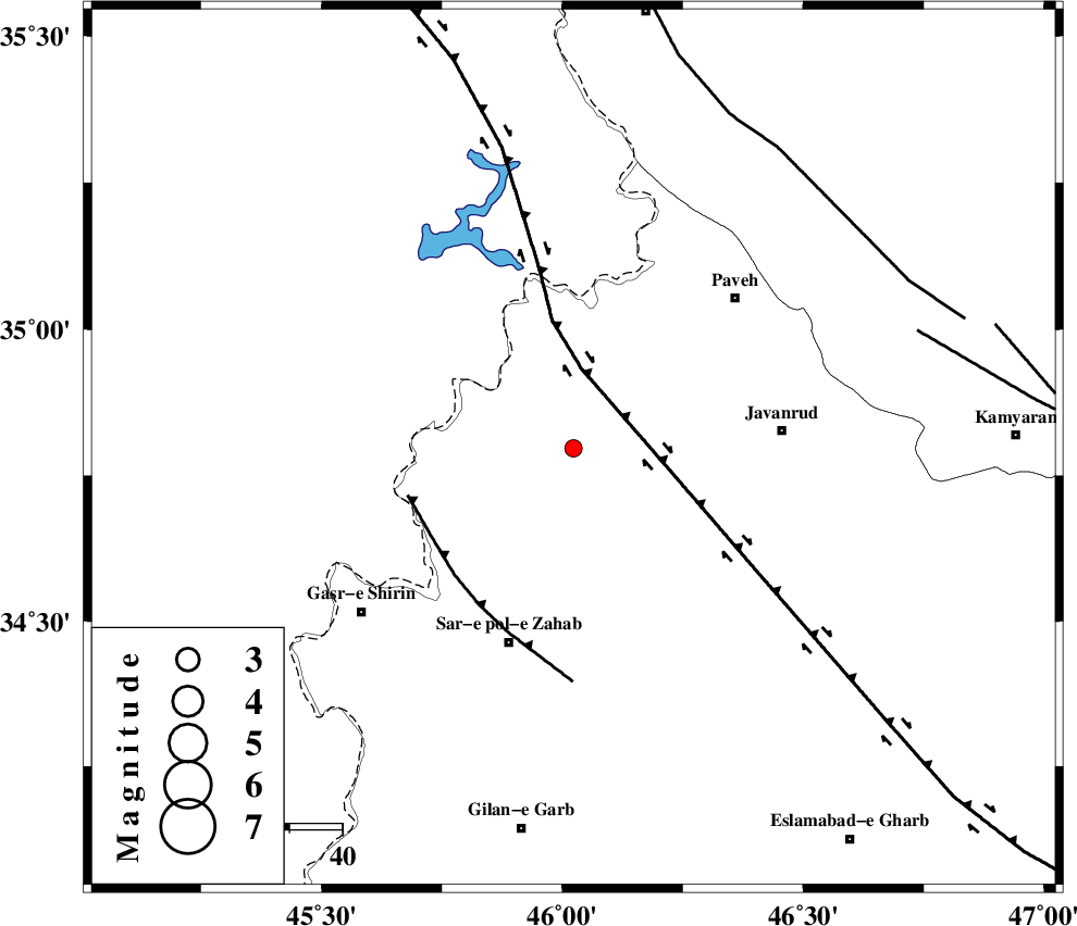
| Location | Lat:34.796 Lon: 46.023 |
| Region | Kermanshah Province, 18 km -East of Tazehabad |
Nearest Cities |
|
| 8 km of Dehsheykh, Kermanshah Province | |
| 15 km North West of Qolqoleh, Kermanshah Province | |
| 18 km North East of Tazehabad, Kermanshah Province | |
| 18 km South West of Mazran, Kermanshah Province | |
| 19 km South of Bayangan, Kermanshah Province | |
| Depth | 16 km |
| Agency | |
Faults within 150 km: |
|
| HZF4 (Length: 492 km) , Distance to epicenter: 15 km | |
| MFF8 (Length: 48 km) , Distance to epicenter: 32 km | |
| SARTAKHT_F (Length: 78 km) , Distance to epicenter: 69 km | |
| Number of Phases | 5 |
| RMS | 0 |
| Number of Stations | 4 |
| Error in Latitude | >3 km |
| Error in Longitude | 8.2 km |
| Error in Depth | 3.4 km |
Download waveform in seisan format
to download seisan software Click here
to access information about IIEES stations Click here
Amplitude | ||||||||
| UID | Agency | Station | Component | Amplitude | Period | Arrival Time | Proccessing Time | Signal Clip |
| 133083 | IIEES | ILBA | E | 57.2 | 0.38 | 2018-04-01 06:24:32 | 2018-06-03 11:40:00 | n |
Phase | ||||||||||||
| Agency | Station | Component | Phase Type | Phase Quality | First Motion | Observed Arrival Time | Time Residual | Loc. Flag | Input Weight | Distance | Azimuth | |
| IIEES | SNGE | Z | Pg | E | 2018-04-01 06:24:08 | 0 | y | 125 | 74 | |||
| IIEES | ILBA | Z | Pg | E | 2018-04-01 06:24:09 | 0 | y | 131 | 172 | |||
| IIEES | ILBA | N | Sg | E | 2018-04-01 06:24:25 | -0.01 | y | 131 | 172 | |||
| IIEES | ASAO | Z | Pn | E | 2018-04-01 06:24:40 | -0.04 | y | 368 | 93 | |||
| IIEES | KHMZ | Z | Pn | E | 2018-04-01 06:24:42 | 0.04 | y | 381 | 107 | |||
کلیه حقوق مادی و معنوی این سایت متعلق به پژوهشگاه بین المللی زلزله شناسی و مهندسی زلزله می باشد.
