خانه / مشخصات زلزله
Magnitude |
:2.7 |
| Date & Time (UTC) | 2018-07-26 07:42:07.5 |
| Date & Time (Local) | 1397/5/4 12:12:07.5 |
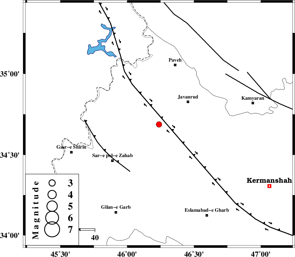
| Location | Lat:34.687 Lon: 46.238 |
| Region | Kermanshah Province, 25 km South-West of Javanrud |
Nearest Cities |
|
| 7 km North of Mirabad, Kermanshah Province | |
| 8 km of Qolqoleh, Kermanshah Province | |
| 18 km South of Shervineh, Kermanshah Province | |
| 21 km West of Sarukhan, Kermanshah Province | |
| 21 km North West of Dolatabad, Kermanshah Province | |
| Depth | 6 km |
| Agency | |
Faults within 150 km: |
|
| HZF4 (Length: 492 km) , Distance to epicenter: 7 km | |
| MFF8 (Length: 48 km) , Distance to epicenter: 38 km | |
| SARTAKHT_F (Length: 78 km) , Distance to epicenter: 57 km | |
| Number of Phases | 6 |
| RMS | 0.1 |
| Number of Stations | 4 |
| Error in Latitude | >2.5 km |
| Error in Longitude | 4.5 km |
| Error in Depth | 3.8 km |
Download waveform in seisan format
to download seisan software Click here
to access information about IIEES stations Click here
Amplitude | ||||||||
| UID | Agency | Station | Component | Amplitude | Period | Arrival Time | Proccessing Time | Signal Clip |
| 135431 | IIEES | ILBA | N | 176.3 | 0.21 | 2018-07-26 07:42:50 | 2018-08-01 06:47:00 | n |
| 135432 | IIEES | ILBA | E | 173.1 | 0.42 | 2018-07-26 07:42:54 | 2018-08-01 06:47:00 | n |
Phase | ||||||||||||
| Agency | Station | Component | Phase Type | Phase Quality | First Motion | Observed Arrival Time | Time Residual | Loc. Flag | Input Weight | Distance | Azimuth | |
| IIEES | SNGE | Z | Pg | E | 2018-07-26 07:42:26 | 0.08 | y | 111 | 66 | |||
| IIEES | SNGE | N | Sg | E | 2018-07-26 07:42:40 | -0.11 | y | 111 | 66 | |||
| IIEES | ILBA | Z | Pg | E | 2018-07-26 07:42:27 | 0.02 | y | 118 | 181 | |||
| IIEES | ILBA | N | Sg | E | 2018-07-26 07:42:42 | -0.06 | y | 118 | 181 | |||
| IIEES | ZNJK | Z | Pn | E | 2018-07-26 07:42:55 | -0.07 | y | 312 | 44 | |||
| IIEES | ASAO | Z | Pn | E | 2018-07-26 07:42:59 | 0.17 | y | 348 | 91 | |||
کلیه حقوق مادی و معنوی این سایت متعلق به پژوهشگاه بین المللی زلزله شناسی و مهندسی زلزله می باشد.
