خانه / مشخصات زلزله
Magnitude |
:2.9 |
| Date & Time (UTC) | 2018-10-21 04:11:22.8 |
| Date & Time (Local) | 1397/7/29 07:41:22.8 |
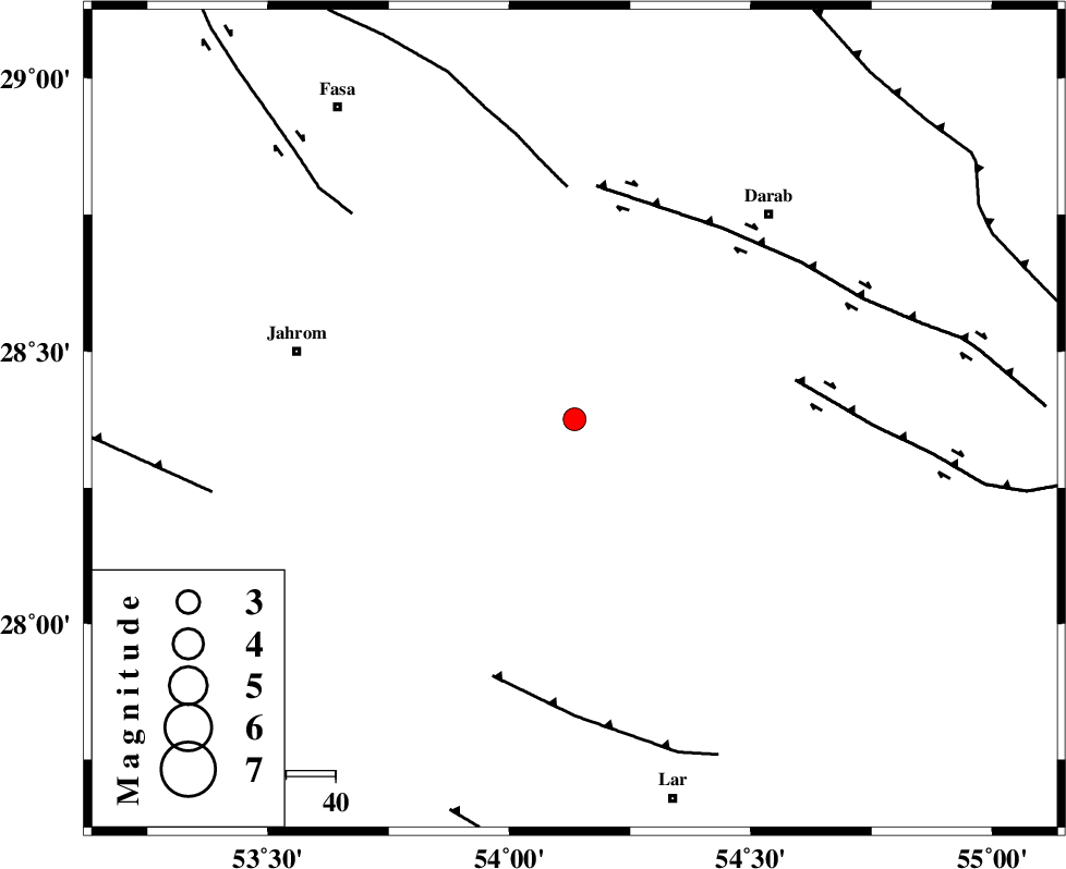
| Location | Lat:28.375 Lon: 54.135 |
| Region | Fars Province, 58 km South-East of Jahrom |
Nearest Cities |
|
| 7 km of Dabiran, Fars Province | |
| 22 km North West of Shahr-e pir, Fars Province | |
| 28 km North West of Hajiabad, Fars Province | |
| 33 km North East of Juyam, Fars Province | |
| 41 km East of Khorramabad, Fars Province | |
| Depth | 18 km |
| Agency | |
Faults within 150 km: |
|
| HZF2 (Length: 437 km) , Distance to epicenter: 45 km | |
| BAKHTEGAN_F (Length: 94 km) , Distance to epicenter: 47 km | |
| HZF1 (Length: 102 km) , Distance to epicenter: 48 km | |
| Number of Phases | 6 |
| RMS | 0.4 |
| Number of Stations | 4 |
| Error in Latitude | >6.1 km |
| Error in Longitude | 3.7 km |
| Error in Depth | 8.8 km |
Download waveform in seisan format
to download seisan software Click here
to access information about IIEES stations Click here
Amplitude | ||||||||
| UID | Agency | Station | Component | Amplitude | Period | Arrival Time | Proccessing Time | Signal Clip |
| 137933 | IIEES | GHIR | N | 819.8 | 0.38 | 2018-10-21 04:11:58 | 2018-10-21 09:25:00 | n |
| 137934 | IIEES | BNDS | E | 35.5 | 0.49 | 2018-10-21 04:12:41 | 2018-10-21 09:25:00 | n |
| 137935 | IIEES | BNDS | N | 42.7 | 0.3 | 2018-10-21 04:12:42 | 2018-10-21 09:25:00 | n |
| 137936 | IIEES | KRBR | N | 33.4 | 0.38 | 2018-10-21 04:12:55 | 2018-10-21 09:25:00 | n |
| 137937 | IIEES | KRBR | E | 37 | 0.47 | 2018-10-21 04:12:57 | 2018-10-21 09:25:00 | n |
Phase | ||||||||||||
| Agency | Station | Component | Phase Type | Phase Quality | First Motion | Observed Arrival Time | Time Residual | Loc. Flag | Input Weight | Distance | Azimuth | |
| IIEES | GHIR | Z | Pg | E | 2018-10-21 04:11:41 | -0.58 | y | 113 | 265 | |||
| IIEES | GHIR | N | Sg | E | 2018-10-21 04:11:56 | 0.48 | y | 113 | 265 | |||
| IIEES | BNDS | Z | Pn | E | 2018-10-21 04:11:58 | 0 | y | 228 | 118 | |||
| IIEES | KRBR | Z | Pn | E | 2018-10-21 04:12:09 | 0.27 | y | 311 | 54 | |||
| IIEES | KRBR | N | Sg | E | 2018-10-21 04:12:50 | 0.09 | y | 311 | 54 | |||
| IIEES | YZKH | Z | Pn | E | 2018-10-21 04:12:25 | -0.3 | y | 447 | 6 | |||
کلیه حقوق مادی و معنوی این سایت متعلق به پژوهشگاه بین المللی زلزله شناسی و مهندسی زلزله می باشد.
