خانه / مشخصات زلزله
Magnitude |
:2.5 |
| Date & Time (UTC) | 2018-11-09 19:25:55.7 |
| Date & Time (Local) | 1397/8/18 22:55:55.7 |
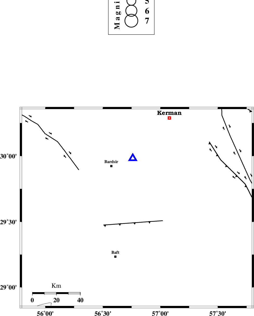
| Location | Lat:29.606 Lon: 56.796 |
| Region | Kerman Province, 41 km South-East of Bardsir |
Nearest Cities |
|
| 10 km North of Lalehzar, Kerman Province | |
| 15 km North East of Ghale-ye asgar, Kerman Province | |
| 28 km South of Negar, Kerman Province | |
| 32 km North East of Karin, Kerman Province | |
| 32 km North West of Siyah bonueyeh, Kerman Province | |
| Depth | 14 km |
| Agency | |
Faults within 150 km: |
|
| LALEHZAR_F (Length: 52 km) , Distance to epicenter: 24 km | |
| RAFSANJAN_F (Length: 129 km) , Distance to epicenter: 58 km | |
| GOWK_F (Length: 152 km) , Distance to epicenter: 81 km | |
| Number of Phases | 8 |
| RMS | 0.2 |
| Number of Stations | 5 |
| Error in Latitude | >5.5 km |
| Error in Longitude | 2.9 km |
| Error in Depth | 8.5 km |
Download waveform in seisan format
to download seisan software Click here
to access information about IIEES stations Click here
Amplitude | ||||||||
| UID | Agency | Station | Component | Amplitude | Period | Arrival Time | Proccessing Time | Signal Clip |
| 138302 | IIEES | TABS | N | 4.8 | 0.8 | 2018-11-09 19:28:15 | 2018-11-11 09:00:00 | n |
Phase | ||||||||||||
| Agency | Station | Component | Phase Type | Phase Quality | First Motion | Observed Arrival Time | Time Residual | Loc. Flag | Input Weight | Distance | Azimuth | |
| IIEES | KRBR | Z | Pg | E | 2018-11-09 19:26:03 | -0.52 | y | 41.8 | 355 | |||
| IIEES | KRBR | N | Sg | E | 2018-11-09 19:26:09 | 0.17 | y | 41.8 | 355 | |||
| IIEES | BSRN | Z | Pn | E | 2018-11-09 19:26:46 | 0.17 | y | 344 | 40 | |||
| IIEES | BSRN | N | Sg | E | 2018-11-09 19:27:32 | -0.01 | y | 344 | 40 | |||
| IIEES | YZKH | Z | Pn | E | 2018-11-09 19:26:50 | -0.01 | y | 374 | 326 | |||
| IIEES | YZKH | N | Sg | E | 2018-11-09 19:27:40 | 0.17 | y | 374 | 326 | |||
| IIEES | ZHSF | Z | Pn | E | 2018-11-09 19:26:51 | 0.06 | y | 385 | 89 | |||
| IIEES | TABS | Z | Pn | E | 2018-11-09 19:26:59 | 0.04 | y | 449 | 4 | |||
کلیه حقوق مادی و معنوی این سایت متعلق به پژوهشگاه بین المللی زلزله شناسی و مهندسی زلزله می باشد.
