خانه / مشخصات زلزله
Magnitude |
:2.7 |
| Date & Time (UTC) | 2018-11-27 22:56:43.6 |
| Date & Time (Local) | 1397/9/7 02:26:43.6 |
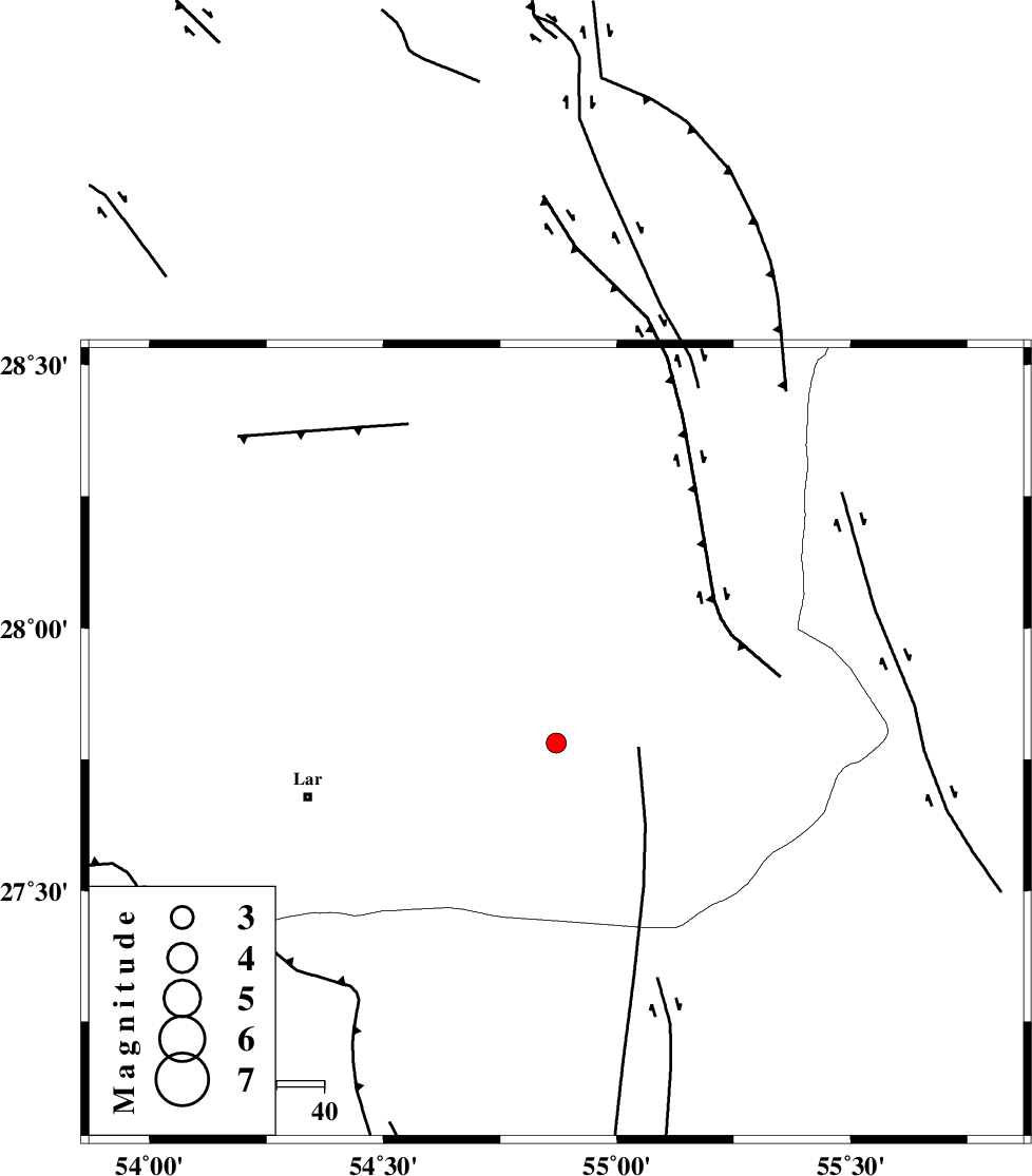
| Location | Lat:27.782 Lon: 54.87 |
| Region | Fars Province, 54 km North-East of Lar |
Nearest Cities |
|
| 45 km East of Dehkuyeh, Fars Province | |
| 49 km North East of Latifi, Fars Province | |
| 54 km North East of Lar, Fars Province | |
| 55 km West of Darz, Fars Province | |
| 56 km South West of Fadami, Fars Province | |
| Depth | 15 km |
| Agency | |
Faults within 150 km: |
|
| LAR_F (Length: 99 km) , Distance to epicenter: 19 km | |
| BERIZ_F (Length: 49 km) , Distance to epicenter: 43 km | |
| HZF2 (Length: 437 km) , Distance to epicenter: 54 km | |
| Number of Phases | 5 |
| RMS | 0.4 |
| Number of Stations | 3 |
| Error in Latitude | >4.1 km |
| Error in Longitude | 2 km |
| Error in Depth | 0 km |
Download waveform in seisan format
to download seisan software Click here
to access information about IIEES stations Click here
Amplitude | ||||||||
| UID | Agency | Station | Component | Amplitude | Period | Arrival Time | Proccessing Time | Signal Clip |
| 138800 | IIEES | KRBR | N | 26.4 | 0.62 | 2018-11-27 22:58:13 | 2018-11-28 11:07:00 | n |
| 138801 | IIEES | KRBR | E | 23.7 | 0.62 | 2018-11-27 22:58:18 | 2018-11-28 11:07:00 | n |
Phase | ||||||||||||
| Agency | Station | Component | Phase Type | Phase Quality | First Motion | Observed Arrival Time | Time Residual | Loc. Flag | Input Weight | Distance | Azimuth | |
| IIEES | BNDS | Z | Pg | E | 2018-11-27 22:57:06 | 0.23 | y | 135 | 108 | |||
| IIEES | BNDS | N | Sg | E | 2018-11-27 22:57:22 | -0.27 | y | 135 | 108 | |||
| IIEES | GHIR | Z | Pg | E | 2018-11-27 22:57:15 | -0.23 | y | 193 | 287 | |||
| IIEES | KRBR | Z | Pn | E | 2018-11-27 22:57:30 | 0.67 | y | 306 | 37 | |||
| IIEES | KRBR | N | S | E | 2018-11-27 22:58:02 | -0.39 | y | 306 | 37 | |||
کلیه حقوق مادی و معنوی این سایت متعلق به پژوهشگاه بین المللی زلزله شناسی و مهندسی زلزله می باشد.
