خانه / مشخصات زلزله
Magnitude |
:2.6 |
| Date & Time (UTC) | 2018-12-05 00:10:34.5 |
| Date & Time (Local) | 1397/9/14 03:40:34.5 |
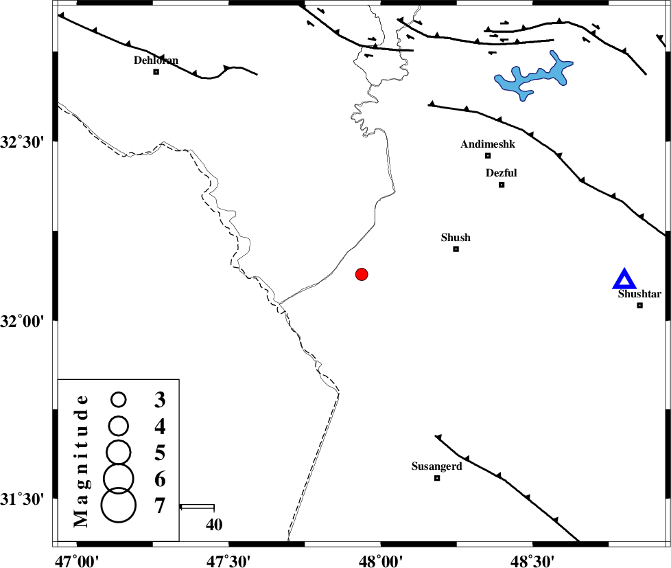
| Location | Lat:32.128 Lon: 47.937 |
| Region | Khoozestan Province, 30 km -West of Shush |
Nearest Cities |
|
| 30 km West of Shush, Khoozestan Province | |
| 33 km West of Amaleh teimur, Khoozestan Province | |
| 45 km North of Bostan, Khoozestan Province | |
| 50 km South West of Shamsabad, Khoozestan Province | |
| 52 km South West of Dezful, Khoozestan Province | |
| Depth | 15 km |
| Agency | |
Faults within 150 km: |
|
| AHVAZ_F (Length: 99 km) , Distance to epicenter: 55 km | |
| DEZFUL_EMBAYMENT (Length: 228 km) , Distance to epicenter: 56 km | |
| MFF6 (Length: 144 km) , Distance to epicenter: 70 km | |
| Number of Phases | 5 |
| RMS | 0 |
| Number of Stations | 5 |
| Error in Latitude | >9.2 km |
| Error in Longitude | 1.3 km |
| Error in Depth | 0 km |
Download waveform in seisan format
to download seisan software Click here
to access information about IIEES stations Click here
Amplitude | ||||||||
| UID | Agency | Station | Component | Amplitude | Period | Arrival Time | Proccessing Time | Signal Clip |
| 139047 | IIEES | ILBA | E | 44.6 | 0.51 | 2018-12-05 00:11:56 | 2018-12-05 10:00:00 | n |
| 139048 | IIEES | ILBA | N | 39.7 | 0.58 | 2018-12-05 00:11:58 | 2018-12-05 10:00:00 | n |
| 139049 | IIEES | GHVR | N | 6.8 | 0.36 | 2018-12-05 00:12:18 | 2018-12-05 10:00:00 | n |
| 139050 | IIEES | GHVR | E | 8.4 | 0.67 | 2018-12-05 00:12:32 | 2018-12-05 10:00:00 | n |
Phase | ||||||||||||
| Agency | Station | Component | Phase Type | Phase Quality | First Motion | Observed Arrival Time | Time Residual | Loc. Flag | Input Weight | Distance | Azimuth | |
| IIEES | ILBA | Z | Pn | E | 2018-12-05 00:11:10 | -0.01 | y | 232 | 316 | |||
| IIEES | KHMZ | Z | Pn | E | 2018-12-05 00:11:14 | 0 | y | 261 | 46 | |||
| IIEES | ASAO | Z | Pn | E | 2018-12-05 00:11:23 | -0.07 | y | 331 | 35 | |||
| IIEES | SNGE | Z | Pn | E | 2018-12-05 00:11:23 | 0.04 | y | 333 | 351 | |||
| IIEES | GHVR | Z | Pn | E | 2018-12-05 00:11:32 | 0.05 | y | 404 | 49 | |||
کلیه حقوق مادی و معنوی این سایت متعلق به پژوهشگاه بین المللی زلزله شناسی و مهندسی زلزله می باشد.
