خانه / مشخصات زلزله
Magnitude |
:2.6 |
| Date & Time (UTC) | 2018-12-07 18:34:25.1 |
| Date & Time (Local) | 1397/9/16 22:04:25.1 |
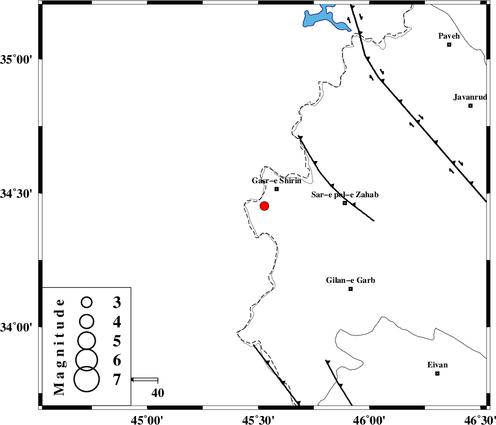
| Location | Lat:34.453 Lon: 45.527 |
| Region | Kermanshah Province, 9 km of Qasr-E-Shirin |
Nearest Cities |
|
| 6 km North of Seyyed sohrab, Kermanshah Province | |
| 8 km North of Khosravi, Kermanshah Province | |
| 9 km of Qasr-E-Shirin, Kermanshah Province | |
| 16 km West of Aqabarar, Kermanshah Province | |
| 23 km West of Qareh belagh, Kermanshah Province | |
| Depth | 15 km |
| Agency | |
Faults within 150 km: |
|
| MFF8 (Length: 48 km) , Distance to epicenter: 27 km | |
| ZFF4 (Length: 128 km) , Distance to epicenter: 58 km | |
| MFF7 (Length: 99 km) , Distance to epicenter: 69 km | |
| Number of Phases | 7 |
| RMS | 0.3 |
| Number of Stations | 5 |
| Error in Latitude | >2.6 km |
| Error in Longitude | 4.2 km |
| Error in Depth | 7.1 km |
Download waveform in seisan format
to download seisan software Click here
to access information about IIEES stations Click here
Amplitude | ||||||||
| UID | Agency | Station | Component | Amplitude | Period | Arrival Time | Proccessing Time | Signal Clip |
| 139102 | IIEES | SNGE | E | 52.8 | 0.32 | 2018-12-07 18:35:19 | 2018-12-08 06:35:00 | n |
| 139103 | IIEES | SNGE | N | 44.3 | 0.41 | 2018-12-07 18:35:21 | 2018-12-08 06:35:00 | n |
| 139104 | IIEES | SRSL | N | 83.4 | 0.37 | 2018-12-07 18:35:23 | 2018-12-08 06:35:00 | n |
| 139105 | IIEES | SRSL | E | 77.8 | 0.5 | 2018-12-07 18:35:24 | 2018-12-08 06:35:00 | n |
Phase | ||||||||||||
| Agency | Station | Component | Phase Type | Phase Quality | First Motion | Observed Arrival Time | Time Residual | Loc. Flag | Input Weight | Distance | Azimuth | |
| IIEES | ILBA | Z | Pg | E | 2018-12-07 18:34:43 | 0.11 | y | 111 | 145 | |||
| IIEES | SNGE | Z | Pg | E | 2018-12-07 18:34:54 | -0.49 | y | 181 | 66 | |||
| IIEES | SNGE | N | Sg | E | 2018-12-07 18:35:17 | 0.25 | y | 181 | 66 | |||
| IIEES | SRSL | Z | Pg | E | 2018-12-07 18:34:57 | 0.08 | y | 195 | 358 | |||
| IIEES | SRSL | N | Sg | E | 2018-12-07 18:35:20 | 0.05 | y | 195 | 358 | |||
| IIEES | ASAO | Z | Pn | E | 2018-12-07 18:35:23 | -0.33 | y | 413 | 87 | |||
| IIEES | KHMZ | Z | Pn | E | 2018-12-07 18:35:25 | 0.33 | y | 417 | 100 | |||
کلیه حقوق مادی و معنوی این سایت متعلق به پژوهشگاه بین المللی زلزله شناسی و مهندسی زلزله می باشد.
