خانه / مشخصات زلزله
Magnitude |
:2.9 |
| Date & Time (UTC) | 2018-12-06 22:16:10.0 |
| Date & Time (Local) | 1397/9/16 01:46:10.0 |
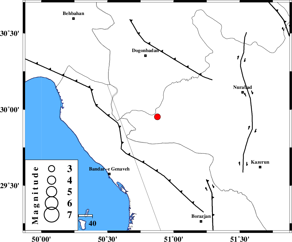
| Location | Lat:29.952 Lon: 50.877 |
| Region | Fars Province, 45 km South of Dogonbadan |
Nearest Cities |
|
| 34 km South West of Babamonir, Fars Province | |
| 43 km North East of Mohammad salehi, Bushehr Province | |
| 45 km South of Dogonbadan, Kohkiluieh va boyerahmad Province | |
| 46 km North of Chehar rustaee, Bushehr Province | |
| 53 km South West of Basht, Kohkiluieh va boyerahmad Province | |
| Depth | 15 km |
| Agency | |
Faults within 150 km: |
|
| ZFF3 (Length: 125 km) , Distance to epicenter: 29 km | |
| MISHAN_F (Length: 76 km) , Distance to epicenter: 43 km | |
| RAG_E_SEFID_F (Length: 84 km) , Distance to epicenter: 53 km | |
| Number of Phases | 6 |
| RMS | 0.1 |
| Number of Stations | 4 |
| Error in Latitude | >3.6 km |
| Error in Longitude | 4.4 km |
| Error in Depth | 9.5 km |
Download waveform in seisan format
to download seisan software Click here
to access information about IIEES stations Click here
Amplitude | ||||||||
| UID | Agency | Station | Component | Amplitude | Period | Arrival Time | Proccessing Time | Signal Clip |
| 139131 | IIEES | AHRM | E | 304.3 | 0.43 | 2018-12-06 22:16:48 | 2018-12-09 04:08:00 | n |
| 139132 | IIEES | AHRM | N | 218.3 | 0.58 | 2018-12-06 22:16:51 | 2018-12-09 04:08:00 | n |
Phase | ||||||||||||
| Agency | Station | Component | Phase Type | Phase Quality | First Motion | Observed Arrival Time | Time Residual | Loc. Flag | Input Weight | Distance | Azimuth | |
| IIEES | AHRM | Z | Pg | E | 2018-12-06 22:16:31 | 0.02 | y | 127 | 161 | |||
| IIEES | AHRM | N | Sg | E | 2018-12-06 22:16:46 | -0.02 | y | 127 | 161 | |||
| IIEES | NASN | Z | Pn | E | 2018-12-06 22:17:03 | -0.1 | y | 365 | 30 | |||
| IIEES | NASN | N | S | E | 2018-12-06 22:17:42 | 0 | y | 365 | 30 | |||
| IIEES | YZKH | Z | Pn | E | 2018-12-06 22:17:13 | 0.09 | y | 445 | 52 | |||
| IIEES | SNGE | Z | Pn | E | 2018-12-06 22:17:39 | 0.03 | y | 659 | 331 | |||
کلیه حقوق مادی و معنوی این سایت متعلق به پژوهشگاه بین المللی زلزله شناسی و مهندسی زلزله می باشد.
