خانه / مشخصات زلزله
Magnitude |
:2.5 |
| Date & Time (UTC) | 2018-12-09 08:59:09.6 |
| Date & Time (Local) | 1397/9/18 12:29:09.6 |
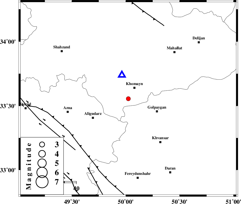
| Location | Lat:33.556 Lon: 50.024 |
| Region | Markazi Province, 11 km of Khomeyn |
Nearest Cities |
|
| 7 km North of Farnaq, Markazi Province | |
| 11 km of Khomeyn, Markazi Province | |
| 16 km North East of Dehnu, Markazi Province | |
| 21 km South East of Qorchibashi, Markazi Province | |
| 25 km North of Veyst, Esfahan Province | |
| Depth | 14 km |
| Agency | |
Faults within 150 km: |
|
| MAIN_ZAGROS_R_F (Length: 1106 km) , Distance to epicenter: 58 km | |
| DORUD (Length: 100 km) , Distance to epicenter: 64 km | |
| ARDAL_F (Length: 170 km) , Distance to epicenter: 69 km | |
| Number of Phases | 6 |
| RMS | 0.1 |
| Number of Stations | 4 |
| Error in Latitude | >2.2 km |
| Error in Longitude | 2.3 km |
| Error in Depth | 2 km |
Download waveform in seisan format
to download seisan software Click here
to access information about IIEES stations Click here
Amplitude | ||||||||
| UID | Agency | Station | Component | Amplitude | Period | Arrival Time | Proccessing Time | Signal Clip |
| 139173 | IIEES | SNGE | N | 14.7 | 0.36 | 2018-12-09 09:00:34 | 2018-12-09 09:30:00 | n |
Phase | ||||||||||||
| Agency | Station | Component | Phase Type | Phase Quality | First Motion | Observed Arrival Time | Time Residual | Loc. Flag | Input Weight | Distance | Azimuth | |
| IIEES | KHMZ | Z | Pg | E | 2018-12-09 08:59:14 | 0.02 | y | 21.1 | 345 | |||
| IIEES | KHMZ | N | Sg | E | 2018-12-09 08:59:17 | 0.02 | y | 21.1 | 345 | |||
| IIEES | ASAO | Z | Pg | E | 2018-12-09 08:59:29 | 0.13 | y | 110 | 0 | |||
| IIEES | ASAO | N | Sg | E | 2018-12-09 08:59:42 | -0.07 | y | 110 | 0 | |||
| IIEES | GHVR | Z | Pg | E | 2018-12-09 08:59:35 | -0.04 | y | 152 | 47 | |||
| IIEES | SNGE | Z | Pn | E | 2018-12-09 08:59:54 | -0.07 | y | 300 | 305 | |||
کلیه حقوق مادی و معنوی این سایت متعلق به پژوهشگاه بین المللی زلزله شناسی و مهندسی زلزله می باشد.
