خانه / مشخصات زلزله
Magnitude |
:3.3 |
| Date & Time (UTC) | 2019-03-01 07:20:06.9 |
| Date & Time (Local) | 1397/12/10 10:50:06.9 |
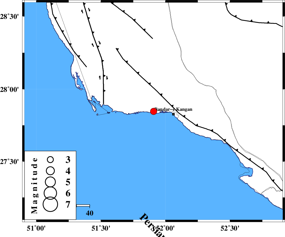
| Location | Lat:27.846 Lon: 51.908 |
| Region | Bushehr Province, 15 km -West of Bandar-e kangan |
Nearest Cities |
|
| 15 km North West of Bandar-e kangan, Bushehr Province | |
| 27 km South West of Riz, Bushehr Province | |
| 30 km South East of Abdan, Bushehr Province | |
| 40 km North West of Jam, Bushehr Province | |
| 47 km North West of Bandar-e taheri, Bushehr Province | |
| Depth | 37 km |
| Agency | |
Faults within 150 km: |
|
| MFF3 (Length: 292 km) , Distance to epicenter: 16 km | |
| BORAZJAN_F (Length: 168 km) , Distance to epicenter: 39 km | |
| MFF5 (Length: 74 km) , Distance to epicenter: 56 km | |
| Number of Phases | 4 |
| RMS | 0 |
| Number of Stations | 3 |
| Error in Latitude | >6.5 km |
| Error in Longitude | 8.7 km |
| Error in Depth | 6.6 km |
Download waveform in seisan format
to download seisan software Click here
to access information about IIEES stations Click here
Amplitude | ||||||||
| UID | Agency | Station | Component | Amplitude | Period | Arrival Time | Proccessing Time | Signal Clip |
| 141429 | IIEES | AHRM | N | 722.2 | 0.49 | 2019-03-01 07:20:47 | 2019-03-02 08:55:00 | n |
| 141430 | IIEES | KHMZ | E | 6.2 | 0.68 | 2019-03-01 07:22:55 | 2019-03-02 08:55:00 | n |
| 141431 | IIEES | KHMZ | N | 4.4 | 0.08 | 2019-03-01 07:23:00 | 2019-03-02 08:55:00 | n |
Phase | ||||||||||||
| Agency | Station | Component | Phase Type | Phase Quality | First Motion | Observed Arrival Time | Time Residual | Loc. Flag | Input Weight | Distance | Azimuth | |
| IIEES | AHRM | Z | EPg | E | 2019-03-01 07:20:28 | 0 | y | 128 | 332 | |||
| IIEES | AHRM | N | ESg | E | 2019-03-01 07:20:43 | 0 | y | 128 | 332 | |||
| IIEES | YZKH | Z | EPn | E | 2019-03-01 07:21:23 | 0 | y | 566 | 27 | |||
| IIEES | KHMZ | Z | EPn | E | 2019-03-01 07:21:37 | 0 | y | 679 | 345 | |||
کلیه حقوق مادی و معنوی این سایت متعلق به پژوهشگاه بین المللی زلزله شناسی و مهندسی زلزله می باشد.
