خانه / مشخصات زلزله
Magnitude |
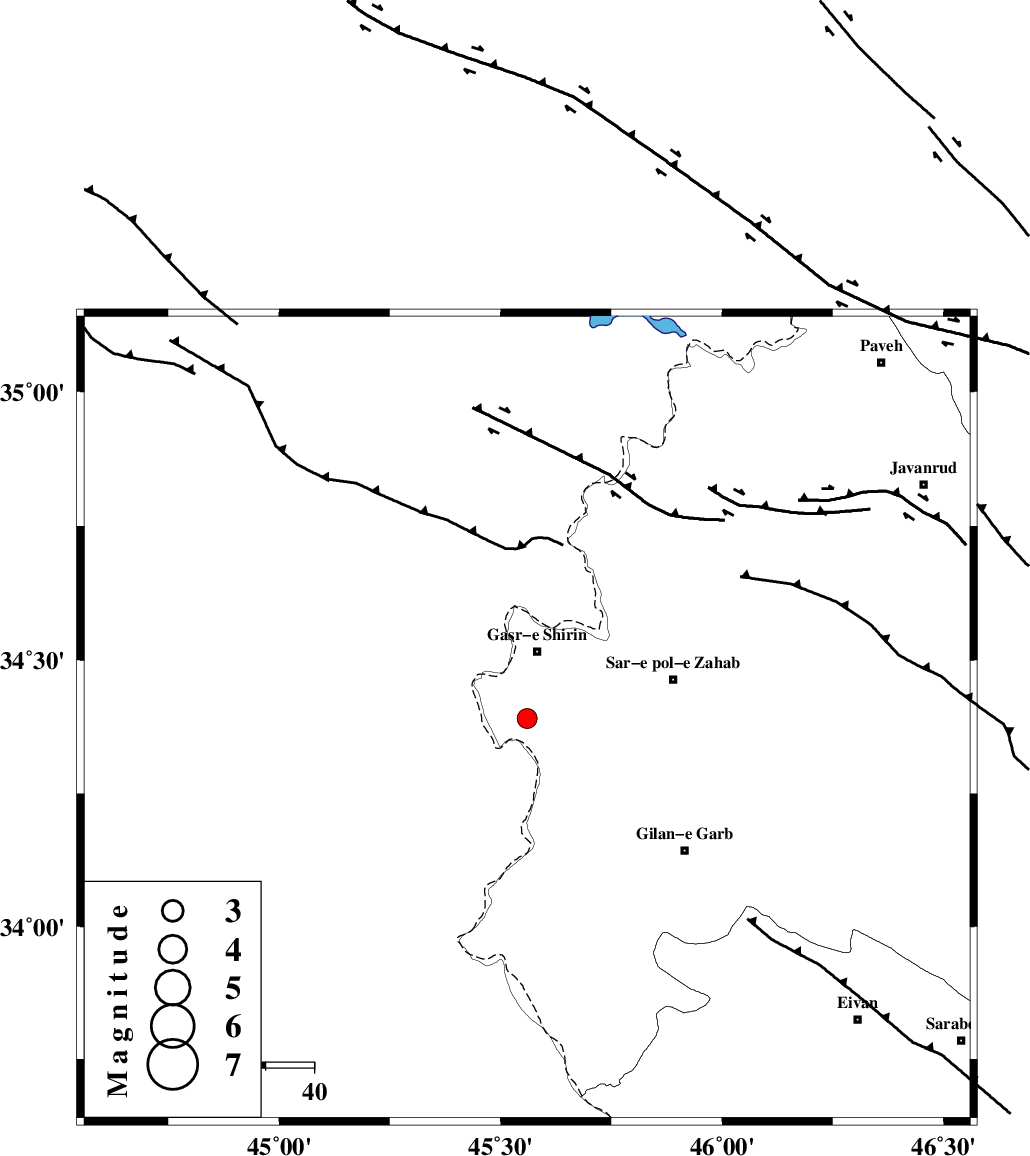
:2.8 |
| Date & Time (UTC) | 2019-10-14 11:40:54.7 |
| Date & Time (Local) | 1398/7/22 15:10:54.7 |
| Location | Lat:34.39 Lon: 45.56 |
| Region | Kermanshah Province, 14 km South of Qasr-E-Shirin |
Nearest Cities |
|
| 7 km of Seyyed sohrab, Kermanshah Province | |
| 8 km of Khosravi, Kermanshah Province | |
| 14 km South of Qasr-E-Shirin, Kermanshah Province | |
| 20 km South West of Aqabarar, Kermanshah Province | |
| 23 km West of Qareh belagh, Kermanshah Province | |
| Depth | 14 km |
| Agency | |
Faults within 150 km: |
|
| MFF8 (Length: 48 km) , Distance to epicenter: 29 km | |
| ZFF4 (Length: 128 km) , Distance to epicenter: 51 km | |
| MFF7 (Length: 99 km) , Distance to epicenter: 61 km | |
| Number of Phases | 6 |
| RMS | 0.6 |
| Number of Stations | 6 |
| Error in Latitude | >8 km |
| Error in Longitude | 0 km |
| Error in Depth | 2 km |
Download waveform in seisan format
to download seisan software Click here
to access information about IIEES stations Click here
Amplitude | ||||||||
| UID | Agency | Station | Component | Amplitude | Period | Arrival Time | Proccessing Time | Signal Clip |
| 146706 | IIEES SC | KGS1 | Z | 5200 | 1 | 2019-10-14 11:41:01 | 2019-10-15 08:24:00 | n |
| 146707 | IIEES SC | SNGE | Z | 160 | 1 | 2019-10-14 11:41:50 | 2019-10-15 08:24:00 | n |
| 146708 | IIEES SC | SRSL | Z | 170 | 1 | 2019-10-14 11:41:54 | 2019-10-15 08:24:00 | n |
| 146709 | IIEES SC | ZNJK | Z | 9.9 | 1 | 2019-10-14 11:41:59 | 2019-10-15 08:24:00 | n |
| 146710 | IIEES SC | QABG | Z | 3.3 | 1 | 2019-10-14 11:42:08 | 2019-10-15 08:24:00 | n |
| 146711 | IIEES SC | ASAO | Z | 20 | 1 | 2019-10-14 11:43:08 | 2019-10-15 08:24:00 | n |
Phase | ||||||||||||
| Agency | Station | Component | Phase Type | Phase Quality | First Motion | Observed Arrival Time | Time Residual | Loc. Flag | Input Weight | Distance | Azimuth | |
| IIEES SC | KGS1 | Z | IP | I | 2019-10-14 11:40:57 | -0.8 | y | 11 | 12 | |||
| IIEES SC | SNGE | Z | IP | I | 2019-10-14 11:41:24 | 0 | y | 177 | 64 | |||
| IIEES SC | SRSL | N | IP | I | 2019-10-14 11:41:28 | 0.6 | y | 200 | 357 | |||
| IIEES SC | ZNJK | Z | IP | I | 2019-10-14 11:41:49 | -0.1 | y | 378 | 48 | |||
| IIEES SC | QABG | Z | IP | I | 2019-10-14 11:41:52 | 0.3 | y | 400 | 68 | |||
| IIEES SC | ASAO | Z | IP | I | 2019-10-14 11:41:53 | 0.2 | y | 411 | 88 | |||
کلیه حقوق مادی و معنوی این سایت متعلق به پژوهشگاه بین المللی زلزله شناسی و مهندسی زلزله می باشد.
