خانه / مشخصات زلزله
Magnitude |
:3.4 |
| Date & Time (UTC) | 2019-11-23 02:21:31.5 |
| Date & Time (Local) | 1398/9/2 05:51:31.5 |
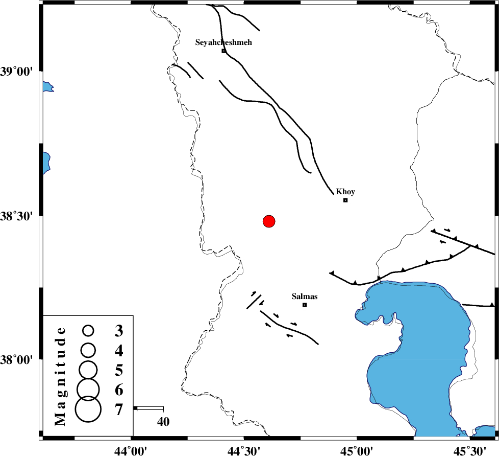
| Location | Lat:38.48 Lon: 44.61 |
| Region | Azarbaijan Gharbi Province, 31 km -West of Khoy |
Nearest Cities |
|
| 17 km North East of Gatur, Azarbaijan Gharbi Province | |
| 18 km West of Beyk sofla, Azarbaijan Gharbi Province | |
| 21 km South East of Baleh sur-e sofla, Azarbaijan Gharbi Province | |
| 23 km North West of Saylab, Azarbaijan Gharbi Province | |
| 27 km North West of Quruq, Azarbaijan Gharbi Province | |
| Depth | 10 km |
| Agency | |
Faults within 150 km: |
|
| KHOY (Length: 100 km) , Distance to epicenter: 25 km | |
| SALMAS (Length: 20 km) , Distance to epicenter: 29 km | |
| N_TABRIZ_F3 (Length: 66 km) , Distance to epicenter: 31 km | |
| Number of Phases | 4 |
| RMS | 0.6 |
| Number of Stations | 4 |
| Error in Latitude | >0 km |
| Error in Longitude | 0 km |
| Error in Depth | 0 km |
Download waveform in seisan format
to download seisan software Click here
to access information about IIEES stations Click here
Amplitude | ||||||||
| UID | Agency | Station | Component | Amplitude | Period | Arrival Time | Proccessing Time | Signal Clip |
| 148729 | IIEES SC | SRSL | Z | 150 | 1 | 2019-11-23 02:22:54 | 2019-11-23 08:39:00 | n |
| 148730 | IIEES SC | GRMI | Z | 110 | 1 | 2019-11-23 02:22:59 | 2019-11-23 08:39:00 | n |
| 148731 | IIEES SC | ZNJK | Z | 4.2 | 1 | 2019-11-23 02:23:25 | 2019-11-23 08:39:00 | n |
| 148732 | IIEES SC | SNGE | Z | 31 | 1 | 2019-11-23 02:23:15 | 2019-11-23 08:39:00 | n |
Phase | ||||||||||||
| Agency | Station | Component | Phase Type | Phase Quality | First Motion | Observed Arrival Time | Time Residual | Loc. Flag | Input Weight | Distance | Azimuth | |
| IIEES SC | SRSL | Z | IP | I | 2019-11-23 02:22:11 | -0.5 | y | 266 | 164 | |||
| IIEES SC | GRMI | Z | IP | I | 2019-11-23 02:22:15 | -0.1 | y | 289 | 83 | |||
| IIEES SC | ZNJK | Z | IP | I | 2019-11-23 02:22:30 | -0.2 | y | 411 | 119 | |||
| IIEES SC | SNGE | Z | IP | I | 2019-11-23 02:22:36 | 1.3 | y | 444 | 147 | |||
کلیه حقوق مادی و معنوی این سایت متعلق به پژوهشگاه بین المللی زلزله شناسی و مهندسی زلزله می باشد.
