خانه / مشخصات زلزله
Magnitude |
:2.9 |
| Date & Time (UTC) | 2019-11-27 21:49:01.8 |
| Date & Time (Local) | 1398/9/7 01:19:01.8 |
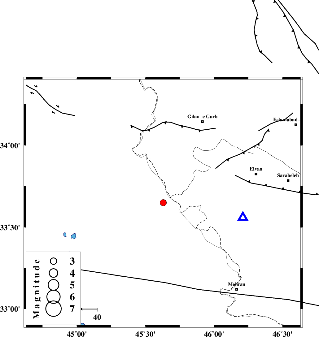
| Location | Lat:33.65 Lon: 45.63 |
| Region | Iraq, 61 km South-West of Gilan-E-Gharb |
Nearest Cities |
|
| 25 km South of Sumar, Kermanshah Province | |
| 52 km South West of Nian, Kermanshah Province | |
| 55 km North West of Salehabad, Ilam Province | |
| 57 km South West of Teran, Ilam Province | |
| 59 km West of Chavar, Ilam Province | |
| Depth | 14 km |
| Agency | |
Faults within 150 km: |
|
| ZFF4 (Length: 128 km) , Distance to epicenter: 8 km | |
| MFF7 (Length: 99 km) , Distance to epicenter: 26 km | |
| MFF6 (Length: 144 km) , Distance to epicenter: 81 km | |
| Number of Phases | 5 |
| RMS | 0.3 |
| Number of Stations | 5 |
| Error in Latitude | >2 km |
| Error in Longitude | 0 km |
| Error in Depth | 602 km |
Download waveform in seisan format
to download seisan software Click here
to access information about IIEES stations Click here
Amplitude | ||||||||
| UID | Agency | Station | Component | Amplitude | Period | Arrival Time | Proccessing Time | Signal Clip |
| 149176 | IIEES SC | SRSL | Z | 44 | 1 | 2019-11-27 21:50:24 | 2019-12-02 07:57:00 | n |
| 149177 | IIEES SC | GTMR | Z | 16 | 1 | 2019-11-27 21:50:53 | 2019-12-02 07:57:00 | n |
| 149178 | IIEES SC | KHMZ | Z | 7.9 | 1 | 2019-11-27 21:50:43 | 2019-12-02 07:57:00 | n |
| 149179 | IIEES SC | ASAO | Z | 8.3 | 1 | 2019-11-27 21:50:58 | 2019-12-02 07:57:00 | n |
| 149180 | IIEES SC | GHVR | Z | 360 | 1 | 2019-11-27 21:52:06 | 2019-12-02 07:57:00 | n |
Phase | ||||||||||||
| Agency | Station | Component | Phase Type | Phase Quality | First Motion | Observed Arrival Time | Time Residual | Loc. Flag | Input Weight | Distance | Azimuth | |
| IIEES SC | SRSL | Z | IP | I | 2019-11-27 21:49:45 | 0 | y | 289 | 356 | |||
| IIEES SC | GTMR | Z | IP | I | 2019-11-27 21:49:53 | 0.1 | y | 355 | 112 | |||
| IIEES SC | KHMZ | Z | IP | I | 2019-11-27 21:49:58 | -0.7 | y | 400 | 89 | |||
| IIEES SC | ASAO | Z | IP | I | 2019-11-27 21:50:01 | -0.1 | y | 422 | 76 | |||
| IIEES SC | GHVR | Z | IP | I | 2019-11-27 21:50:15 | 0.6 | y | 522 | 80 | |||
کلیه حقوق مادی و معنوی این سایت متعلق به پژوهشگاه بین المللی زلزله شناسی و مهندسی زلزله می باشد.
