خانه / مشخصات زلزله
Magnitude |
:3.1 |
| Date & Time (UTC) | 2019-12-31 15:20:25.4 |
| Date & Time (Local) | 1398/10/10 18:50:25.4 |
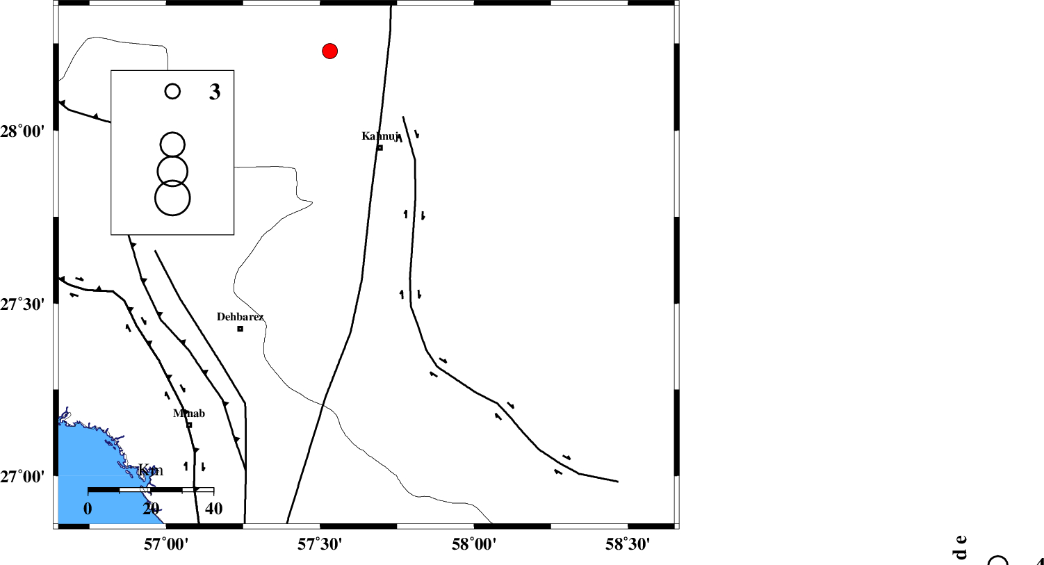
| Location | Lat:27.61 Lon: 57.65 |
| Region | Kerman Province, 27 km North-East of Manujan |
Nearest Cities |
|
| 3 km of Bargah, Kerman Province | |
| 18 km North East of Bejogan, Kerman Province | |
| 22 km North East of Nodezh, Kerman Province | |
| 25 km North West of Qalehy-eganj, Kerman Province | |
| 27 km North East of Manujan, Kerman Province | |
| Depth | 14 km |
| Agency | |
Faults within 150 km: |
|
| SABZEVARAN_F (Length: 190 km) , Distance to epicenter: 5 km | |
| JIROFT_F (Length: 144 km) , Distance to epicenter: 15 km | |
| ZENDAN_MINAB_F_Z1 (Length: 183 km) , Distance to epicenter: 56 km | |
| Number of Phases | 7 |
| RMS | 0.8 |
| Number of Stations | 6 |
| Error in Latitude | >8 km |
| Error in Longitude | 0 km |
| Error in Depth | 25 km |
Download waveform in seisan format
to download seisan software Click here
to access information about IIEES stations Click here
Amplitude | ||||||||
| UID | Agency | Station | Component | Amplitude | Period | Arrival Time | Proccessing Time | Signal Clip |
| 150267 | IIEES SC | BNDS | Z | 150 | 1 | 2019-12-31 15:21:29 | 2020-01-01 08:43:00 | n |
| 150268 | IIEES SC | KRBR | Z | 120 | 1 | 2019-12-31 15:21:46 | 2020-01-01 08:43:00 | n |
| 150269 | IIEES SC | SRVN | Z | 3.2 | 1 | 2019-12-31 15:22:29 | 2020-01-01 08:43:00 | n |
| 150270 | IIEES SC | BSRN | Z | 7.3 | 1 | 2019-12-31 15:22:50 | 2020-01-01 08:43:00 | n |
Phase | ||||||||||||
| Agency | Station | Component | Phase Type | Phase Quality | First Motion | Observed Arrival Time | Time Residual | Loc. Flag | Input Weight | Distance | Azimuth | |
| IIEES SC | BNDS | N | IS | I | 2019-12-31 15:21:07 | -0.2 | y | 144 | 261 | |||
| IIEES SC | BNDS | Z | IP | I | 2019-12-31 15:20:49 | 0.1 | y | 144 | 261 | |||
| IIEES SC | KRBR | N | IS | I | 2019-12-31 15:21:39 | 0.3 | y | 278 | 342 | |||
| IIEES SC | KRBR | Z | IP | I | 2019-12-31 15:21:08 | 0.8 | y | 278 | 342 | |||
| IIEES SC | ZHSF | Z | IP | I | 2019-12-31 15:21:25 | 5.4 | n | 4 | 378 | 54 | ||
| IIEES SC | SRVN | Z | IP | I | 2019-12-31 15:21:32 | 0.5 | y | 467 | 93 | |||
| IIEES SC | BSRN | Z | IP | I | 2019-12-31 15:21:34 | -1.7 | y | 500 | 17 | |||
کلیه حقوق مادی و معنوی این سایت متعلق به پژوهشگاه بین المللی زلزله شناسی و مهندسی زلزله می باشد.
