خانه / مشخصات زلزله
Magnitude |
:3 |
| Date & Time (UTC) | 2020-09-29 10:11:39.6 |
| Date & Time (Local) | 1399/7/8 13:41:39.6 |
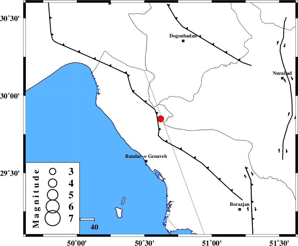
| Location | Lat:29.85 Lon: 50.62 |
| Region | Bushehr Province, 32 km North-East of Bandar-e genaveh |
Nearest Cities |
|
| 23 km North of Mohammad salehi, Bushehr Province | |
| 32 km North East of Bandar-e genaveh, Bushehr Province | |
| 35 km North East of Emamhasan, Bushehr Province | |
| 37 km South East of Siyahmakan-e bozorg, Bushehr Province | |
| 37 km North West of Chehar rustaee, Bushehr Province | |
| Depth | 10 km |
| Agency | |
Faults within 150 km: |
|
| ZFF3 (Length: 125 km) , Distance to epicenter: 4 km | |
| RAG_E_SEFID_F (Length: 84 km) , Distance to epicenter: 40 km | |
| MISHAN_F (Length: 76 km) , Distance to epicenter: 66 km | |
| Number of Phases | 5 |
| RMS | 0.4 |
| Number of Stations | 5 |
| Error in Latitude | >9 km |
| Error in Longitude | 0 km |
| Error in Depth | 34 km |
Download waveform in seisan format
to download seisan software Click here
to access information about IIEES stations Click here
Amplitude | ||||||||
| UID | Agency | Station | Component | Amplitude | Period | Arrival Time | Proccessing Time | Signal Clip |
| 158092 | IIEES SC | AHRM | Z | 36 | 1 | 2020-09-29 10:12:18 | 2020-09-30 01:27:00 | n |
| 158093 | IIEES SC | AMIS | Z | 59 | 1 | 2020-09-29 10:12:57 | 2020-09-30 01:27:00 | n |
| 158094 | IIEES SC | GHIR | Z | 0.28 | 1 | 2020-09-29 10:13:43 | 2020-09-30 01:27:00 | n |
| 158095 | IIEES SC | GTMR | Z | 34 | 1 | 2020-09-29 10:13:29 | 2020-09-30 01:27:00 | n |
Phase | ||||||||||||
| Agency | Station | Component | Phase Type | Phase Quality | First Motion | Observed Arrival Time | Time Residual | Loc. Flag | Input Weight | Distance | Azimuth | |
| IIEES SC | AHRM | Z | IP | I | 2020-09-29 10:12:00 | -0.1 | y | 122 | 149 | |||
| IIEES SC | AMIS | Z | IP | I | 2020-09-29 10:12:17 | 0.4 | y | 233 | 328 | |||
| IIEES SC | GHIR | Z | IP | I | 2020-09-29 10:12:24 | 0.6 | y | 289 | 127 | |||
| IIEES SC | GTMR | Z | IP | I | 2020-09-29 10:12:27 | -0.5 | y | 322 | 334 | |||
| IIEES SC | MEH | Z | IP | I | 2020-09-29 10:12:39 | -0.2 | y | 422 | 66 | |||
کلیه حقوق مادی و معنوی این سایت متعلق به پژوهشگاه بین المللی زلزله شناسی و مهندسی زلزله می باشد.
