خانه / مشخصات زلزله
Magnitude |
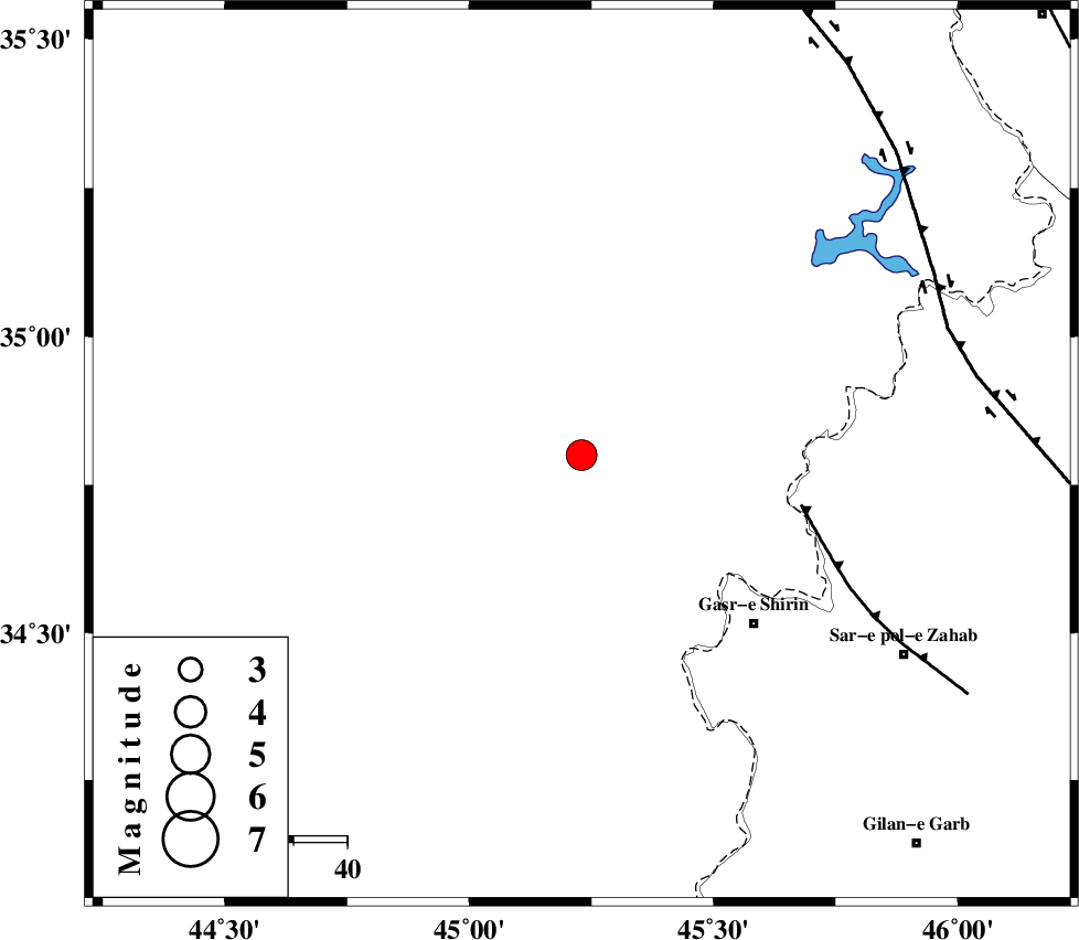
:4 |
| Date & Time (UTC) | 2020-10-18 17:25:24.3 |
| Date & Time (Local) | 1399/7/27 20:55:24.3 |
| Location | Lat:34.8 Lon: 45.23 |
| Region | Iraq, 45 km North-West of Qasr-E-Shirin |
Nearest Cities |
|
| 45 km North West of Qasr-E-Shirin, Kermanshah Province | |
| 45 km North West of Tappeh rash, Kermanshah Province | |
| 49 km North West of Aqabarar, Kermanshah Province | |
| 50 km North West of Khosravi, Kermanshah Province | |
| 52 km North West of Seyyed sohrab, Kermanshah Province | |
| Depth | 10 km |
| Agency | |
Faults within 150 km: |
|
| MFF8 (Length: 48 km) , Distance to epicenter: 42 km | |
| HZF4 (Length: 492 km) , Distance to epicenter: 72 km | |
| ZFF4 (Length: 128 km) , Distance to epicenter: 99 km | |
| Number of Phases | 7 |
| RMS | 0.3 |
| Number of Stations | 7 |
| Error in Latitude | >4 km |
| Error in Longitude | 0 km |
| Error in Depth | 8 km |
Download waveform in seisan format
to download seisan software Click here
to access information about IIEES stations Click here
Amplitude | ||||||||
| UID | Agency | Station | Component | Amplitude | Period | Arrival Time | Proccessing Time | Signal Clip |
| 158495 | IIEES SC | ILBA | Z | 670 | 1 | 2020-10-18 17:26:18 | 2020-10-19 11:25:00 | n |
| 158496 | IIEES SC | SRSL | Z | 2900 | 1 | 2020-10-18 17:26:13 | 2020-10-19 11:25:00 | n |
| 158497 | IIEES SC | SNGE | Z | 980 | 1 | 2020-10-18 17:26:31 | 2020-10-19 11:25:00 | n |
| 158498 | IIEES SC | AZR | Z | 2000 | 1 | 2020-10-18 17:27:13 | 2020-10-19 11:25:00 | n |
Phase | ||||||||||||
| Agency | Station | Component | Phase Type | Phase Quality | First Motion | Observed Arrival Time | Time Residual | Loc. Flag | Input Weight | Distance | Azimuth | |
| IIEES SC | ILBA | N | IS | I | 2020-10-18 17:26:10 | 0.3 | y | 155 | 145 | |||
| IIEES SC | ILBA | Z | IP | I | 2020-10-18 17:25:50 | 0 | y | 155 | 145 | |||
| IIEES SC | SRSL | N | IS | I | 2020-10-18 17:26:11 | 0.7 | y | 155 | 7 | |||
| IIEES SC | SRSL | Z | IP | I | 2020-10-18 17:25:50 | 0.1 | y | 155 | 7 | |||
| IIEES SC | SNGE | Z | IP | I | 2020-10-18 17:25:56 | -0.3 | y | 200 | 80 | |||
| IIEES SC | MAHB | Z | IP | I | 2020-10-18 17:25:59 | -0.4 | y | 222 | 11 | |||
| IIEES SC | AZR | Z | IP | I | 2020-10-18 17:26:13 | -0.3 | y | 322 | 12 | |||
کلیه حقوق مادی و معنوی این سایت متعلق به پژوهشگاه بین المللی زلزله شناسی و مهندسی زلزله می باشد.
