خانه / مشخصات زلزله
Magnitude |
:3 |
| Date & Time (UTC) | 2020-11-28 10:23:45.0 |
| Date & Time (Local) | 1399/9/8 13:53:45.0 |
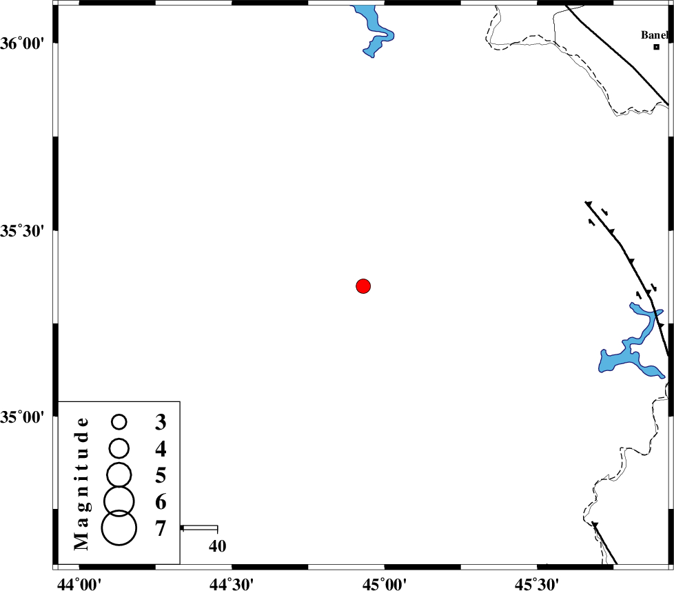
| Location | Lat:35.35 Lon: 44.93 |
| Region | Iraq, 52 km South-West of Sulaymaniyah |
Nearest Cities |
|
| 52 km South West of Sulaymaniyah, Iraq Province | |
| 94 km South West of Balekeh, Kurdistan Province | |
| 98 km North West of Markhil, Kermanshah Province | |
| 98 km North West of Tappeh rash, Kermanshah Province | |
| 98 km South West of Bolhasan, Kurdistan Province | |
| Depth | 10 km |
| Agency | |
Faults within 150 km: |
|
| HZF4 (Length: 492 km) , Distance to epicenter: 70 km | |
| MFF8 (Length: 48 km) , Distance to epicenter: 98 km | |
| PIRANSHAHR_F (Length: 253 km) , Distance to epicenter: 102 km | |
| Number of Phases | 7 |
| RMS | 0.3 |
| Number of Stations | 6 |
| Error in Latitude | >5 km |
| Error in Longitude | 0 km |
| Error in Depth | 12 km |
Download waveform in seisan format
to download seisan software Click here
to access information about IIEES stations Click here
Amplitude | ||||||||
| UID | Agency | Station | Component | Amplitude | Period | Arrival Time | Proccessing Time | Signal Clip |
| 159975 | IIEES SC | SRSL | Z | 140 | 1 | 2020-11-28 10:24:21 | 2020-12-15 11:44:00 | n |
| 159976 | IIEES SC | MAHB | Z | 130 | 1 | 2020-11-28 10:24:39 | 2020-12-15 11:44:00 | n |
| 159977 | IIEES SC | SNGE | Z | 70 | 1 | 2020-11-28 10:24:56 | 2020-12-15 11:44:00 | n |
| 159978 | IIEES SC | ILBA | Z | 54 | 1 | 2020-11-28 10:24:56 | 2020-12-15 11:44:00 | n |
| 159979 | IIEES SC | AZR | Z | 210 | 1 | 2020-11-28 10:25:18 | 2020-12-15 11:44:00 | n |
| 159980 | IIEES SC | MRD | Z | 28 | 1 | 2020-11-28 10:25:50 | 2020-12-15 11:44:00 | n |
Phase | ||||||||||||
| Agency | Station | Component | Phase Type | Phase Quality | First Motion | Observed Arrival Time | Time Residual | Loc. Flag | Input Weight | Distance | Azimuth | |
| IIEES SC | SRSL | Z | IP | I | 2020-11-28 10:24:02 | -0.6 | y | 111 | 26 | |||
| IIEES SC | MAHB | Z | IP | I | 2020-11-28 10:24:13 | 0.4 | y | 177 | 24 | |||
| IIEES SC | SNGE | Z | IP | I | 2020-11-28 10:24:21 | 0.1 | y | 222 | 97 | |||
| IIEES SC | ILBA | Z | IP | I | 2020-11-28 10:24:21 | -0.1 | y | 222 | 148 | |||
| IIEES SC | AZR | Z | IP | I | 2020-11-28 10:24:27 | -0.1 | y | 278 | 20 | |||
| IIEES SC | MRD | Z | IP | I | 2020-11-28 10:24:40 | 0.2 | y | 378 | 10 | |||
| IIEES SC | QABG | Z | IP | I | 2020-11-28 10:24:53 | 6.9 | n | 4 | 422 | 85 | ||
کلیه حقوق مادی و معنوی این سایت متعلق به پژوهشگاه بین المللی زلزله شناسی و مهندسی زلزله می باشد.
