خانه / مشخصات زلزله
Magnitude |
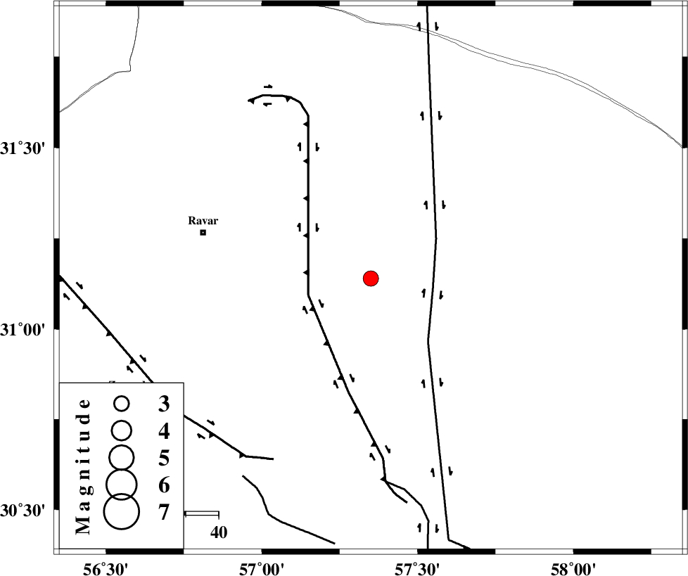
:3.1 |
| Date & Time (UTC) | 2020-11-03 02:02:28.4 |
| Date & Time (Local) | 1399/8/13 05:32:28.4 |
| Location | Lat:31.14 Lon: 57.35 |
| Region | Kerman Province, 53 km South-East of Ravar |
Nearest Cities |
|
| 53 km South East of Ravar, Kerman Province | |
| 55 km North East of Hejdak, Kerman Province | |
| 56 km South East of Dehali, Kerman Province | |
| 57 km North East of Harjand, Kerman Province | |
| 63 km North East of Hatkan, Kerman Province | |
| Depth | 10 km |
| Agency | |
Faults within 150 km: |
|
| NAYBAND_F (Length: 258 km) , Distance to epicenter: 19 km | |
| LAKARKUH_F (Length: 138 km) , Distance to epicenter: 20 km | |
| GOLBAF_SIRCH_F (Length: 114 km) , Distance to epicenter: 63 km | |
| Number of Phases | 7 |
| RMS | 0.3 |
| Number of Stations | 5 |
| Error in Latitude | >9 km |
| Error in Longitude | 0 km |
| Error in Depth | 27 km |
Download waveform in seisan format
to download seisan software Click here
to access information about IIEES stations Click here
Amplitude | ||||||||
| UID | Agency | Station | Component | Amplitude | Period | Arrival Time | Proccessing Time | Signal Clip |
| 160422 | IIEES SC | BSRN | Z | 190 | 1 | 2020-11-03 02:03:25 | 2021-01-02 12:19:00 | n |
| 160423 | IIEES SC | YZKH | Z | 45 | 1 | 2020-11-03 02:04:09 | 2021-01-02 12:19:00 | n |
| 160424 | IIEES SC | SHRT | Z | 15 | 1 | 2020-11-03 02:04:32 | 2021-01-02 12:19:00 | n |
Phase | ||||||||||||
| Agency | Station | Component | Phase Type | Phase Quality | First Motion | Observed Arrival Time | Time Residual | Loc. Flag | Input Weight | Distance | Azimuth | |
| IIEES SC | KRBR | Z | IP | I | 2020-11-03 02:03:04 | 12.3 | n | 4 | 144 | 204 | ||
| IIEES SC | BSRN | Z | IP | I | 2020-11-03 02:02:59 | 0 | y | 189 | 61 | |||
| IIEES SC | MEH | Z | IP | I | 2020-11-03 02:03:09 | 0.2 | y | 266 | 276 | |||
| IIEES SC | TABS | Z | IP | I | 2020-11-03 02:03:11 | 0.4 | y | 278 | 356 | |||
| IIEES SC | YZKH | Z | IP | I | 2020-11-03 02:03:13 | -0.4 | y | 300 | 298 | |||
| IIEES SC | ZHSF | Z | IP | I | 2020-11-03 02:03:31 | 9.2 | n | 4 | 366 | 117 | ||
| IIEES SC | SHRT | Z | IP | I | 2020-11-03 02:03:25 | -0.2 | y | 389 | 45 | |||
کلیه حقوق مادی و معنوی این سایت متعلق به پژوهشگاه بین المللی زلزله شناسی و مهندسی زلزله می باشد.
