خانه / مشخصات زلزله
Magnitude |
:3.1 |
| Date & Time (UTC) | 2021-04-08 03:19:45.3 |
| Date & Time (Local) | 1400/1/19 07:49:45.3 |
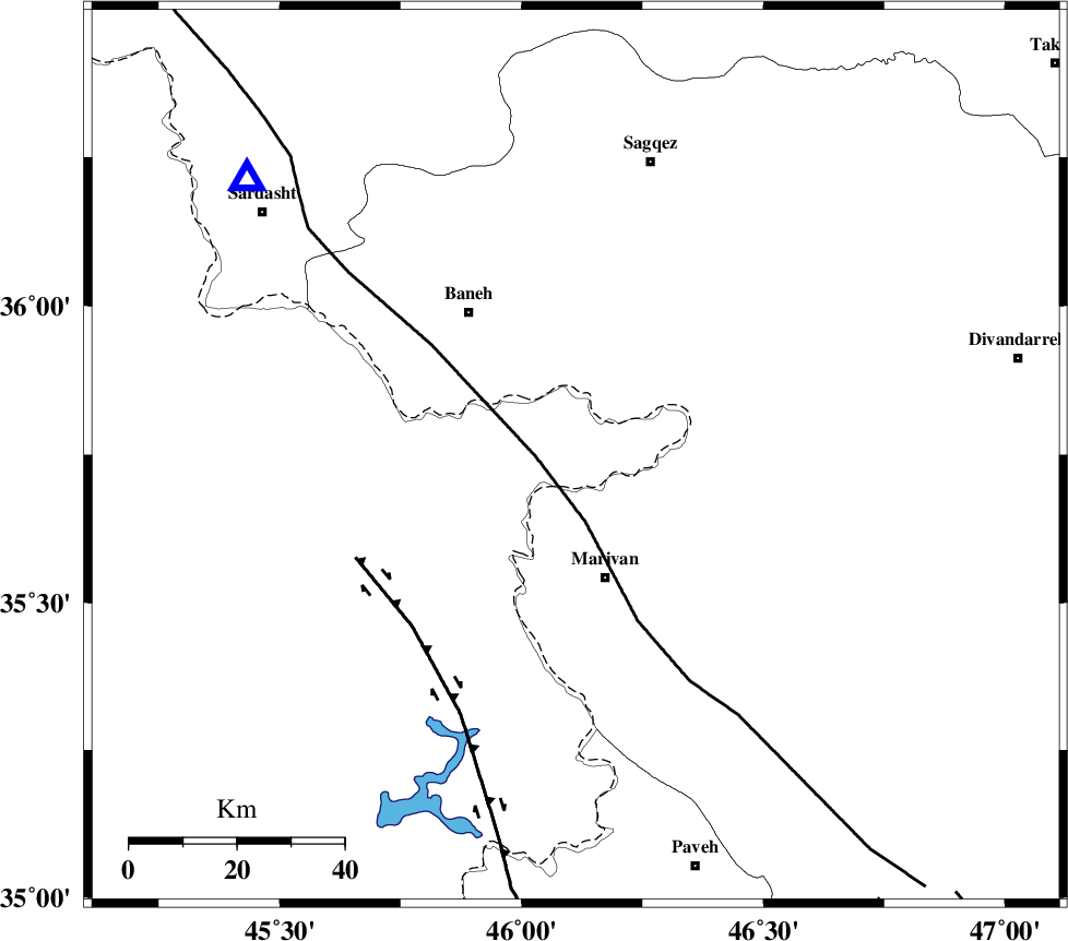
| Location | Lat:35.747 Lon: 46.112 |
| Region | Iraq, 23 km North of Marivan |
Nearest Cities |
|
| 9 km North of Savoji, Kurdistan Province | |
| 17 km North of Bardeh rasheh, Kurdistan Province | |
| 18 km South of Nanur, Kurdistan Province | |
| 21 km North West of Chenareh, Kurdistan Province | |
| 23 km North of Marivan, Kurdistan Province | |
| Depth | 12 km |
| Agency | |
Faults within 150 km: |
|
| PIRANSHAHR_F (Length: 253 km) , Distance to epicenter: 8 km | |
| HZF4 (Length: 492 km) , Distance to epicenter: 44 km | |
| SARTAKHT_F (Length: 78 km) , Distance to epicenter: 101 km | |
| Number of Phases | 8 |
| RMS | 0.4 |
| Number of Stations | 8 |
| Error in Latitude | >1.8 km |
| Error in Longitude | 1.8 km |
| Error in Depth | 7 km |
Download waveform in seisan format
to download seisan software Click here
to access information about IIEES stations Click here
Amplitude | ||||||||
| UID | Agency | Station | Component | Amplitude | Period | Arrival Time | Proccessing Time | Signal Clip |
| 162623 | IIEES SC | MAHB | Z | 1 | 1 | 2021-04-08 03:20:05 | 2021-04-17 10:46:00 | n |
| 162624 | IIEES SC | SNGE | Z | 0.7 | 1 | 2021-04-08 03:20:07 | 2021-04-17 10:46:00 | n |
| 162625 | IIEES SC | ILBA | Z | 0.2 | 1 | 2021-04-08 03:20:22 | 2021-04-17 10:46:00 | n |
| 162626 | IIEES SC | ASAO | Z | 0.05 | 1 | 2021-04-08 03:20:40 | 2021-04-17 10:46:00 | n |
Phase | ||||||||||||
| Agency | Station | Component | Phase Type | Phase Quality | First Motion | Observed Arrival Time | Time Residual | Loc. Flag | Input Weight | Distance | Azimuth | |
| IIEES SC | MAHB | Z | EPg | E | 2021-04-08 03:20:05 | -0.4 | y | 0 | 119 | 342 | ||
| IIEES SC | SNGE | Z | EPg | E | 2021-04-08 03:20:07 | -0.2 | y | 0 | 134 | 123 | ||
| IIEES SC | AZR | Z | EPn | E | 2021-04-08 03:20:20 | 0.8 | y | 0 | 215 | 357 | ||
| IIEES SC | ILBA | Z | EPn | E | 2021-04-08 03:20:22 | 0.1 | y | 0 | 236 | 178 | ||
| IIEES SC | ZNJK | Z | EPn | E | 2021-04-08 03:20:24 | 0.1 | y | 0 | 253 | 66 | ||
| IIEES SC | GRMI | Z | EPn | E | 2021-04-08 03:20:40 | 0.8 | y | 0 | 375 | 25 | ||
| IIEES SC | ASAO | Z | EPn | E | 2021-04-08 03:20:40 | -0.3 | y | 0 | 381 | 110 | ||
| IIEES SC | GTMR | Z | EPn | E | 2021-04-08 03:20:49 | -0.1 | y | 0 | 457 | 143 | ||
کلیه حقوق مادی و معنوی این سایت متعلق به پژوهشگاه بین المللی زلزله شناسی و مهندسی زلزله می باشد.
