خانه / مشخصات زلزله
Magnitude |
:3.2 |
| Date & Time (UTC) | 2021-09-21 01:24:39.3 |
| Date & Time (Local) | 1400/6/30 05:54:39.3 |
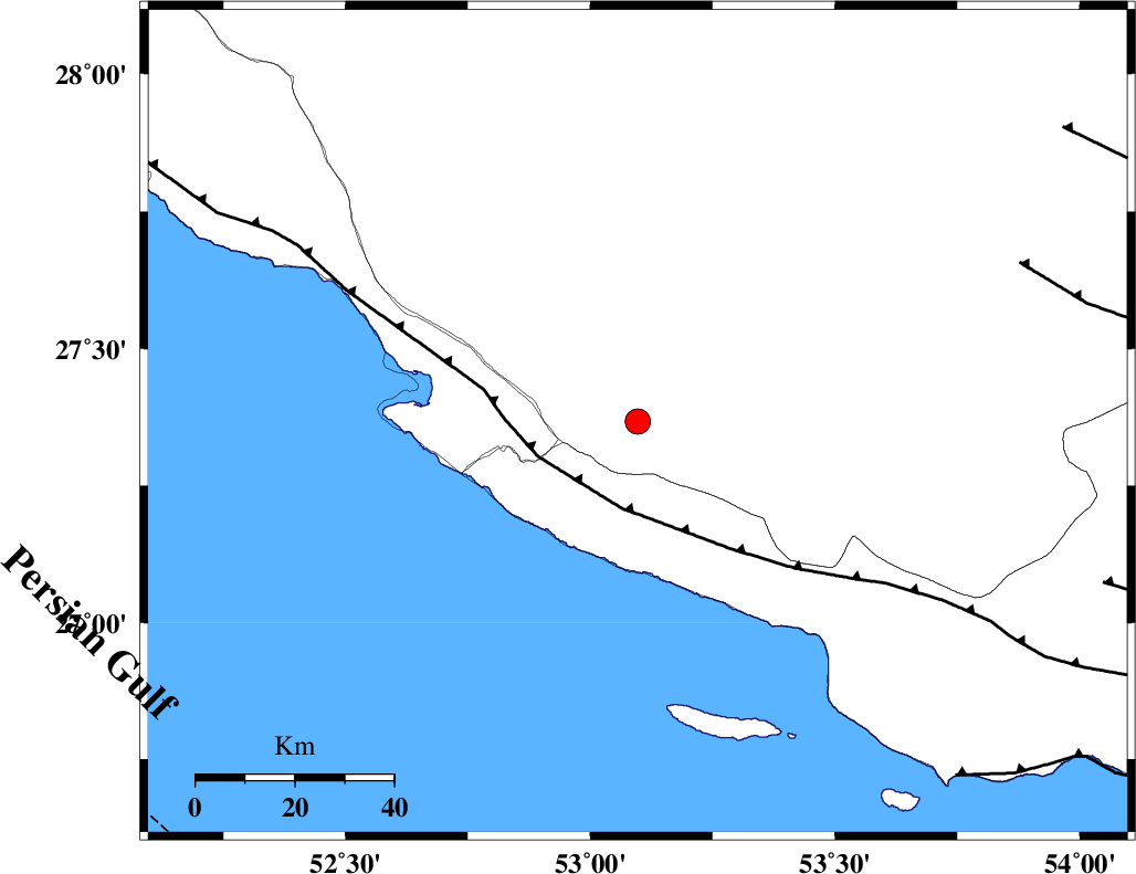
| Location | Lat:27.367 Lon: 53.097 |
| Region | Fars Province, 8 km of Lamerd |
Nearest Cities |
|
| 8 km North of Lamerd, Fars Province | |
| 15 km East of Khoozi, Fars Province | |
| 29 km South East of Mehr, Fars Province | |
| 30 km North East of Chah-e mobarak, Bushehr Province | |
| 31 km South East of Alamarvdasht, Fars Province | |
| Depth | 12 km |
| Agency | |
Faults within 150 km: |
|
| MFF3 (Length: 292 km) , Distance to epicenter: 18 km | |
| LAR_F (Length: 99 km) , Distance to epicenter: 83 km | |
| ZFF1 (Length: 165 km) , Distance to epicenter: 96 km | |
| Number of Phases | 10 |
| RMS | 0.6 |
| Number of Stations | 10 |
| Error in Latitude | >6 km |
| Error in Longitude | 6 km |
| Error in Depth | 20.7 km |
Download waveform in seisan format
to download seisan software Click here
to access information about IIEES stations Click here
Amplitude | ||||||||
| UID | Agency | Station | Component | Amplitude | Period | Arrival Time | Proccessing Time | Signal Clip |
| 165282 | IIEES SC | KLNJ | Z | 0.06 | 1 | 2021-09-21 01:25:40 | 2021-09-21 05:12:00 | n |
| 165283 | IIEES SC | YZKH | Z | 0.02 | 1 | 2021-09-21 01:25:58 | 2021-09-21 05:12:00 | n |
| 165284 | IIEES SC | NASN | Z | 0.02 | 1 | 2021-09-21 01:26:01 | 2021-09-21 05:12:00 | n |
| 165285 | IIEES SC | TABS | Z | 0.01 | 1 | 2021-09-21 01:26:26 | 2021-09-21 05:12:00 | n |
Phase | ||||||||||||
| Agency | Station | Component | Phase Type | Phase Quality | First Motion | Observed Arrival Time | Time Residual | Loc. Flag | Input Weight | Distance | Azimuth | |
| IIEES SC | GHIR | Z | EPg | E | 2021-09-21 01:24:56 | 0 | y | 0 | 102 | 354 | ||
| IIEES SC | AHRM | Z | EPn | E | 2021-09-21 01:25:19 | 0.7 | y | 0 | 255 | 311 | ||
| IIEES SC | BNDS | Z | EPn | E | 2021-09-21 01:25:24 | -0.4 | y | 0 | 304 | 89 | ||
| IIEES SC | KLNJ | Z | EPn | E | 2021-09-21 01:25:40 | -0.8 | y | 0 | 429 | 340 | ||
| IIEES SC | KRBR | Z | EPn | E | 2021-09-21 01:25:45 | 0.5 | y | 0 | 461 | 51 | ||
| IIEES SC | MEH | Z | EPn | E | 2021-09-21 01:25:45 | -0.2 | y | 0 | 470 | 18 | ||
| IIEES SC | YZKH | Z | EPn | E | 2021-09-21 01:25:58 | -0.4 | y | 0 | 575 | 15 | ||
| IIEES SC | NASN | Z | EPn | E | 2021-09-21 01:26:01 | -0.8 | y | 0 | 603 | 357 | ||
| IIEES SC | TABS | Z | EPn | E | 2021-09-21 01:26:26 | 0.8 | y | 0 | 796 | 29 | ||
| IIEES SC | ILBA | Z | EPn | E | 2021-09-21 01:26:43 | -3 | n | 4 | 958 | 316 | ||
کلیه حقوق مادی و معنوی این سایت متعلق به پژوهشگاه بین المللی زلزله شناسی و مهندسی زلزله می باشد.
