خانه / مشخصات زلزله
Magnitude |
:4.2 |
| Date & Time (UTC) | 2014-03-16 14:34:43.9 |
| Date & Time (Local) | 1392/12/25 18:04:43.9 |
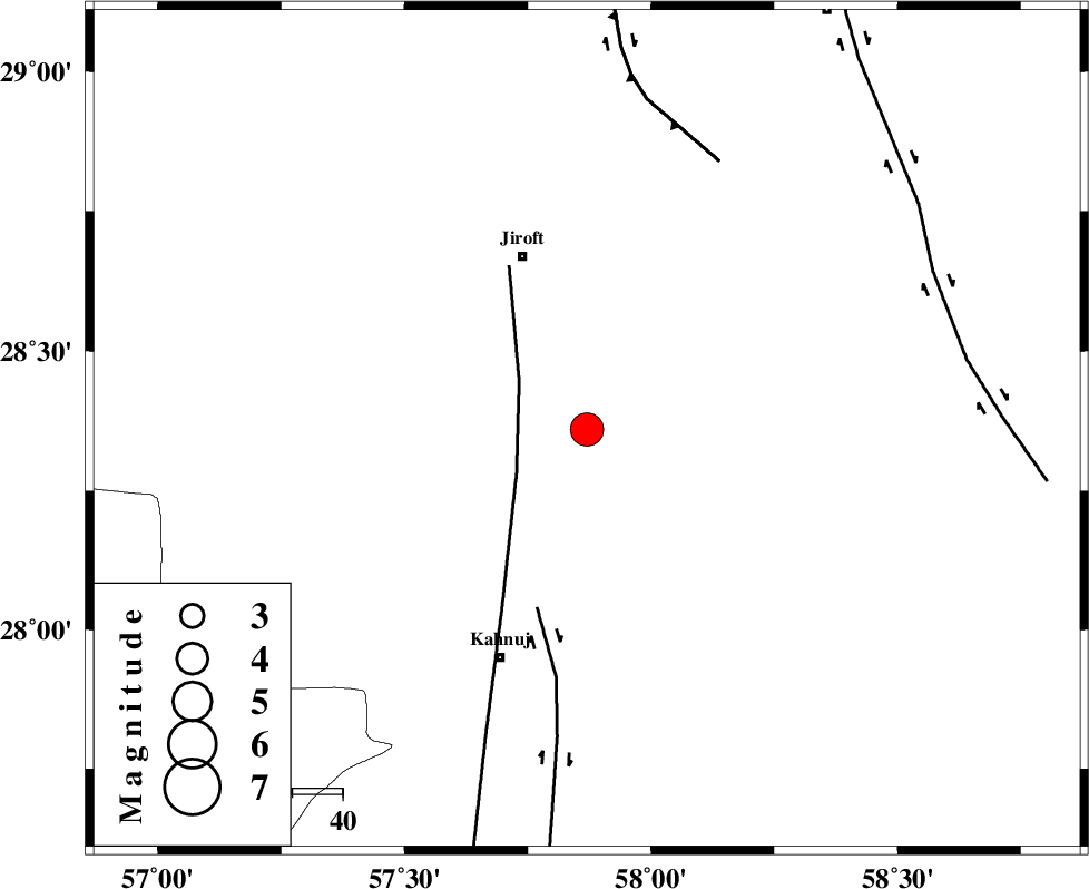
| Location | Lat:28.36 Lon: 57.87 |
| Region | Kerman Province, 37 km South-East of Jiroft |
Nearest Cities |
|
| 9 km of Aliabad-e qadiri, Kerman Province | |
| 10 km of Dosari, Kerman Province | |
| 16 km South of Khesrabad, Kerman Province | |
| 28 km South of Dolatabad, Kerman Province | |
| 29 km South East of Khatunabad-e zangian, Kerman Province | |
| Depth | 15 km |
| Agency | |
Faults within 150 km: |
|
| SABZEVARAN_F (Length: 190 km) , Distance to epicenter: 16 km | |
| JIROFT_F (Length: 144 km) , Distance to epicenter: 37 km | |
| GOWK_F (Length: 152 km) , Distance to epicenter: 59 km | |
| Number of Phases | 6 |
| RMS | 0.1 |
| Number of Stations | 4 |
| Error in Latitude | >2.5 km |
| Error in Longitude | 3.7 km |
| Error in Depth | 5.2 km |
Download waveform in seisan format
to download seisan software Click here
to access information about IIEES stations Click here
Amplitude | ||||||||
| UID | Agency | Station | Component | Amplitude | Period | Arrival Time | Proccessing Time | Signal Clip |
| 92003 | IIEES | KRBR | N | 1728.5 | 0.68 | 2014-03-16 14:35:46 | 2014-03-16 03:06:00 | n |
| 92004 | IIEES | KRBR | E | 2108.5 | 0.6 | 2014-03-16 14:35:49 | 2014-03-16 03:06:00 | n |
Phase | ||||||||||||
| Agency | Station | Component | Phase Type | Phase Quality | First Motion | Observed Arrival Time | Time Residual | Loc. Flag | Input Weight | Distance | Azimuth | |
| IIEES | KRBR | Z | Pn | E | 2014-03-16 14:35:17 | -0.05 | y | 210 | 329 | |||
| IIEES | KRBR | E | Sg | E | 2014-03-16 14:35:43 | 0.01 | y | 210 | 329 | |||
| IIEES | CHBR | Z | Pn | E | 2014-03-16 14:35:41 | 0.01 | y | 401 | 139 | |||
| IIEES | TABS | Z | Pn | E | 2014-03-16 14:36:05 | 0.16 | y | 591 | 353 | |||
| IIEES | TABS | E | Sg | E | 2014-03-16 14:37:28 | -0.01 | y | 591 | 353 | |||
| IIEES | SHRT | Z | Pn | E | 2014-03-16 14:36:09 | -0.08 | y | 631 | 21 | |||
کلیه حقوق مادی و معنوی این سایت متعلق به پژوهشگاه بین المللی زلزله شناسی و مهندسی زلزله می باشد.
