خانه / مشخصات زلزله
Magnitude |
:3 |
| Date & Time (UTC) | 2014-06-25 07:42:36.4 |
| Date & Time (Local) | 1393/4/4 12:12:36.4 |
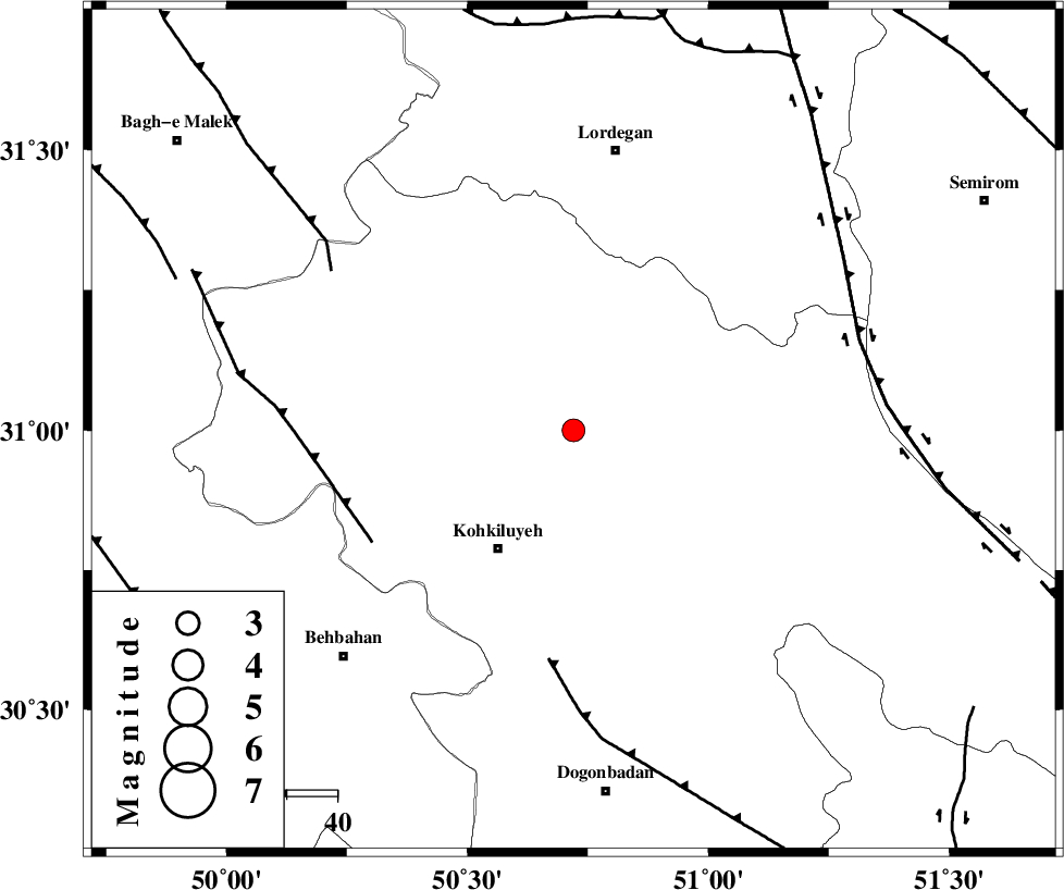
| Location | Lat:31 Lon: 50.72 |
| Region | Kohkiluieh va boyerahmad Province, 28 km North-East of Dehdasht |
Nearest Cities |
|
| 12 km North of Savari, Kohkiluieh va boyerahmad Province | |
| 28 km North East of Dehdasht, Kohkiluieh va boyerahmad Province | |
| 28 km North East of Lendeh, Kohkiluieh va boyerahmad Province | |
| 33 km South of Pataveh, Kohkiluieh va boyerahmad Province | |
| 34 km South East of Qale-ye raiesi, Kohkiluieh va boyerahmad Province | |
| Depth | 14 km |
| Agency | |
Faults within 150 km: |
|
| MFF4 (Length: 62 km) , Distance to epicenter: 46 km | |
| MISHAN_F (Length: 76 km) , Distance to epicenter: 46 km | |
| MFF2 (Length: 205 km) , Distance to epicenter: 57 km | |
| Number of Phases | 5 |
| RMS | 0.1 |
| Number of Stations | 4 |
| Error in Latitude | >3.7 km |
| Error in Longitude | 5.5 km |
| Error in Depth | 6.7 km |
Download waveform in seisan format
to download seisan software Click here
to access information about IIEES stations Click here
Amplitude | ||||||||
| UID | Agency | Station | Component | Amplitude | Period | Arrival Time | Proccessing Time | Signal Clip |
| 92675 | IIEES | SHGR | N | 119.7 | 0.31 | 2014-06-25 07:43:40 | 2014-06-25 09:25:00 | n |
| 92676 | IIEES | SHGR | E | 139.3 | 0.72 | 2014-06-25 07:43:48 | 2014-06-25 09:25:00 | n |
Phase | ||||||||||||
| Agency | Station | Component | Phase Type | Phase Quality | First Motion | Observed Arrival Time | Time Residual | Loc. Flag | Input Weight | Distance | Azimuth | |
| IIEES | SHGR | Z | Pn | E | 2014-06-25 07:43:11 | 0.06 | y | 220 | 305 | |||
| IIEES | SHGR | E | Sg | E | 2014-06-25 07:43:38 | 0 | y | 220 | 305 | |||
| IIEES | AHRM | Z | Pn | E | 2014-06-25 07:43:14 | -0.03 | y | 243 | 167 | |||
| IIEES | SNGE | Z | Pn | E | 2014-06-25 07:43:52 | -0.09 | y | 553 | 326 | |||
| IIEES | BNDS | Z | Pn | E | 2014-06-25 07:44:06 | 0.06 | y | 663 | 126 | |||
کلیه حقوق مادی و معنوی این سایت متعلق به پژوهشگاه بین المللی زلزله شناسی و مهندسی زلزله می باشد.
