خانه / مشخصات زلزله
Magnitude |
:2.7 |
| Date & Time (UTC) | 2014-09-03 06:04:06.7 |
| Date & Time (Local) | 1393/6/12 10:34:06.7 |
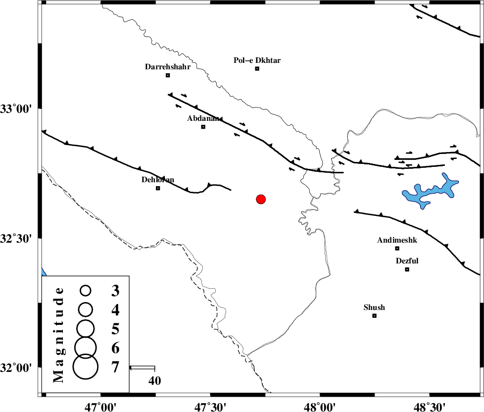
| Location | Lat:32.65 Lon: 47.73 |
| Region | Ilam Province, 44 km East of Dehloran |
Nearest Cities |
|
| 32 km South East of Sarabbagh, Ilam Province | |
| 37 km North East of Musian, Ilam Province | |
| 40 km South East of Abdanan, Ilam Province | |
| 44 km East of Dehloran, Ilam Province | |
| 49 km West of Hoseinieh, Khoozestan Province | |
| Depth | 14 km |
| Agency | |
Faults within 150 km: |
|
| MFF6 (Length: 144 km) , Distance to epicenter: 13 km | |
| BALARUD_F_Z1 (Length: 87 km) , Distance to epicenter: 20 km | |
| BALARUD_F_Z3 (Length: 53 km) , Distance to epicenter: 37 km | |
| Number of Phases | 6 |
| RMS | 0.2 |
| Number of Stations | 4 |
| Error in Latitude | >2.2 km |
| Error in Longitude | 8.9 km |
| Error in Depth | 8.2 km |
Download waveform in seisan format
to download seisan software Click here
to access information about IIEES stations Click here
Amplitude | ||||||||
| UID | Agency | Station | Component | Amplitude | Period | Arrival Time | Proccessing Time | Signal Clip |
| 93453 | IIEES | SHGR | N | 169.5 | 0.24 | 2014-09-03 06:04:46 | 2014-09-03 07:57:00 | n |
Phase | ||||||||||||
| Agency | Station | Component | Phase Type | Phase Quality | First Motion | Observed Arrival Time | Time Residual | Loc. Flag | Input Weight | Distance | Azimuth | |
| IIEES | SHGR | Z | Pg | E | 2014-09-03 06:04:26 | -0.27 | y | 118 | 120 | |||
| IIEES | SHGR | N | Sg | E | 2014-09-03 06:04:41 | 0.18 | y | 118 | 120 | |||
| IIEES | KHMZ | Z | Pn | E | 2014-09-03 06:04:44 | 0.21 | y | 241 | 59 | |||
| IIEES | ASAO | Z | Pn | E | 2014-09-03 06:04:51 | 0.12 | y | 300 | 45 | |||
| IIEES | ASAO | N | Sg | E | 2014-09-03 06:05:31 | -0.08 | y | 300 | 45 | |||
| IIEES | GHVR | Z | Pn | E | 2014-09-03 06:05:02 | -0.2 | y | 385 | 57 | |||
کلیه حقوق مادی و معنوی این سایت متعلق به پژوهشگاه بین المللی زلزله شناسی و مهندسی زلزله می باشد.
