خانه / مشخصات زلزله
Magnitude |
:2.6 |
| Date & Time (UTC) | 2014-09-23 03:51:57.3 |
| Date & Time (Local) | 1393/7/1 07:21:57.3 |
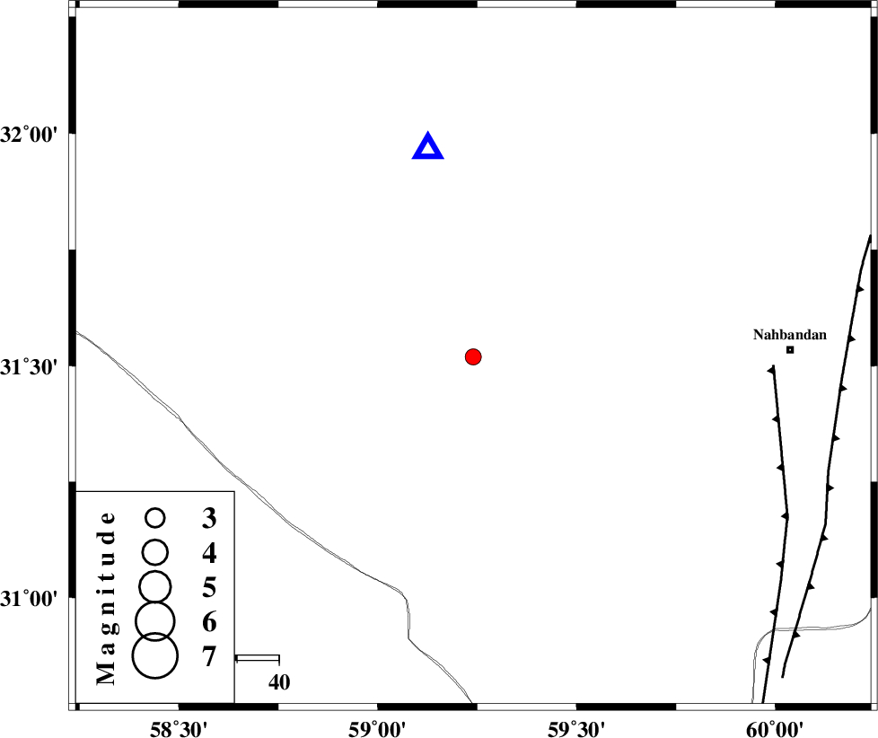
| Location | Lat:31.52 Lon: 59.24 |
| Region | Khorasan(south) Province, 75 km West of Nehbandan |
Nearest Cities |
|
| 76 km West of Nehbandan, Khorasan(south) Province | |
| 82 km South West of Shusef, Khorasan(south) Province | |
| 106 km South West of Mokhtaran, Khorasan(south) Province | |
| 113 km South East of Hamand, Khorasan(south) Province | |
| 115 km South West of Kalateh soleyman, Khorasan(south) Province | |
| Depth | 17 km |
| Agency | |
Faults within 150 km: |
|
| W_NEH_F (Length: 158 km) , Distance to epicenter: 72 km | |
| E_NEH_F (Length: 148 km) , Distance to epicenter: 88 km | |
| SEFIDABAD_F (Length: 26 km) , Distance to epicenter: 138 km | |
| Number of Phases | 5 |
| RMS | 0 |
| Number of Stations | 3 |
| Error in Latitude | >2.9 km |
| Error in Longitude | 6.8 km |
| Error in Depth | 5.6 km |
Download waveform in seisan format
to download seisan software Click here
to access information about IIEES stations Click here
Amplitude | ||||||||
| UID | Agency | Station | Component | Amplitude | Period | Arrival Time | Proccessing Time | Signal Clip |
| 93664 | IIEES | BSRN | E | 439.5 | 0.13 | 2014-09-23 03:52:13 | 2014-09-23 06:47:00 | n |
Phase | ||||||||||||
| Agency | Station | Component | Phase Type | Phase Quality | First Motion | Observed Arrival Time | Time Residual | Loc. Flag | Input Weight | Distance | Azimuth | |
| IIEES | BSRN | E | Sg | E | 2014-09-23 03:52:13 | -0.01 | y | 50.5 | 347 | |||
| IIEES | SHRT | Z | Pn | E | 2014-09-23 03:52:36 | 0 | y | 256 | 22 | |||
| IIEES | SHRT | E | Sn | 2014-09-23 03:53:05 | 0.03 | y | 256 | 22 | ||||
| IIEES | KRBR | Z | Pn | E | 2014-09-23 03:52:41 | -0.06 | y | 292 | 235 | |||
| IIEES | KRBR | E | Sg | E | 2014-09-23 03:53:19 | 0.04 | y | 292 | 235 | |||
کلیه حقوق مادی و معنوی این سایت متعلق به پژوهشگاه بین المللی زلزله شناسی و مهندسی زلزله می باشد.
