خانه / مشخصات زلزله
Magnitude |
:2.2 |
| Date & Time (UTC) | 2014-10-21 00:43:02.2 |
| Date & Time (Local) | 1393/7/29 04:13:02.2 |
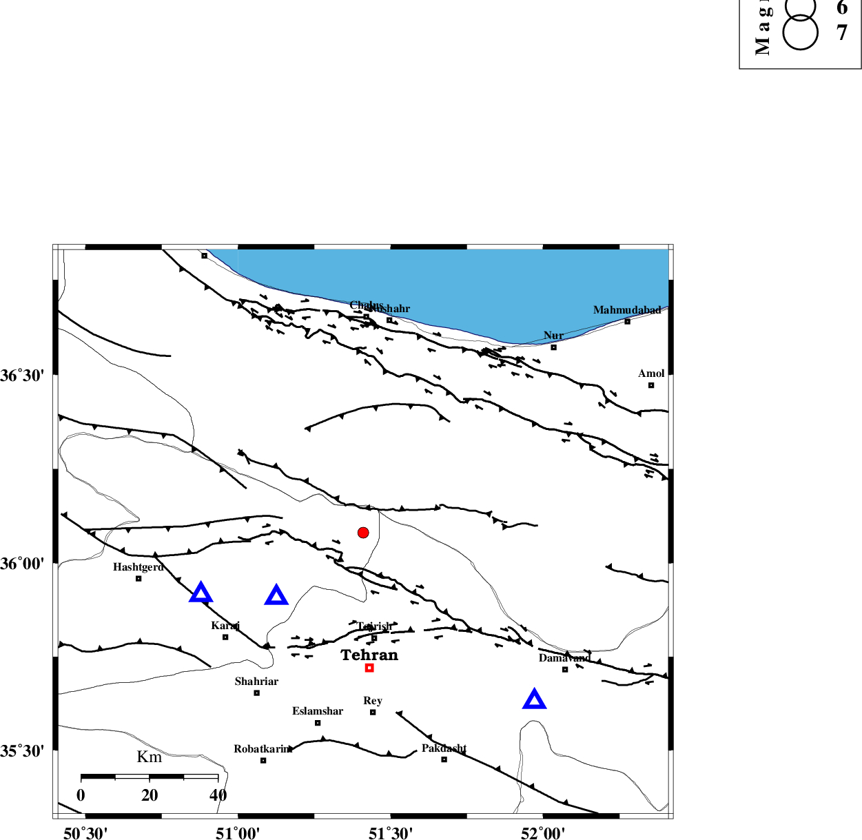
| Location | Lat:36.08 Lon: 51.41 |
| Region | Tehran Province, 31 km North of Tajrish |
Nearest Cities |
|
| 2 km North of Nesa, Tehran Province | |
| 12 km North of Asara, Tehran Province | |
| 16 km North of Meygon, Tehran Province | |
| 17 km South of Pol-e zanguleh, Mazandaran Province | |
| 19 km North West of Fasham, Tehran Province | |
| Depth | 14 km |
| Agency | |
Faults within 150 km: |
|
| KANDOVAN_F (Length: 90 km) , Distance to epicenter: 8 km | |
| MOSHA_F (Length: 234 km) , Distance to epicenter: 9 km | |
| TALEGHAN_F (Length: 71 km) , Distance to epicenter: 19 km | |
| Number of Phases | 6 |
| RMS | 0.3 |
| Number of Stations | 4 |
| Error in Latitude | >4.7 km |
| Error in Longitude | 9 km |
| Error in Depth | 8.2 km |
Download waveform in seisan format
to download seisan software Click here
to access information about IIEES stations Click here
Amplitude | ||||||||
| UID | Agency | Station | Component | Amplitude | Period | Arrival Time | Proccessing Time | Signal Clip |
| 94030 | IIEES | GHVR | N | 25.9 | 0.45 | 2014-10-21 00:43:57 | 2014-10-21 01:13:00 | n |
Phase | ||||||||||||
| Agency | Station | Component | Phase Type | Phase Quality | First Motion | Observed Arrival Time | Time Residual | Loc. Flag | Input Weight | Distance | Azimuth | |
| IIEES | CHTH | Z | Pg | E | 2014-10-21 00:43:08 | 0.16 | y | 31.2 | 234 | |||
| IIEES | THKV | Z | Pg | E | 2014-10-21 00:43:10 | -0.48 | y | 50.6 | 250 | |||
| IIEES | GHVR | N | Pn | E | 2014-10-21 00:43:32 | 0.06 | y | 177 | 185 | |||
| IIEES | GHVR | N | Sg | E | 2014-10-21 00:43:52 | -0.26 | y | 177 | 185 | |||
| IIEES | ASAO | Z | Pn | E | 2014-10-21 00:43:36 | 0.32 | y | 211 | 217 | |||
| IIEES | ASAO | E | Sg | E | 2014-10-21 00:44:02 | 0.2 | y | 211 | 217 | |||
کلیه حقوق مادی و معنوی این سایت متعلق به پژوهشگاه بین المللی زلزله شناسی و مهندسی زلزله می باشد.
