خانه / مشخصات زلزله
Magnitude |
:1.5 |
| Date & Time (UTC) | 2015-01-14 20:57:00.3 |
| Date & Time (Local) | 1393/10/25 00:27:00.3 |
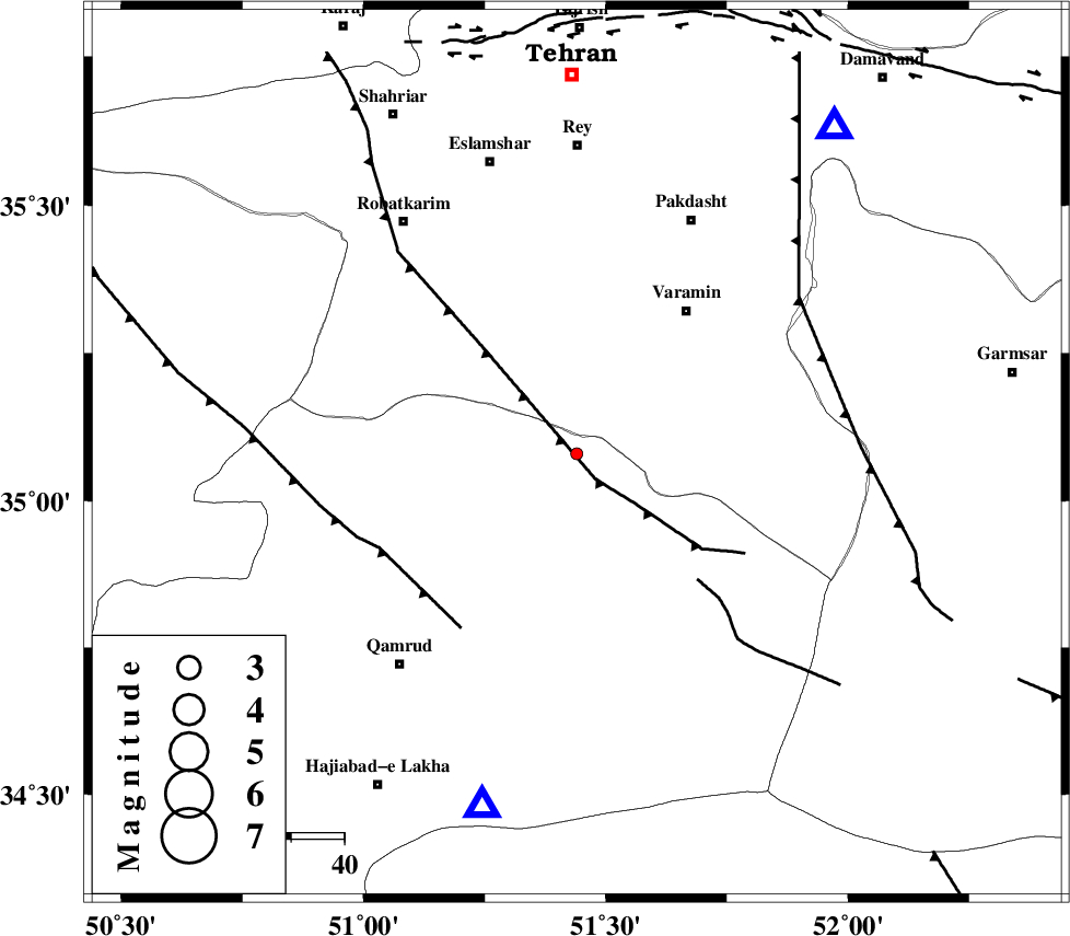
| Location | Lat:35.08 Lon: 51.44 |
| Region | Qom Province, 34 km South-West of Varamin |
Nearest Cities |
|
| 25 km South West of Ab barik, Tehran Province | |
| 30 km South West of Bagh-e khavas, Tehran Province | |
| 34 km South West of Varamin, Tehran Province | |
| 36 km South West of Pishva, Tehran Province | |
| 41 km South West of Khalilabad, Tehran Province | |
| Depth | 18 km |
| Agency | |
Faults within 150 km: |
|
| SIAHKUH_F (Length: 154 km) , Distance to epicenter: 2 km | |
| PISHAV_F (Length: 34 km) , Distance to epicenter: 36 km | |
| GARMSAR_F (Length: 77 km) , Distance to epicenter: 40 km | |
| Number of Phases | 6 |
| RMS | 0 |
| Number of Stations | 4 |
| Error in Latitude | >0.7 km |
| Error in Longitude | 2.5 km |
| Error in Depth | 3.1 km |
Download waveform in seisan format
to download seisan software Click here
to access information about IIEES stations Click here
Amplitude | ||||||||
| UID | Agency | Station | Component | Amplitude | Period | Arrival Time | Proccessing Time | Signal Clip |
| 94773 | IIEES | DAMV | Z | 20.5 | 0.32 | 2015-01-14 20:57:24 | 2015-01-14 10:23:00 | n |
Phase | ||||||||||||
| Agency | Station | Component | Phase Type | Phase Quality | First Motion | Observed Arrival Time | Time Residual | Loc. Flag | Input Weight | Distance | Azimuth | |
| IIEES | GHVR | Z | Pg | E | 2015-01-14 20:57:12 | -0.04 | y | 69 | 195 | |||
| IIEES | GHVR | E | Sg | E | 2015-01-14 20:57:21 | 0.03 | y | 69 | 195 | |||
| IIEES | DAMV | Z | Pg | E | 2015-01-14 20:57:13 | 0.01 | y | 77.7 | 38 | |||
| IIEES | CHTH | Z | Pg | E | 2015-01-14 20:57:16 | -0.01 | y | 96.1 | 343 | |||
| IIEES | CHTH | E | Sg | E | 2015-01-14 20:57:28 | 0.01 | y | 96.1 | 343 | |||
| IIEES | ASAO | Z | Pn | E | 2015-01-14 20:57:25 | 0 | y | 142 | 246 | |||
کلیه حقوق مادی و معنوی این سایت متعلق به پژوهشگاه بین المللی زلزله شناسی و مهندسی زلزله می باشد.
