خانه / مشخصات زلزله
Magnitude |
:2.7 |
| Date & Time (UTC) | 2015-08-11 02:08:05.2 |
| Date & Time (Local) | 1394/5/20 06:38:05.2 |
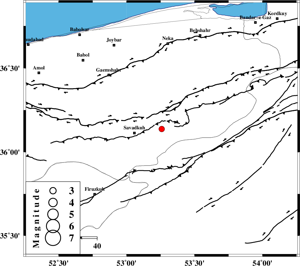
| Location | Lat:36.138 Lon: 53.258 |
| Region | Mazandaran Province, 18 km -East of Pol-E-Sefid |
Nearest Cities |
|
| 8 km North of Sangdeh, Mazandaran Province | |
| 18 km North East of Pol-E-Sefid, Mazandaran Province | |
| 19 km North East of Shurmast-e peyrudbar, Mazandaran Province | |
| 22 km South of Khalkhil, Mazandaran Province | |
| 24 km East of Utu, Mazandaran Province | |
| Depth | 14 km |
| Agency | |
Faults within 150 km: |
|
| N_ALBORZ_F (Length: 360 km) , Distance to epicenter: 11 km | |
| KHAZAR_F (Length: 523 km) , Distance to epicenter: 45 km | |
| ATARI_F (Length: 185 km) , Distance to epicenter: 48 km | |
| Number of Phases | 7 |
| RMS | 0.2 |
| Number of Stations | 6 |
| Error in Latitude | >7 km |
| Error in Longitude | 1.7 km |
| Error in Depth | 3.8 km |
Download waveform in seisan format
to download seisan software Click here
to access information about IIEES stations Click here
Amplitude | ||||||||
| UID | Agency | Station | Component | Amplitude | Period | Arrival Time | Proccessing Time | Signal Clip |
| 100300 | IIEES | GHVR | N | 36.4 | 0.47 | 2015-08-11 02:09:23 | 2015-08-12 08:24:00 | n |
| 100301 | IIEES | GHVR | E | 46.5 | 0.36 | 2015-08-11 02:09:26 | 2015-08-12 08:24:00 | n |
Phase | ||||||||||||
| Agency | Station | Component | Phase Type | Phase Quality | First Motion | Observed Arrival Time | Time Residual | Loc. Flag | Input Weight | Distance | Azimuth | |
| IIEES | DAMV | Z | Pg | E | 2015-08-11 02:08:26 | -0.32 | y | 129 | 245 | |||
| IIEES | CHTH | Z | Pg | E | 2015-08-11 02:08:37 | 0.13 | y | 194 | 263 | |||
| IIEES | THKV | Z | Pn | E | 2015-08-11 02:08:39 | -0.06 | y | 216 | 264 | |||
| IIEES | SHRO | Z | Pn | E | 2015-08-11 02:08:43 | -0.07 | y | 249 | 93 | |||
| IIEES | SHRO | E | Sg | E | 2015-08-11 02:09:15 | 0.03 | y | 249 | 93 | |||
| IIEES | GHVR | Z | Pn | E | 2015-08-11 02:08:45 | 0.08 | y | 259 | 225 | |||
| IIEES | ASAO | Z | Pn | E | 2015-08-11 02:08:55 | 0.24 | y | 343 | 240 | |||
کلیه حقوق مادی و معنوی این سایت متعلق به پژوهشگاه بین المللی زلزله شناسی و مهندسی زلزله می باشد.
