خانه / مشخصات زلزله
Magnitude |
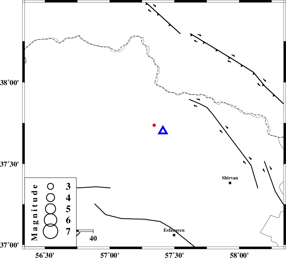
:1.4 |
| Date & Time (UTC) | 2015-10-10 02:02:59.4 |
| Date & Time (Local) | 1394/7/18 05:32:59.4 |
| Location | Lat:37.737 Lon: 57.343 |
| Region | Khorasan(north) Province, 29 km North of Bojnurd |
Nearest Cities |
|
| 22 km South West of Gifan olia, Khorasan(north) Province | |
| 28 km North West of Hesar-egarmkhanh, Khorasan(north) Province | |
| 29 km South East of Raz, Khorasan(north) Province | |
| 29 km North of Void, Khorasan(north) Province | |
| 29 km North of Bojnurd, Khorasan(north) Province | |
| Depth | 6 km |
| Agency | |
Faults within 150 km: |
|
| BAGHAN_GERMAB_F (Length: 79 km) , Distance to epicenter: 29 km | |
| ROBATE_QARABIL_F (Length: 168 km) , Distance to epicenter: 52 km | |
| MAIN_KOPEHDAGH_F2 (Length: 131 km) , Distance to epicenter: 65 km | |
| Number of Phases | 5 |
| RMS | 0.3 |
| Number of Stations | 3 |
| Error in Latitude | >4 km |
| Error in Longitude | 3.5 km |
| Error in Depth | 5.1 km |
Download waveform in seisan format
to download seisan software Click here
to access information about IIEES stations Click here
Amplitude | ||||||||
| UID | Agency | Station | Component | Amplitude | Period | Arrival Time | Proccessing Time | Signal Clip |
| 101647 | IIEES | MRVT | E | 9.5 | 0.34 | 2015-10-10 02:03:35 | 2015-10-11 12:59:00 | n |
| 101648 | IIEES | MRVT | N | 10.7 | 0.34 | 2015-10-10 02:03:35 | 2015-10-11 12:59:00 | n |
Phase | ||||||||||||
| Agency | Station | Component | Phase Type | Phase Quality | First Motion | Observed Arrival Time | Time Residual | Loc. Flag | Input Weight | Distance | Azimuth | |
| IIEES | BJRD | Z | Pg | E | 2015-10-10 02:03:01 | -0.25 | y | 7.07 | 126 | |||
| IIEES | MRVT | Z | Pg | E | 2015-10-10 02:03:18 | 0 | y | 111 | 266 | |||
| IIEES | MRVT | E | Sg | E | 2015-10-10 02:03:32 | -0.13 | y | 111 | 266 | |||
| IIEES | SHRO | Z | Pn | E | 2015-10-10 02:03:36 | 0.52 | y | 226 | 212 | |||
| IIEES | SHRO | E | Sg | E | 2015-10-10 02:04:06 | -0.13 | y | 226 | 212 | |||
کلیه حقوق مادی و معنوی این سایت متعلق به پژوهشگاه بین المللی زلزله شناسی و مهندسی زلزله می باشد.
