خانه / مشخصات زلزله
Magnitude |
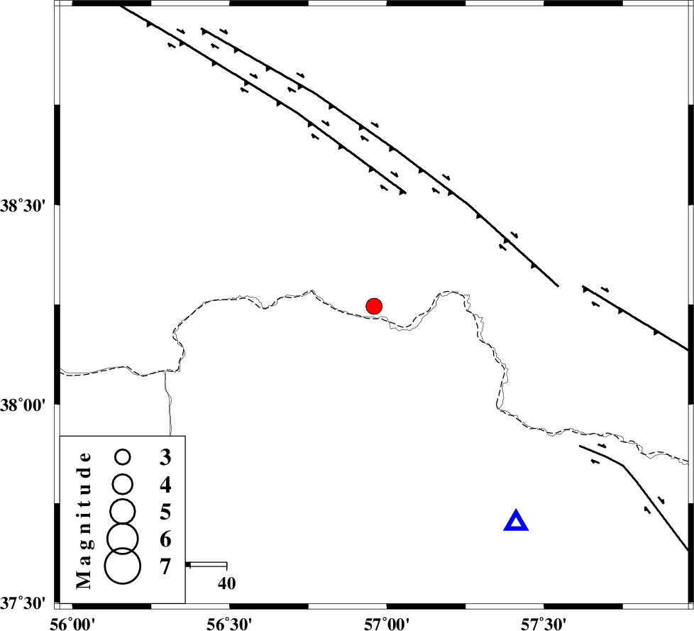
:3.2 |
| Date & Time (UTC) | 2015-11-08 13:38:01.8 |
| Date & Time (Local) | 1394/8/17 17:08:01.8 |
| Location | Lat:38.246 Lon: 56.959 |
| Region | , 77 km North of Ashkhaneh |
Nearest Cities |
|
| 21 km North East of Yekehsoud-e paeen, Khorasan(north) Province | |
| 33 km North of Tangehzar, Khorasan(north) Province | |
| 37 km North West of Raz, Khorasan(north) Province | |
| 60 km North West of Gifan olia, Khorasan(north) Province | |
| 66 km North of Pish qaleh, Khorasan(north) Province | |
| Depth | 14 km |
| Agency | |
Faults within 150 km: |
|
| MAIN_KOPEHDAGH_F1 (Length: 318 km) , Distance to epicenter: 33 km | |
| MAIN_KOPEHDAGH_F2 (Length: 131 km) , Distance to epicenter: 39 km | |
| MAIN_KOPEHDAGH_F3 (Length: 96 km) , Distance to epicenter: 58 km | |
| Number of Phases | 7 |
| RMS | 0.2 |
| Number of Stations | 5 |
| Error in Latitude | >6.6 km |
| Error in Longitude | 4.2 km |
| Error in Depth | 9.8 km |
Download waveform in seisan format
to download seisan software Click here
to access information about IIEES stations Click here
Amplitude | ||||||||
| UID | Agency | Station | Component | Amplitude | Period | Arrival Time | Proccessing Time | Signal Clip |
| 102265 | IIEES | DAMV | E | 18.6 | 0.33 | 2015-11-08 13:40:02 | 2015-11-09 09:40:00 | n |
| 102266 | IIEES | YZKH | E | 6.7 | 0.86 | 2015-11-08 13:41:45 | 2015-11-09 09:40:00 | n |
Phase | ||||||||||||
| Agency | Station | Component | Phase Type | Phase Quality | First Motion | Observed Arrival Time | Time Residual | Loc. Flag | Input Weight | Distance | Azimuth | |
| IIEES | BJRD | Z | Pg | E | 2015-11-08 13:38:14 | -0.43 | y | 72.3 | 147 | |||
| IIEES | BJRD | E | Sg | E | 2015-11-08 13:38:24 | 0.27 | y | 72.3 | 147 | |||
| IIEES | SHRO | Z | Pn | E | 2015-11-08 13:38:42 | 0.27 | y | 262 | 199 | |||
| IIEES | SHRO | N | Sg | E | 2015-11-08 13:39:15 | -0.12 | y | 262 | 199 | |||
| IIEES | DAMV | Z | Pn | E | 2015-11-08 13:39:15 | -0.05 | y | 531 | 238 | |||
| IIEES | SHRT | Z | Pn | E | 2015-11-08 13:39:23 | 0.04 | y | 592 | 149 | |||
| IIEES | YZKH | Z | Pn | E | 2015-11-08 13:39:34 | 0.02 | y | 684 | 199 | |||
کلیه حقوق مادی و معنوی این سایت متعلق به پژوهشگاه بین المللی زلزله شناسی و مهندسی زلزله می باشد.
