خانه / مشخصات زلزله
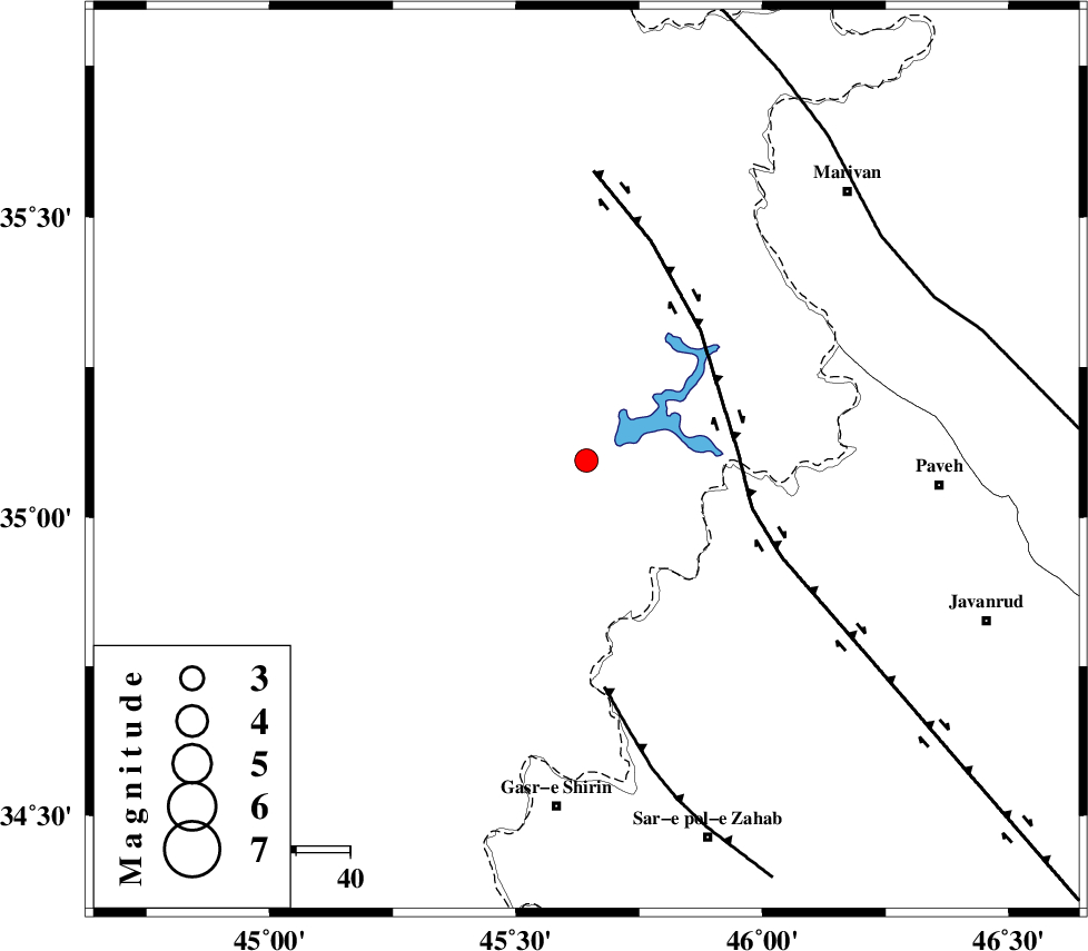
Magnitude |
:3 |
| Date & Time (UTC) | 2016-02-15 02:45:51.1 |
| Date & Time (Local) | 1394/11/26 06:15:51.1 |
| Location | Lat:35.094 Lon: 45.643 |
| Region | Iraq, 41 km North-West of Tazehabad |
Nearest Cities |
|
| 28 km North West of Markhil, Kermanshah Province | |
| 38 km North of Tappeh rash, Kermanshah Province | |
| 40 km North West of Dehsheykh, Kermanshah Province | |
| 41 km North West of Tazehabad, Kermanshah Province | |
| 45 km North West of Gardehnu, Kermanshah Province | |
| Depth | 14 km |
| Agency | |
Faults within 150 km: |
|
| HZF4 (Length: 492 km) , Distance to epicenter: 28 km | |
| MFF8 (Length: 48 km) , Distance to epicenter: 42 km | |
| PIRANSHAHR_F (Length: 253 km) , Distance to epicenter: 68 km | |
| Number of Phases | 7 |
| RMS | 0.2 |
| Number of Stations | 6 |
| Error in Latitude | >5.1 km |
| Error in Longitude | 7.3 km |
| Error in Depth | 7.8 km |
Download waveform in seisan format
to download seisan software Click here
to access information about IIEES stations Click here
Amplitude | ||||||||
| UID | Agency | Station | Component | Amplitude | Period | Arrival Time | Proccessing Time | Signal Clip |
| 104363 | IIEES | SNGE | N | 202.8 | 0.81 | 2016-02-15 02:46:45 | 2016-02-15 06:13:00 | n |
Phase | ||||||||||||
| Agency | Station | Component | Phase Type | Phase Quality | First Motion | Observed Arrival Time | Time Residual | Loc. Flag | Input Weight | Distance | Azimuth | |
| IIEES | SNGE | Z | Pg | E | 2016-02-15 02:46:16 | -0.35 | y | 155 | 90 | |||
| IIEES | SNGE | N | Sg | E | 2016-02-15 02:46:36 | 0.12 | y | 155 | 90 | |||
| IIEES | ZNJK | Z | Pn | E | 2016-02-15 02:46:39 | -0.03 | y | 326 | 57 | |||
| IIEES | ASAO | Z | Pn | E | 2016-02-15 02:46:49 | 0.13 | y | 405 | 97 | |||
| IIEES | KHMZ | Z | Pn | E | 2016-02-15 02:46:51 | 0.21 | y | 425 | 109 | |||
| IIEES | GRMI | Z | Pn | E | 2016-02-15 02:46:55 | 0.11 | y | 459 | 25 | |||
| IIEES | GHVR | Z | Pn | E | 2016-02-15 02:47:02 | -0.14 | y | 517 | 96 | |||
کلیه حقوق مادی و معنوی این سایت متعلق به پژوهشگاه بین المللی زلزله شناسی و مهندسی زلزله می باشد.
