خانه / مشخصات زلزله
Magnitude |
:2.9 |
| Date & Time (UTC) | 2016-04-01 13:16:57.1 |
| Date & Time (Local) | 1395/1/13 17:46:57.1 |
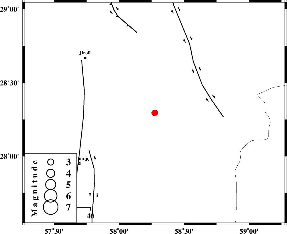
| Location | Lat:28.295 Lon: 58.274 |
| Region | Kerman Province, 91 km South of Bam |
Nearest Cities |
|
| 11 km of Mardehak, Kerman Province | |
| 35 km South East of Dosari, Kerman Province | |
| 38 km North West of Borj-e abbasabad, Kerman Province | |
| 39 km South East of Dahane-ye gomrokan, Kerman Province | |
| 43 km South East of Aliabad-e qadiri, Kerman Province | |
| Depth | 14 km |
| Agency | |
Faults within 150 km: |
|
| BAM_F (Length: 118 km) , Distance to epicenter: 42 km | |
| SABZEVARAN_F (Length: 190 km) , Distance to epicenter: 54 km | |
| JIROFT_F (Length: 144 km) , Distance to epicenter: 57 km | |
| Number of Phases | 6 |
| RMS | 0.1 |
| Number of Stations | 5 |
| Error in Latitude | >5.9 km |
| Error in Longitude | 5.2 km |
| Error in Depth | 6.3 km |
Download waveform in seisan format
to download seisan software Click here
to access information about IIEES stations Click here
Amplitude | ||||||||
| UID | Agency | Station | Component | Amplitude | Period | Arrival Time | Proccessing Time | Signal Clip |
| 105140 | IIEES | KRBR | N | 63.4 | 0.11 | 2016-04-01 13:18:09 | 2016-04-03 08:23:00 | n |
Phase | ||||||||||||
| Agency | Station | Component | Phase Type | Phase Quality | First Motion | Observed Arrival Time | Time Residual | Loc. Flag | Input Weight | Distance | Azimuth | |
| IIEES | KRBR | Z | Pg | E | 2016-04-01 13:17:36 | 0.01 | y | 238 | 322 | |||
| IIEES | KRBR | N | Sg | E | 2016-04-01 13:18:04 | -0.01 | y | 238 | 322 | |||
| IIEES | BSRN | Z | Pn | E | 2016-04-01 13:17:56 | -0.14 | y | 415 | 11 | |||
| IIEES | YZKH | Z | Pn | E | 2016-04-01 13:18:16 | -0.05 | y | 576 | 323 | |||
| IIEES | TABS | Z | Pn | E | 2016-04-01 13:18:20 | 0.16 | y | 604 | 350 | |||
| IIEES | SHRT | Z | Pn | E | 2016-04-01 13:18:22 | 0.1 | y | 624 | 17 | |||
کلیه حقوق مادی و معنوی این سایت متعلق به پژوهشگاه بین المللی زلزله شناسی و مهندسی زلزله می باشد.
