خانه / مشخصات زلزله
Magnitude |
:2.8 |
| Date & Time (UTC) | 2017-11-20 11:21:17.0 |
| Date & Time (Local) | 1396/8/29 14:51:17.0 |
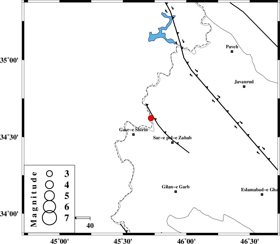
| Location | Lat:34.622 Lon: 45.72 |
| Region | Iraq, 17 km North-East of Qasr-E-Shirin |
Nearest Cities |
|
| 8 km North of Mirmiru, Kermanshah Province | |
| 10 km North of Aqabarar, Kermanshah Province | |
| 13 km of Gardehnu, Kermanshah Province | |
| 15 km South of Tappeh rash, Kermanshah Province | |
| 16 km North of Qareh belagh, Kermanshah Province | |
| Depth | 14 km |
| Agency | |
Faults within 150 km: |
|
| MFF8 (Length: 48 km) , Distance to epicenter: 3 km | |
| HZF4 (Length: 492 km) , Distance to epicenter: 45 km | |
| ZFF4 (Length: 128 km) , Distance to epicenter: 80 km | |
| Number of Phases | 6 |
| RMS | 0.3 |
| Number of Stations | 5 |
| Error in Latitude | >5 km |
| Error in Longitude | 8 km |
| Error in Depth | 9.3 km |
Download waveform in seisan format
to download seisan software Click here
to access information about IIEES stations Click here
Amplitude | ||||||||
| UID | Agency | Station | Component | Amplitude | Period | Arrival Time | Proccessing Time | Signal Clip |
| 122115 | IIEES | SNGE | E | 173.7 | 0.36 | 2017-11-20 11:22:06 | 2017-11-20 12:13:00 | n |
| 122116 | IIEES | SNGE | N | 180.5 | 0.72 | 2017-11-20 11:22:07 | 2017-11-20 12:13:00 | n |
| 122117 | IIEES | ASAO | E | 8.2 | 0.52 | 2017-11-20 11:23:23 | 2017-11-20 12:13:00 | n |
Phase | ||||||||||||
| Agency | Station | Component | Phase Type | Phase Quality | First Motion | Observed Arrival Time | Time Residual | Loc. Flag | Input Weight | Distance | Azimuth | |
| IIEES | ILBA | Z | Pg | E | 2017-11-20 11:21:37 | -0.03 | y | 119 | 158 | |||
| IIEES | SNGE | Z | Pg | E | 2017-11-20 11:21:43 | -0.17 | y | 158 | 70 | |||
| IIEES | SNGE | N | Sg | E | 2017-11-20 11:22:02 | 0.09 | y | 158 | 70 | |||
| IIEES | ZNJK | Z | Pn | E | 2017-11-20 11:22:08 | -0.46 | y | 352 | 49 | |||
| IIEES | ASAO | Z | Pn | E | 2017-11-20 11:22:14 | 0.37 | y | 395 | 90 | |||
| IIEES | GRMI | Z | Pn | E | 2017-11-20 11:22:27 | 0.32 | y | 504 | 22 | |||
کلیه حقوق مادی و معنوی این سایت متعلق به پژوهشگاه بین المللی زلزله شناسی و مهندسی زلزله می باشد.
