خانه / مشخصات زلزله
Magnitude |
:3 |
| Date & Time (UTC) | 2018-02-13 12:49:07.2 |
| Date & Time (Local) | 1396/11/24 16:19:07.2 |
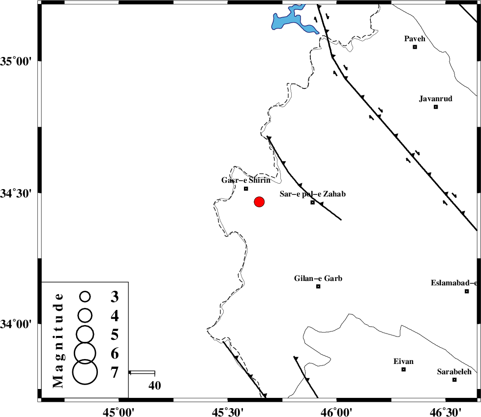
| Location | Lat:34.465 Lon: 45.644 |
| Region | Kermanshah Province, 8 km of Qasr-E-Shirin |
Nearest Cities |
|
| 5 km North of Seyyed sohrab, Kermanshah Province | |
| 8 km of Qasr-E-Shirin, Kermanshah Province | |
| 9 km of Aqabarar, Kermanshah Province | |
| 13 km West of Qareh belagh, Kermanshah Province | |
| 16 km South West of Mirmiru, Kermanshah Province | |
| Depth | 15 km |
| Agency | |
Faults within 150 km: |
|
| MFF8 (Length: 48 km) , Distance to epicenter: 18 km | |
| ZFF4 (Length: 128 km) , Distance to epicenter: 61 km | |
| HZF4 (Length: 492 km) , Distance to epicenter: 62 km | |
| Number of Phases | 6 |
| RMS | 0.3 |
| Number of Stations | 4 |
| Error in Latitude | >2.5 km |
| Error in Longitude | 4 km |
| Error in Depth | 8.9 km |
Download waveform in seisan format
to download seisan software Click here
to access information about IIEES stations Click here
Amplitude | ||||||||
| UID | Agency | Station | Component | Amplitude | Period | Arrival Time | Proccessing Time | Signal Clip |
| 128377 | IIEES | SNGE | N | 165.9 | 0.4 | 2018-02-13 12:49:59 | 2018-02-14 06:02:00 | n |
| 128378 | IIEES | SNGE | E | 258.9 | 0.3 | 2018-02-13 12:50:00 | 2018-02-14 06:02:00 | n |
| 128379 | IIEES | SRSL | N | 151.6 | 0.52 | 2018-02-13 12:50:05 | 2018-02-14 06:02:00 | n |
| 128380 | IIEES | SRSL | E | 118.6 | 0.33 | 2018-02-13 12:50:07 | 2018-02-14 06:02:00 | n |
Phase | ||||||||||||
| Agency | Station | Component | Phase Type | Phase Quality | First Motion | Observed Arrival Time | Time Residual | Loc. Flag | Input Weight | Distance | Azimuth | |
| IIEES | ILBA | Z | Pg | E | 2018-02-13 12:49:25 | 0.19 | y | 107 | 151 | |||
| IIEES | SNGE | Z | Pg | E | 2018-02-13 12:49:35 | -0.53 | y | 171 | 65 | |||
| IIEES | SNGE | N | Sg | E | 2018-02-13 12:49:56 | 0.26 | y | 171 | 65 | |||
| IIEES | SRSL | Z | Pg | E | 2018-02-13 12:49:39 | -0.07 | y | 195 | 354 | |||
| IIEES | SRSL | N | Sg | E | 2018-02-13 12:50:02 | 0.16 | y | 195 | 354 | |||
| IIEES | ASAO | Z | Pn | E | 2018-02-13 12:50:05 | 0.01 | y | 402 | 87 | |||
کلیه حقوق مادی و معنوی این سایت متعلق به پژوهشگاه بین المللی زلزله شناسی و مهندسی زلزله می باشد.
