خانه / مشخصات زلزله
Magnitude |
:2.5 |
| Date & Time (UTC) | 2018-04-13 19:51:02.2 |
| Date & Time (Local) | 1397/1/25 00:21:02.2 |
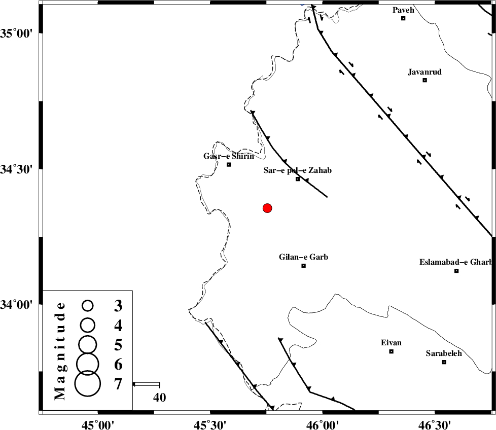
| Location | Lat:34.355 Lon: 45.754 |
| Region | Kermanshah Province, 17 km South-West of Sar-e pol-e zahab |
Nearest Cities |
|
| 10 km North West of Chub baghan, Kermanshah Province | |
| 15 km South of Qareh belagh, Kermanshah Province | |
| 16 km West of Tarkveys, Kermanshah Province | |
| 17 km South West of Sar-e pol-e zahab, Kermanshah Province | |
| 18 km East of Seyyed sohrab, Kermanshah Province | |
| Depth | 14 km |
| Agency | |
Faults within 150 km: |
|
| MFF8 (Length: 48 km) , Distance to epicenter: 19 km | |
| ZFF4 (Length: 128 km) , Distance to epicenter: 53 km | |
| MFF7 (Length: 99 km) , Distance to epicenter: 53 km | |
| Number of Phases | 6 |
| RMS | 0.2 |
| Number of Stations | 4 |
| Error in Latitude | >2.1 km |
| Error in Longitude | 3.5 km |
| Error in Depth | 5.9 km |
Download waveform in seisan format
to download seisan software Click here
to access information about IIEES stations Click here
Amplitude | ||||||||
| UID | Agency | Station | Component | Amplitude | Period | Arrival Time | Proccessing Time | Signal Clip |
| 130287 | IIEES | ILBA | E | 133.8 | 0.46 | 2018-04-13 19:51:41 | 2018-04-15 07:09:00 | n |
| 130288 | IIEES | SNGE | N | 65.9 | 0.6 | 2018-04-13 19:51:54 | 2018-04-15 07:09:00 | n |
| 130289 | IIEES | SNGE | E | 77.7 | 0.54 | 2018-04-13 19:51:55 | 2018-04-15 07:09:00 | n |
| 130290 | IIEES | ASAO | E | 5 | 0.61 | 2018-04-13 19:53:03 | 2018-04-15 07:09:00 | n |
Phase | ||||||||||||
| Agency | Station | Component | Phase Type | Phase Quality | First Motion | Observed Arrival Time | Time Residual | Loc. Flag | Input Weight | Distance | Azimuth | |
| IIEES | ILBA | Z | Pg | E | 2018-04-13 19:51:17 | -0.01 | y | 91.2 | 153 | |||
| IIEES | SNGE | Z | Pg | E | 2018-04-13 19:51:29 | -0.34 | y | 167 | 60 | |||
| IIEES | SNGE | N | Sg | E | 2018-04-13 19:51:50 | 0.04 | y | 167 | 60 | |||
| IIEES | SRSL | Z | Pn | E | 2018-04-13 19:51:35 | -0.15 | y | 208 | 352 | |||
| IIEES | SRSL | N | Sg | E | 2018-04-13 19:52:01 | 0.13 | y | 208 | 352 | |||
| IIEES | ASAO | Z | Pn | E | 2018-04-13 19:51:59 | 0.4 | y | 393 | 86 | |||
کلیه حقوق مادی و معنوی این سایت متعلق به پژوهشگاه بین المللی زلزله شناسی و مهندسی زلزله می باشد.
