خانه / مشخصات زلزله
Magnitude |
:2.7 |
| Date & Time (UTC) | 2018-04-01 10:21:07.9 |
| Date & Time (Local) | 1397/1/12 14:51:07.9 |
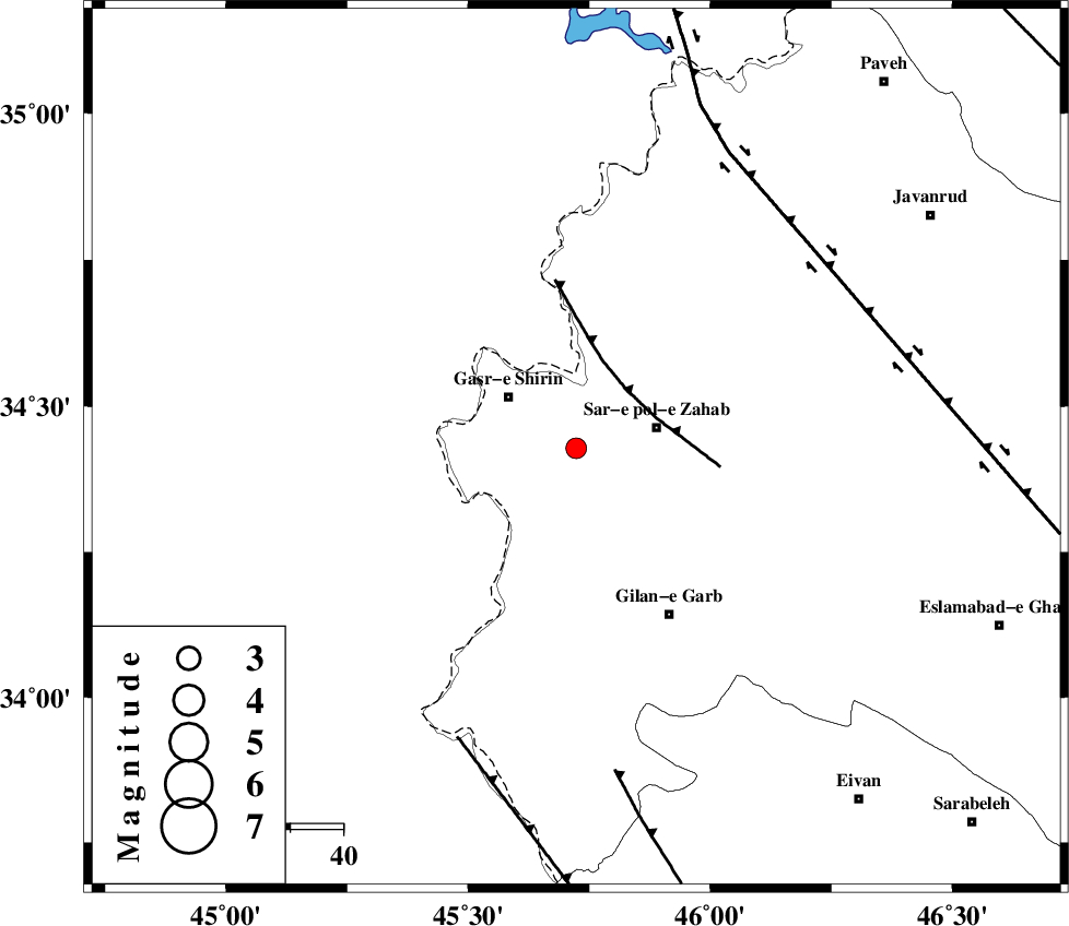
| Location | Lat:34.428 Lon: 45.723 |
| Region | Kermanshah Province, 16 km -West of Sar-e pol-e zahab |
Nearest Cities |
|
| 8 km of Qareh belagh, Kermanshah Province | |
| 12 km East of Seyyed sohrab, Kermanshah Province | |
| 14 km South of Aqabarar, Kermanshah Province | |
| 16 km West of Sar-e pol-e zahab, Kermanshah Province | |
| 16 km South of Mirmiru, Kermanshah Province | |
| Depth | 14 km |
| Agency | |
Faults within 150 km: |
|
| MFF8 (Length: 48 km) , Distance to epicenter: 15 km | |
| HZF4 (Length: 492 km) , Distance to epicenter: 59 km | |
| ZFF4 (Length: 128 km) , Distance to epicenter: 60 km | |
| Number of Phases | 6 |
| RMS | 0.2 |
| Number of Stations | 4 |
| Error in Latitude | >2.6 km |
| Error in Longitude | 7.6 km |
| Error in Depth | 5.6 km |
Download waveform in seisan format
to download seisan software Click here
to access information about IIEES stations Click here
Amplitude | ||||||||
| UID | Agency | Station | Component | Amplitude | Period | Arrival Time | Proccessing Time | Signal Clip |
| 133091 | IIEES | ILBA | N | 219.6 | 0.23 | 2018-04-01 10:21:44 | 2018-06-03 11:40:00 | n |
Phase | ||||||||||||
| Agency | Station | Component | Phase Type | Phase Quality | First Motion | Observed Arrival Time | Time Residual | Loc. Flag | Input Weight | Distance | Azimuth | |
| IIEES | ILBA | Z | Pg | E | 2018-04-01 10:21:24 | -0.23 | y | 99.7 | 153 | |||
| IIEES | ILBA | N | Sg | E | 2018-04-01 10:21:37 | 0.06 | y | 99.7 | 153 | |||
| IIEES | SNGE | Z | Pg | E | 2018-04-01 10:21:35 | -0.12 | y | 166 | 63 | |||
| IIEES | SNGE | Z | Sg | E | 2018-04-01 10:21:55 | -0.08 | y | 166 | 63 | |||
| IIEES | ASAO | Z | Pn | E | 2018-04-01 10:22:05 | 0.37 | y | 395 | 87 | |||
| IIEES | KHMZ | Z | Pn | E | 2018-04-01 10:22:05 | 0.11 | y | 399 | 100 | |||
کلیه حقوق مادی و معنوی این سایت متعلق به پژوهشگاه بین المللی زلزله شناسی و مهندسی زلزله می باشد.
