خانه / مشخصات زلزله
Magnitude |
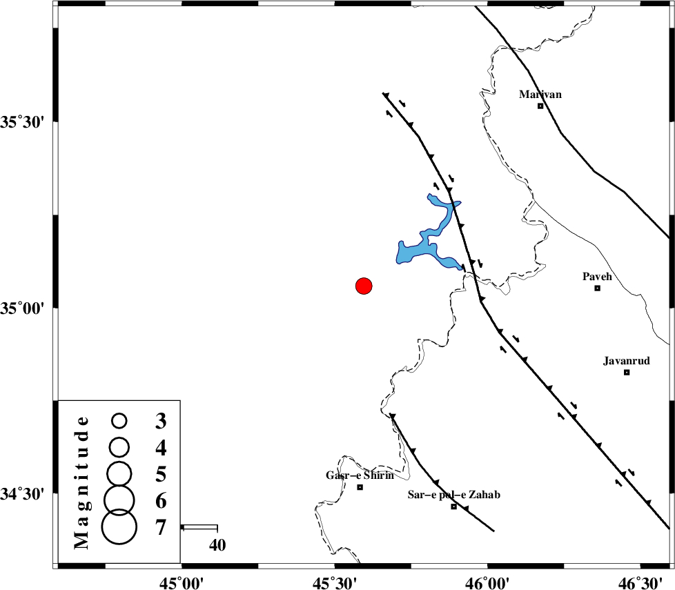
:3.4 |
| Date & Time (UTC) | 2018-09-22 21:46:18.5 |
| Date & Time (Local) | 1397/7/1 01:16:18.5 |
| Location | Lat:35.059 Lon: 45.595 |
| Region | Iraq, 39 km North-West of Tazehabad |
Nearest Cities |
|
| 32 km West of Markhil, Kermanshah Province | |
| 36 km North West of Tappeh rash, Kermanshah Province | |
| 39 km North West of Tazehabad, Kermanshah Province | |
| 42 km North West of Dehsheykh, Kermanshah Province | |
| 43 km North West of Gardehnu, Kermanshah Province | |
| Depth | 14 km |
| Agency | |
Faults within 150 km: |
|
| HZF4 (Length: 492 km) , Distance to epicenter: 33 km | |
| MFF8 (Length: 48 km) , Distance to epicenter: 39 km | |
| PIRANSHAHR_F (Length: 253 km) , Distance to epicenter: 74 km | |
| Number of Phases | 7 |
| RMS | 0.2 |
| Number of Stations | 6 |
| Error in Latitude | >2.2 km |
| Error in Longitude | 6.7 km |
| Error in Depth | 6.2 km |
Download waveform in seisan format
to download seisan software Click here
to access information about IIEES stations Click here
Amplitude | ||||||||
| UID | Agency | Station | Component | Amplitude | Period | Arrival Time | Proccessing Time | Signal Clip |
| 137034 | IIEES | SRSL | N | 370.2 | 0.38 | 2018-09-22 21:47:03 | 2018-09-23 12:06:00 | n |
| 137035 | IIEES | SRSL | E | 432 | 0.3 | 2018-09-22 21:47:04 | 2018-09-23 12:06:00 | n |
| 137036 | IIEES | ILBA | E | 1280.8 | 0.46 | 2018-09-22 21:47:10 | 2018-09-23 12:06:00 | n |
Phase | ||||||||||||
| Agency | Station | Component | Phase Type | Phase Quality | First Motion | Observed Arrival Time | Time Residual | Loc. Flag | Input Weight | Distance | Azimuth | |
| IIEES | SRSL | Z | Pg | E | 2018-09-22 21:46:40 | 0 | y | 129 | 354 | |||
| IIEES | SNGE | Z | Pg | E | 2018-09-22 21:46:44 | -0.24 | y | 160 | 88 | |||
| IIEES | ILBA | Z | Pg | E | 2018-09-22 21:46:46 | -0.17 | y | 169 | 160 | |||
| IIEES | ILBA | N | Sg | E | 2018-09-22 21:47:07 | 0.2 | y | 169 | 160 | |||
| IIEES | ZNJK | Z | Pn | E | 2018-09-22 21:47:07 | 0.22 | y | 331 | 56 | |||
| IIEES | ASAO | Z | Pn | E | 2018-09-22 21:47:17 | 0.36 | y | 409 | 97 | |||
| IIEES | KHMZ | Z | Pn | E | 2018-09-22 21:47:19 | -0.35 | y | 428 | 109 | |||
کلیه حقوق مادی و معنوی این سایت متعلق به پژوهشگاه بین المللی زلزله شناسی و مهندسی زلزله می باشد.
