خانه / مشخصات زلزله
Magnitude |
:3.4 |
| Date & Time (UTC) | 2018-09-24 07:35:21.7 |
| Date & Time (Local) | 1397/7/2 11:05:21.7 |
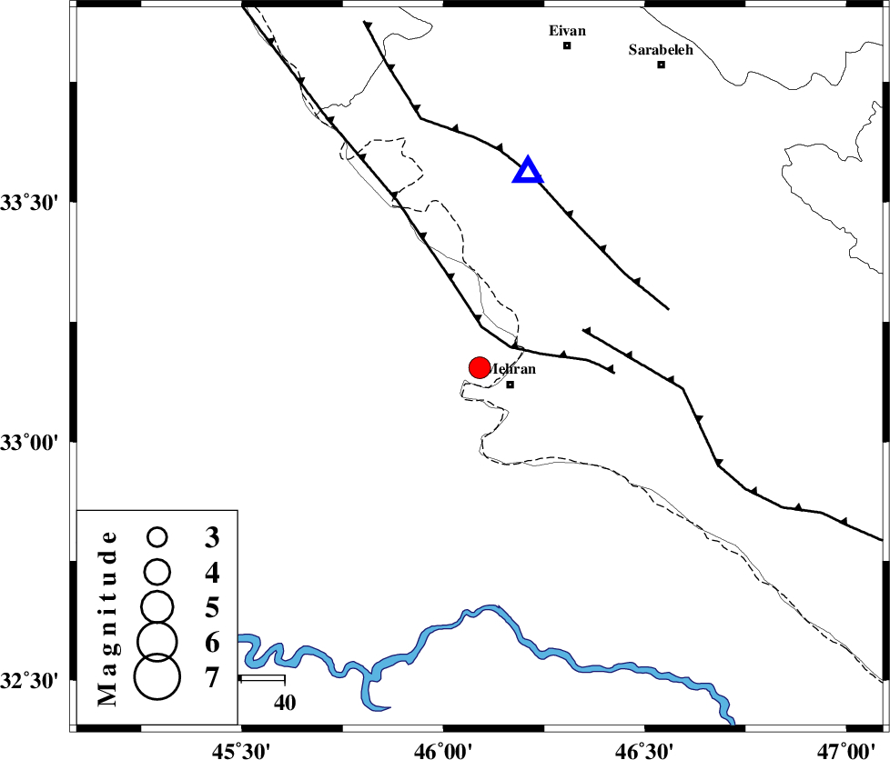
| Location | Lat:33.155 Lon: 46.09 |
| Region | Iraq, 8 km of Mehran |
Nearest Cities |
|
| 8 km North of Mehran, Ilam Province | |
| 36 km South of Salehabad, Ilam Province | |
| 38 km South West of Galeh-yedarre-hemalakshahi, Ilam Province | |
| 44 km West of Gonbad-e pirmohammad, Ilam Province | |
| 47 km South West of Mehr, Ilam Province | |
| Depth | 14 km |
| Agency | |
Faults within 150 km: |
|
| ZFF4 (Length: 128 km) , Distance to epicenter: 9 km | |
| MFF6 (Length: 144 km) , Distance to epicenter: 25 km | |
| MFF7 (Length: 99 km) , Distance to epicenter: 40 km | |
| Number of Phases | 8 |
| RMS | 0.3 |
| Number of Stations | 6 |
| Error in Latitude | >4.3 km |
| Error in Longitude | 6.4 km |
| Error in Depth | 5.9 km |
Download waveform in seisan format
to download seisan software Click here
to access information about IIEES stations Click here
Amplitude | ||||||||
| UID | Agency | Station | Component | Amplitude | Period | Arrival Time | Proccessing Time | Signal Clip |
| 137090 | IIEES | ILBA | N | 3971.4 | 0.7 | 2018-09-24 07:35:46 | 2018-09-24 11:47:00 | n |
| 137091 | IIEES | ILBA | E | 3328.6 | 0.7 | 2018-09-24 07:35:52 | 2018-09-24 11:47:00 | n |
| 137092 | IIEES | SRSL | N | 60.9 | 0.41 | 2018-09-24 07:37:10 | 2018-09-24 11:47:00 | n |
| 137093 | IIEES | GHVR | E | 19.9 | 0.56 | 2018-09-24 07:37:29 | 2018-09-24 11:47:00 | n |
| 137094 | IIEES | GHVR | N | 28.2 | 0.83 | 2018-09-24 07:37:29 | 2018-09-24 11:47:00 | n |
Phase | ||||||||||||
| Agency | Station | Component | Phase Type | Phase Quality | First Motion | Observed Arrival Time | Time Residual | Loc. Flag | Input Weight | Distance | Azimuth | |
| IIEES | ILBA | Z | Pg | E | 2018-09-24 07:35:31 | -0.2 | y | 53.2 | 12 | |||
| IIEES | SNGE | Z | Pn | E | 2018-09-24 07:36:00 | 0.53 | y | 244 | 28 | |||
| IIEES | SNGE | N | Sg | E | 2018-09-24 07:36:30 | 0.05 | y | 244 | 28 | |||
| IIEES | SRSL | Z | Pn | E | 2018-09-24 07:36:12 | 0.16 | y | 344 | 350 | |||
| IIEES | SRSL | N | S | E | 2018-09-24 07:36:49 | -0.26 | y | 344 | 350 | |||
| IIEES | KHMZ | Z | Pn | E | 2018-09-24 07:36:14 | -0.3 | y | 366 | 79 | |||
| IIEES | ASAO | Z | Pn | E | 2018-09-24 07:36:18 | -0.04 | y | 396 | 66 | |||
| IIEES | GHVR | Z | Pn | E | 2018-09-24 07:36:31 | -0.01 | y | 499 | 71 | |||
کلیه حقوق مادی و معنوی این سایت متعلق به پژوهشگاه بین المللی زلزله شناسی و مهندسی زلزله می باشد.
