خانه / مشخصات زلزله
Magnitude |
:2.8 |
| Date & Time (UTC) | 2018-09-25 20:22:02.1 |
| Date & Time (Local) | 1397/7/3 23:52:02.1 |
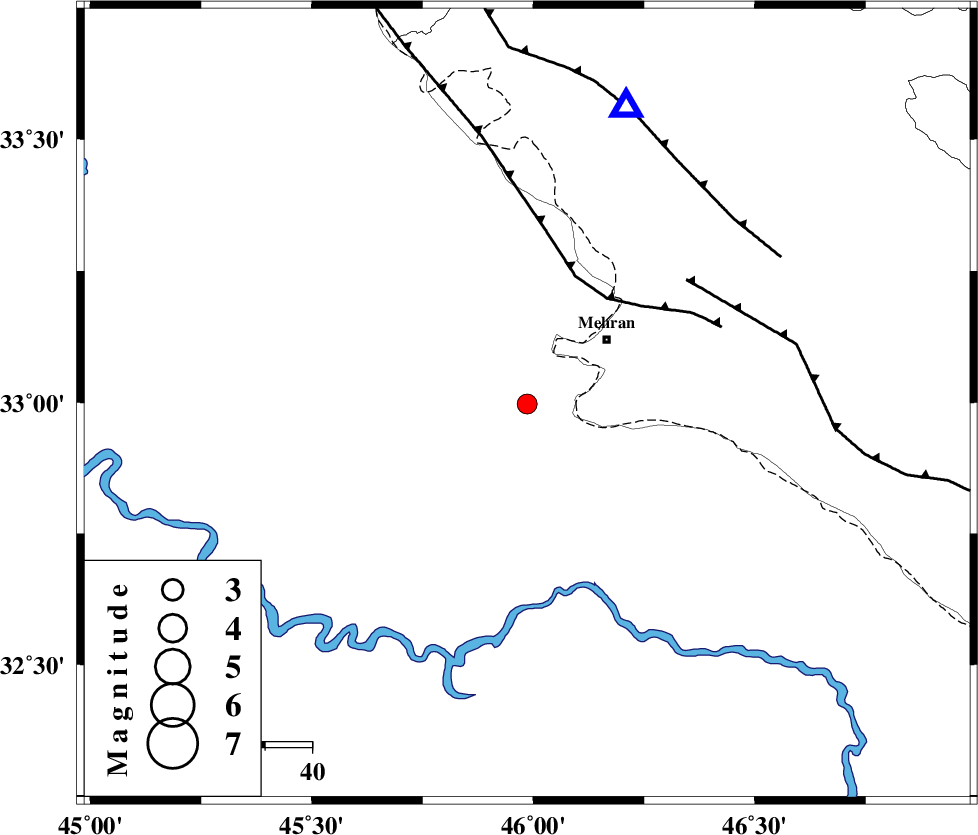
| Location | Lat:32.997 Lon: 45.986 |
| Region | Iraq, 22 km South-West of Mehran |
Nearest Cities |
|
| 22 km South West of Mehran, Ilam Province | |
| 56 km South West of Galeh-yedarre-hemalakshahi, Ilam Province | |
| 56 km South West of Salehabad, Ilam Province | |
| 60 km South West of Gonbad-e pirmohammad, Ilam Province | |
| 67 km South West of Mehr, Ilam Province | |
| Depth | 14 km |
| Agency | |
Faults within 150 km: |
|
| ZFF4 (Length: 128 km) , Distance to epicenter: 28 km | |
| MFF6 (Length: 144 km) , Distance to epicenter: 43 km | |
| MFF7 (Length: 99 km) , Distance to epicenter: 58 km | |
| Number of Phases | 7 |
| RMS | 0.2 |
| Number of Stations | 5 |
| Error in Latitude | >5.8 km |
| Error in Longitude | 6.5 km |
| Error in Depth | 9.7 km |
Download waveform in seisan format
to download seisan software Click here
to access information about IIEES stations Click here
Amplitude | ||||||||
| UID | Agency | Station | Component | Amplitude | Period | Arrival Time | Proccessing Time | Signal Clip |
| 137158 | IIEES | ILBA | N | 641.2 | 0.53 | 2018-09-25 20:22:28 | 2018-09-26 10:37:00 | n |
| 137159 | IIEES | ILBA | E | 488.7 | 0.44 | 2018-09-25 20:22:29 | 2018-09-26 10:37:00 | n |
| 137160 | IIEES | SRSL | N | 12.9 | 0.77 | 2018-09-25 20:23:53 | 2018-09-26 10:37:00 | n |
| 137161 | IIEES | ASAO | N | 21.8 | 1 | 2018-09-25 20:24:12 | 2018-09-26 10:37:00 | n |
Phase | ||||||||||||
| Agency | Station | Component | Phase Type | Phase Quality | First Motion | Observed Arrival Time | Time Residual | Loc. Flag | Input Weight | Distance | Azimuth | |
| IIEES | ILBA | Z | Pg | E | 2018-09-25 20:22:14 | -0.48 | y | 72.6 | 16 | |||
| IIEES | ILBA | N | Sg | E | 2018-09-25 20:22:24 | 0.13 | y | 72.6 | 16 | |||
| IIEES | SNGE | Z | Pn | E | 2018-09-25 20:22:42 | -0.01 | y | 264 | 28 | |||
| IIEES | SNGE | N | Sg | E | 2018-09-25 20:23:16 | 0.04 | y | 264 | 28 | |||
| IIEES | SRSL | Z | Pn | E | 2018-09-25 20:22:54 | 0.28 | y | 360 | 352 | |||
| IIEES | KHMZ | Z | Pn | E | 2018-09-25 20:22:57 | 0.16 | y | 379 | 76 | |||
| IIEES | ASAO | Z | Pn | E | 2018-09-25 20:23:01 | -0.06 | y | 412 | 64 | |||
کلیه حقوق مادی و معنوی این سایت متعلق به پژوهشگاه بین المللی زلزله شناسی و مهندسی زلزله می باشد.
