خانه / مشخصات زلزله
Magnitude |
:2.1 |
| Date & Time (UTC) | 2018-09-25 22:15:55.4 |
| Date & Time (Local) | 1397/7/4 01:45:55.4 |
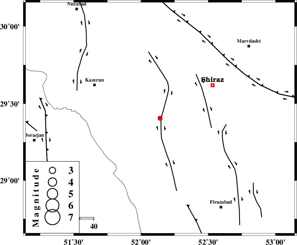
| Location | Lat:29.405 Lon: 52.142 |
| Region | Fars Province, 60 km North of Farashband |
Nearest Cities |
|
| 10 km of Richi, Fars Province | |
| 24 km North East of Baladeh, Fars Province | |
| 24 km North East of Jareh, Fars Province | |
| 29 km North East of Dadin-e olia, Fars Province | |
| 30 km South of Khanehzanian, Fars Province | |
| Depth | 9 km |
| Agency | |
Faults within 150 km: |
|
| KAREBASS_F (Length: 98 km) , Distance to epicenter: 1 km | |
| SABZ_PUSHAN_F_Z3 (Length: 37 km) , Distance to epicenter: 35 km | |
| SABZ_PUSHAN_F_Z1 (Length: 69 km) , Distance to epicenter: 46 km | |
| Number of Phases | 6 |
| RMS | 0.1 |
| Number of Stations | 3 |
| Error in Latitude | >4.5 km |
| Error in Longitude | 1.8 km |
| Error in Depth | 8.9 km |
Download waveform in seisan format
to download seisan software Click here
to access information about IIEES stations Click here
Amplitude | ||||||||
| UID | Agency | Station | Component | Amplitude | Period | Arrival Time | Proccessing Time | Signal Clip |
| 137172 | IIEES | AHRM | E | 52.4 | 0.3 | 2018-09-25 22:16:28 | 2018-09-26 10:37:00 | n |
Phase | ||||||||||||
| Agency | Station | Component | Phase Type | Phase Quality | First Motion | Observed Arrival Time | Time Residual | Loc. Flag | Input Weight | Distance | Azimuth | |
| IIEES | AHRM | Z | Pg | E | 2018-09-25 22:16:13 | 0.04 | y | 102 | 234 | |||
| IIEES | AHRM | N | Sg | E | 2018-09-25 22:16:25 | -0.02 | y | 102 | 234 | |||
| IIEES | GHIR | Z | Pg | E | 2018-09-25 22:16:20 | -0.21 | y | 149 | 146 | |||
| IIEES | GHIR | N | Sg | E | 2018-09-25 22:16:40 | 0.13 | y | 149 | 146 | |||
| IIEES | YZKH | Z | Pn | E | 2018-09-25 22:16:54 | 0.2 | y | 405 | 35 | |||
| IIEES | YZKH | E | S | E | 2018-09-25 22:17:37 | -0.11 | y | 405 | 35 | |||
کلیه حقوق مادی و معنوی این سایت متعلق به پژوهشگاه بین المللی زلزله شناسی و مهندسی زلزله می باشد.
