خانه / مشخصات زلزله
Magnitude |
:2.3 |
| Date & Time (UTC) | 2018-10-06 21:41:09.9 |
| Date & Time (Local) | 1397/7/15 01:11:09.9 |
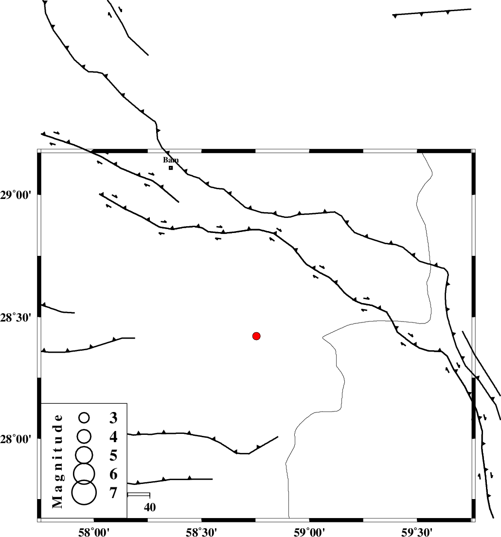
| Location | Lat:28.421 Lon: 58.754 |
| Region | Kerman Province, 86 km South-East of Bam |
Nearest Cities |
|
| 34 km South West of Mohammadabad-e gonbaki, Kerman Province | |
| 44 km South West of Hoseynabad, Kerman Province | |
| 50 km North East of Borj-e abbasabad, Kerman Province | |
| 52 km South West of Void, Kerman Province | |
| 54 km South East of Kruk, Kerman Province | |
| Depth | 14 km |
| Agency | |
Faults within 150 km: |
|
| BAM_F (Length: 118 km) , Distance to epicenter: 6 km | |
| GOWK_F (Length: 152 km) , Distance to epicenter: 76 km | |
| SABZEVARAN_F (Length: 190 km) , Distance to epicenter: 100 km | |
| Number of Phases | 5 |
| RMS | 0.1 |
| Number of Stations | 3 |
| Error in Latitude | >4.4 km |
| Error in Longitude | 1.5 km |
| Error in Depth | 7.2 km |
Download waveform in seisan format
to download seisan software Click here
to access information about IIEES stations Click here
Amplitude | ||||||||
| UID | Agency | Station | Component | Amplitude | Period | Arrival Time | Proccessing Time | Signal Clip |
| 137548 | IIEES | KRBR | N | 15.2 | 0.65 | 2018-10-06 21:42:30 | 2018-10-07 06:03:00 | n |
Phase | ||||||||||||
| Agency | Station | Component | Phase Type | Phase Quality | First Motion | Observed Arrival Time | Time Residual | Loc. Flag | Input Weight | Distance | Azimuth | |
| IIEES | ZHSF | Z | Pn | E | 2018-10-06 21:41:47 | 0.24 | y | 237 | 56 | |||
| IIEES | ZHSF | N | Sg | E | 2018-10-06 21:42:16 | -0.15 | y | 237 | 56 | |||
| IIEES | KRBR | Z | Pn | E | 2018-10-06 21:41:50 | 0.02 | y | 260 | 312 | |||
| IIEES | KRBR | N | Sg | E | 2018-10-06 21:42:23 | 0 | y | 260 | 312 | |||
| IIEES | BNDS | Z | Pn | E | 2018-10-06 21:41:52 | -0.11 | y | 278 | 247 | |||
کلیه حقوق مادی و معنوی این سایت متعلق به پژوهشگاه بین المللی زلزله شناسی و مهندسی زلزله می باشد.
