خانه / مشخصات زلزله
Magnitude |
:3.1 |
| Date & Time (UTC) | 2018-10-09 09:42:19.2 |
| Date & Time (Local) | 1397/7/17 13:12:19.2 |
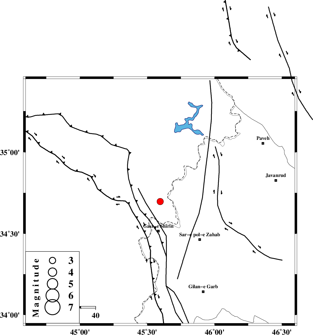
| Location | Lat:34.697 Lon: 45.596 |
| Region | Iraq, 20 km North of Qasr-E-Shirin |
Nearest Cities |
|
| 13 km West of Tappeh rash, Kermanshah Province | |
| 18 km North of Aqabarar, Kermanshah Province | |
| 19 km West of Gardehnu, Kermanshah Province | |
| 20 km North of Qasr-E-Shirin, Kermanshah Province | |
| 21 km North West of Mirmiru, Kermanshah Province | |
| Depth | 14 km |
| Agency | |
Faults within 150 km: |
|
| MFF8 (Length: 48 km) , Distance to epicenter: 8 km | |
| HZF4 (Length: 492 km) , Distance to epicenter: 48 km | |
| ZFF4 (Length: 128 km) , Distance to epicenter: 86 km | |
| Number of Phases | 8 |
| RMS | 0.3 |
| Number of Stations | 7 |
| Error in Latitude | >2.2 km |
| Error in Longitude | 6.9 km |
| Error in Depth | 4.7 km |
Download waveform in seisan format
to download seisan software Click here
to access information about IIEES stations Click here
Amplitude | ||||||||
| UID | Agency | Station | Component | Amplitude | Period | Arrival Time | Proccessing Time | Signal Clip |
| 137652 | IIEES | ILBA | E | 479 | 0.4 | 2018-10-09 09:43:00 | 2018-10-09 11:39:00 | n |
| 137653 | IIEES | ILBA | N | 378.1 | 0.3 | 2018-10-09 09:43:01 | 2018-10-09 11:39:00 | n |
| 137654 | IIEES | SNGE | E | 127.2 | 0.45 | 2018-10-09 09:43:11 | 2018-10-09 11:39:00 | n |
| 137655 | IIEES | SRSL | E | 240.2 | 0.35 | 2018-10-09 09:43:11 | 2018-10-09 11:39:00 | n |
| 137656 | IIEES | SRSL | N | 168.7 | 0.48 | 2018-10-09 09:43:14 | 2018-10-09 11:39:00 | n |
| 137657 | IIEES | GHVR | E | 13.8 | 0.83 | 2018-10-09 09:45:06 | 2018-10-09 11:39:00 | n |
Phase | ||||||||||||
| Agency | Station | Component | Phase Type | Phase Quality | First Motion | Observed Arrival Time | Time Residual | Loc. Flag | Input Weight | Distance | Azimuth | |
| IIEES | ILBA | Z | Pg | E | 2018-10-09 09:42:41 | -0.2 | y | 132 | 154 | |||
| IIEES | ILBA | N | Sg | E | 2018-10-09 09:42:57 | 0.06 | y | 132 | 154 | |||
| IIEES | SNGE | Z | Pg | E | 2018-10-09 09:42:46 | -0.21 | y | 166 | 74 | |||
| IIEES | SRSL | Z | Pg | E | 2018-10-09 09:42:47 | 0.13 | y | 169 | 355 | |||
| IIEES | ZNJK | Z | Pn | E | 2018-10-09 09:43:10 | -0.44 | y | 355 | 51 | |||
| IIEES | ASAO | Z | Pn | E | 2018-10-09 09:43:18 | 0.38 | y | 407 | 91 | |||
| IIEES | KHMZ | Z | Pn | E | 2018-10-09 09:43:18 | 0.13 | y | 416 | 104 | |||
| IIEES | GHVR | Z | Pn | E | 2018-10-09 09:43:31 | 0.29 | y | 519 | 91 | |||
کلیه حقوق مادی و معنوی این سایت متعلق به پژوهشگاه بین المللی زلزله شناسی و مهندسی زلزله می باشد.
