خانه / مشخصات زلزله
Magnitude |
:2.8 |
| Date & Time (UTC) | 2018-10-11 11:48:44.7 |
| Date & Time (Local) | 1397/7/19 15:18:44.7 |
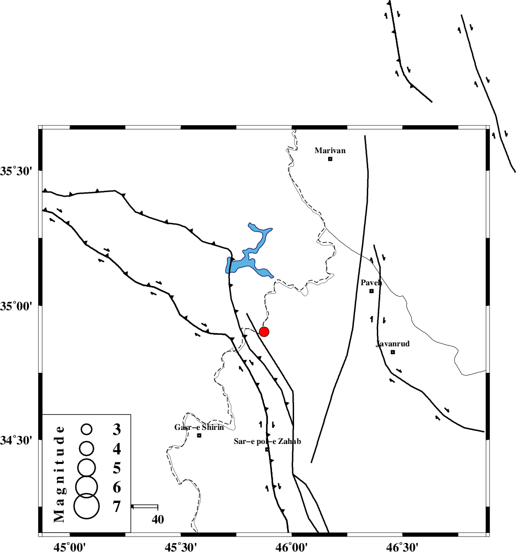
| Location | Lat:34.902 Lon: 45.875 |
| Region | Kermanshah Province, 16 km North of Tazehabad |
Nearest Cities |
|
| 11 km North of Dehsheykh, Kermanshah Province | |
| 16 km North of Tazehabad, Kermanshah Province | |
| 20 km South of Markhil, Kermanshah Province | |
| 22 km North East of Tappeh rash, Kermanshah Province | |
| 22 km West of Bayangan, Kermanshah Province | |
| Depth | 15 km |
| Agency | |
Faults within 150 km: |
|
| HZF4 (Length: 492 km) , Distance to epicenter: 15 km | |
| MFF8 (Length: 48 km) , Distance to epicenter: 27 km | |
| PIRANSHAHR_F (Length: 253 km) , Distance to epicenter: 67 km | |
| Number of Phases | 6 |
| RMS | 0.4 |
| Number of Stations | 4 |
| Error in Latitude | >2.8 km |
| Error in Longitude | 4.8 km |
| Error in Depth | 9.6 km |
Download waveform in seisan format
to download seisan software Click here
to access information about IIEES stations Click here
Amplitude | ||||||||
| UID | Agency | Station | Component | Amplitude | Period | Arrival Time | Proccessing Time | Signal Clip |
| 137706 | IIEES | ILBA | E | 243.7 | 0.54 | 2018-10-11 11:49:29 | 2018-10-13 08:18:00 | n |
| 137707 | IIEES | ILBA | N | 113 | 0.18 | 2018-10-11 11:49:30 | 2018-10-13 08:18:00 | n |
Phase | ||||||||||||
| Agency | Station | Component | Phase Type | Phase Quality | First Motion | Observed Arrival Time | Time Residual | Loc. Flag | Input Weight | Distance | Azimuth | |
| IIEES | SNGE | Z | Pg | E | 2018-10-11 11:49:07 | -0.31 | y | 136 | 81 | |||
| IIEES | SNGE | N | Sg | E | 2018-10-11 11:49:24 | 0.1 | y | 136 | 81 | |||
| IIEES | ILBA | Z | Pg | E | 2018-10-11 11:49:08 | -0.78 | y | 145 | 168 | |||
| IIEES | ILBA | N | Sg | E | 2018-10-11 11:49:26 | 0.56 | y | 145 | 168 | |||
| IIEES | SRSL | Z | Pg | E | 2018-10-11 11:49:10 | 0.23 | y | 151 | 345 | |||
| IIEES | ASAO | Z | Pn | E | 2018-10-11 11:49:40 | 0.25 | y | 382 | 95 | |||
کلیه حقوق مادی و معنوی این سایت متعلق به پژوهشگاه بین المللی زلزله شناسی و مهندسی زلزله می باشد.
