خانه / مشخصات زلزله
Magnitude |
:2.8 |
| Date & Time (UTC) | 2018-10-14 21:18:39.3 |
| Date & Time (Local) | 1397/7/23 00:48:39.3 |
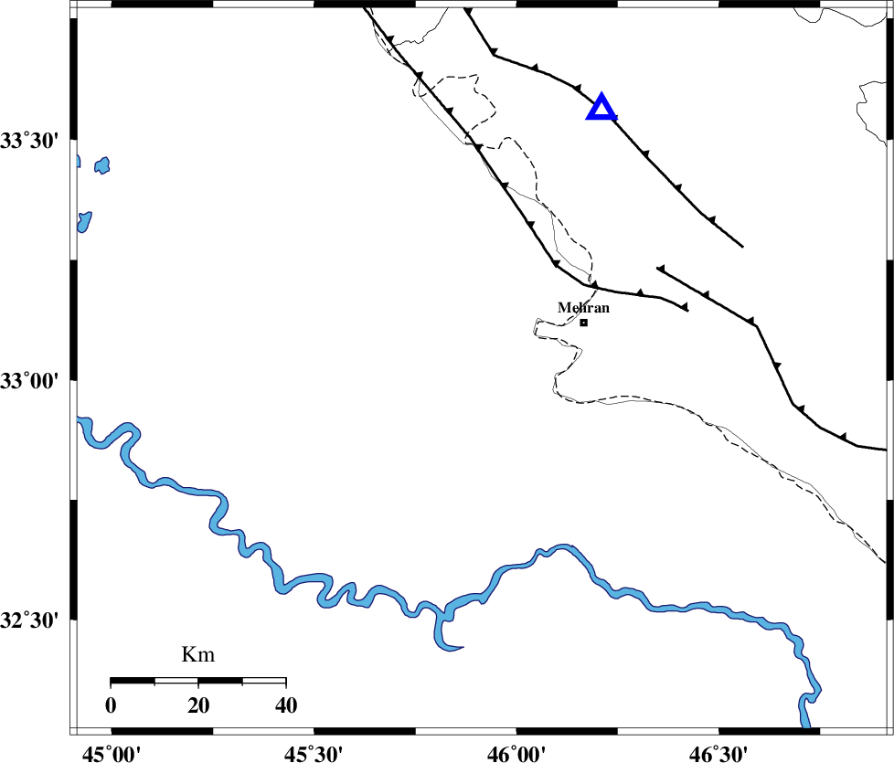
| Location | Lat:33.023 Lon: 45.914 |
| Region | Iraq, 26 km -West of Mehran |
Nearest Cities |
|
| 26 km West of Mehran, Ilam Province | |
| 56 km South West of Salehabad, Ilam Province | |
| 59 km South West of Galeh-yedarre-hemalakshahi, Ilam Province | |
| 65 km South West of Gonbad-e pirmohammad, Ilam Province | |
| 69 km South West of Mehr, Ilam Province | |
| Depth | 6 km |
| Agency | |
Faults within 150 km: |
|
| ZFF4 (Length: 128 km) , Distance to epicenter: 29 km | |
| MFF6 (Length: 144 km) , Distance to epicenter: 46 km | |
| MFF7 (Length: 99 km) , Distance to epicenter: 62 km | |
| Number of Phases | 7 |
| RMS | 0.2 |
| Number of Stations | 5 |
| Error in Latitude | >2.6 km |
| Error in Longitude | 5 km |
| Error in Depth | 2.9 km |
Download waveform in seisan format
to download seisan software Click here
to access information about IIEES stations Click here
Amplitude | ||||||||
| UID | Agency | Station | Component | Amplitude | Period | Arrival Time | Proccessing Time | Signal Clip |
| 137766 | IIEES | ILBA | E | 399.1 | 0.62 | 2018-10-14 21:19:05 | 2018-10-15 08:52:00 | n |
| 137767 | IIEES | ILBA | N | 599.1 | 0.62 | 2018-10-14 21:19:06 | 2018-10-15 08:52:00 | n |
Phase | ||||||||||||
| Agency | Station | Component | Phase Type | Phase Quality | First Motion | Observed Arrival Time | Time Residual | Loc. Flag | Input Weight | Distance | Azimuth | |
| IIEES | ILBA | Z | Pg | E | 2018-10-14 21:18:51 | -0.27 | y | 72 | 22 | |||
| IIEES | ILBA | N | Sg | E | 2018-10-14 21:19:01 | 0.18 | y | 72 | 22 | |||
| IIEES | SNGE | Z | Pn | E | 2018-10-14 21:19:20 | -0.04 | y | 265 | 30 | |||
| IIEES | SNGE | N | S | E | 2018-10-14 21:19:51 | -0.12 | y | 265 | 30 | |||
| IIEES | SRSL | Z | Pn | E | 2018-10-14 21:19:32 | 0.15 | y | 357 | 353 | |||
| IIEES | KHMZ | Z | Pn | E | 2018-10-14 21:19:36 | 0.09 | y | 385 | 77 | |||
| IIEES | ASAO | Z | Pn | E | 2018-10-14 21:19:39 | 0.07 | y | 417 | 65 | |||
کلیه حقوق مادی و معنوی این سایت متعلق به پژوهشگاه بین المللی زلزله شناسی و مهندسی زلزله می باشد.
