خانه / مشخصات زلزله
Magnitude |
:2.5 |
| Date & Time (UTC) | 2018-10-15 08:53:24.9 |
| Date & Time (Local) | 1397/7/23 12:23:24.9 |
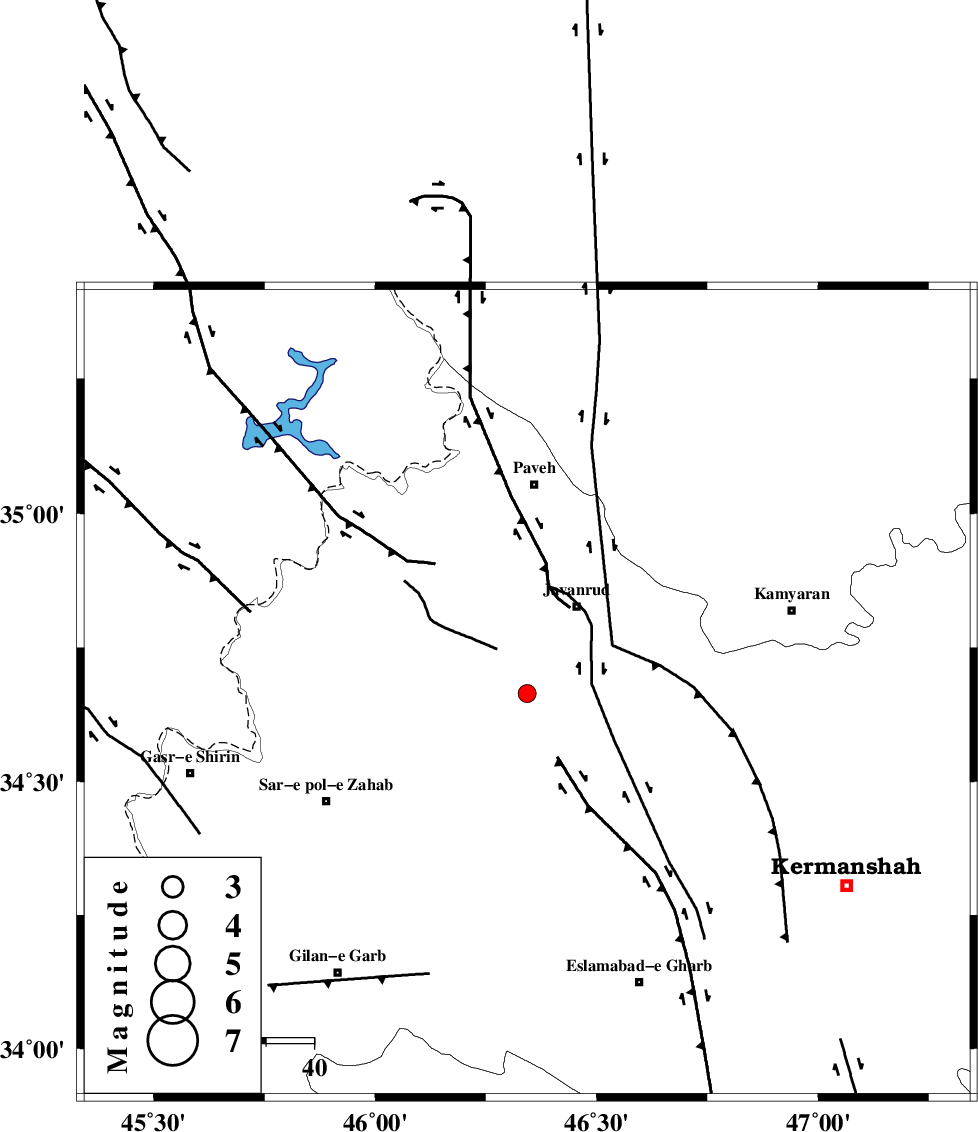
| Location | Lat:34.665 Lon: 46.343 |
| Region | Kermanshah Province, 21 km South-West of Javanrud |
Nearest Cities |
|
| 4 km of Mirabad, Kermanshah Province | |
| 12 km West of Dolatabad, Kermanshah Province | |
| 14 km West of Sarukhan, Kermanshah Province | |
| 18 km East of Qolqoleh, Kermanshah Province | |
| 19 km North of Zavleh olia, Kermanshah Province | |
| Depth | 14 km |
| Agency | |
Faults within 150 km: |
|
| HZF4 (Length: 492 km) , Distance to epicenter: 11 km | |
| MFF8 (Length: 48 km) , Distance to epicenter: 42 km | |
| SARTAKHT_F (Length: 78 km) , Distance to epicenter: 52 km | |
| Number of Phases | 6 |
| RMS | 0.1 |
| Number of Stations | 4 |
| Error in Latitude | >1.3 km |
| Error in Longitude | 2.2 km |
| Error in Depth | 5.1 km |
Download waveform in seisan format
to download seisan software Click here
to access information about IIEES stations Click here
Amplitude | ||||||||
| UID | Agency | Station | Component | Amplitude | Period | Arrival Time | Proccessing Time | Signal Clip |
| 137804 | IIEES | SNGE | E | 96 | 0.57 | 2018-10-15 08:53:59 | 2018-10-16 08:25:00 | n |
| 137805 | IIEES | SNGE | N | 121.1 | 0.54 | 2018-10-15 08:54:00 | 2018-10-16 08:25:00 | n |
| 137806 | IIEES | ILBA | E | 107.1 | 0.41 | 2018-10-15 08:54:03 | 2018-10-16 08:25:00 | n |
| 137807 | IIEES | ILBA | N | 126.9 | 0.29 | 2018-10-15 08:54:05 | 2018-10-16 08:25:00 | n |
| 137808 | IIEES | SRSL | N | 45.8 | 0.93 | 2018-10-15 08:54:25 | 2018-10-16 08:25:00 | n |
| 137809 | IIEES | SRSL | E | 46.4 | 0.41 | 2018-10-15 08:54:27 | 2018-10-16 08:25:00 | n |
Phase | ||||||||||||
| Agency | Station | Component | Phase Type | Phase Quality | First Motion | Observed Arrival Time | Time Residual | Loc. Flag | Input Weight | Distance | Azimuth | |
| IIEES | SNGE | Z | Pg | E | 2018-10-15 08:53:42 | -0.26 | y | 103 | 62 | |||
| IIEES | SNGE | N | Sg | E | 2018-10-15 08:53:55 | 0.14 | y | 103 | 62 | |||
| IIEES | ILBA | Z | Pg | E | 2018-10-15 08:53:44 | -0.01 | y | 116 | 186 | |||
| IIEES | ILBA | N | Sg | E | 2018-10-15 08:53:58 | 0.02 | y | 116 | 186 | |||
| IIEES | SRSL | Z | Pg | E | 2018-10-15 08:53:56 | 0.05 | y | 191 | 335 | |||
| IIEES | ASAO | Z | Pn | E | 2018-10-15 08:54:14 | 0.07 | y | 338 | 91 | |||
کلیه حقوق مادی و معنوی این سایت متعلق به پژوهشگاه بین المللی زلزله شناسی و مهندسی زلزله می باشد.
