خانه / مشخصات زلزله
Magnitude |
:2.8 |
| Date & Time (UTC) | 2018-10-27 07:58:54.5 |
| Date & Time (Local) | 1397/8/5 11:28:54.5 |
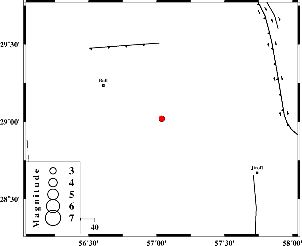
| Location | Lat:29.02 Lon: 57.038 |
| Region | Kerman Province, 48 km South-East of Baft |
Nearest Cities |
|
| 29 km North West of Eslamabad, Kerman Province | |
| 30 km South of Kahnuj, Kerman Province | |
| 33 km South East of Rabar, Kerman Province | |
| 34 km North of Dolatabad, Kerman Province | |
| 37 km South West of Hanza, Kerman Province | |
| Depth | 45 km |
| Agency | |
Faults within 150 km: |
|
| LALEHZAR_F (Length: 52 km) , Distance to epicenter: 54 km | |
| SABZEVARAN_F (Length: 190 km) , Distance to epicenter: 77 km | |
| GOWK_F (Length: 152 km) , Distance to epicenter: 88 km | |
| Number of Phases | 7 |
| RMS | 0.2 |
| Number of Stations | 5 |
| Error in Latitude | >1.8 km |
| Error in Longitude | 4.3 km |
| Error in Depth | 4.5 km |
Download waveform in seisan format
to download seisan software Click here
to access information about IIEES stations Click here
Amplitude | ||||||||
| UID | Agency | Station | Component | Amplitude | Period | Arrival Time | Proccessing Time | Signal Clip |
| 138084 | IIEES | KRBR | N | 154.1 | 0.33 | 2018-10-27 07:59:29 | 2018-10-27 10:49:00 | n |
| 138085 | IIEES | KRBR | E | 215.9 | 0.29 | 2018-10-27 07:59:29 | 2018-10-27 10:49:00 | n |
| 138086 | IIEES | BNDS | E | 101.4 | 0.31 | 2018-10-27 07:59:51 | 2018-10-27 10:49:00 | n |
| 138087 | IIEES | BNDS | N | 88.2 | 0.27 | 2018-10-27 07:59:52 | 2018-10-27 10:49:00 | n |
Phase | ||||||||||||
| Agency | Station | Component | Phase Type | Phase Quality | First Motion | Observed Arrival Time | Time Residual | Loc. Flag | Input Weight | Distance | Azimuth | |
| IIEES | KRBR | Z | Pg | E | 2018-10-27 07:59:13 | -0.01 | y | 110 | 346 | |||
| IIEES | KRBR | N | Sg | E | 2018-10-27 07:59:27 | -0.08 | y | 110 | 346 | |||
| IIEES | BNDS | Z | Pg | E | 2018-10-27 07:59:26 | 0.01 | y | 199 | 206 | |||
| IIEES | BNDS | N | Sg | E | 2018-10-27 07:59:50 | 0.09 | y | 199 | 206 | |||
| IIEES | ZHSF | Z | Pn | E | 2018-10-27 07:59:45 | 0.39 | y | 369 | 79 | |||
| IIEES | GHIR | Z | Pn | E | 2018-10-27 07:59:49 | 0.02 | y | 404 | 259 | |||
| IIEES | CHBR | Z | Pn | E | 2018-10-27 08:00:02 | -0.56 | y | 510 | 137 | |||
کلیه حقوق مادی و معنوی این سایت متعلق به پژوهشگاه بین المللی زلزله شناسی و مهندسی زلزله می باشد.
