خانه / مشخصات زلزله
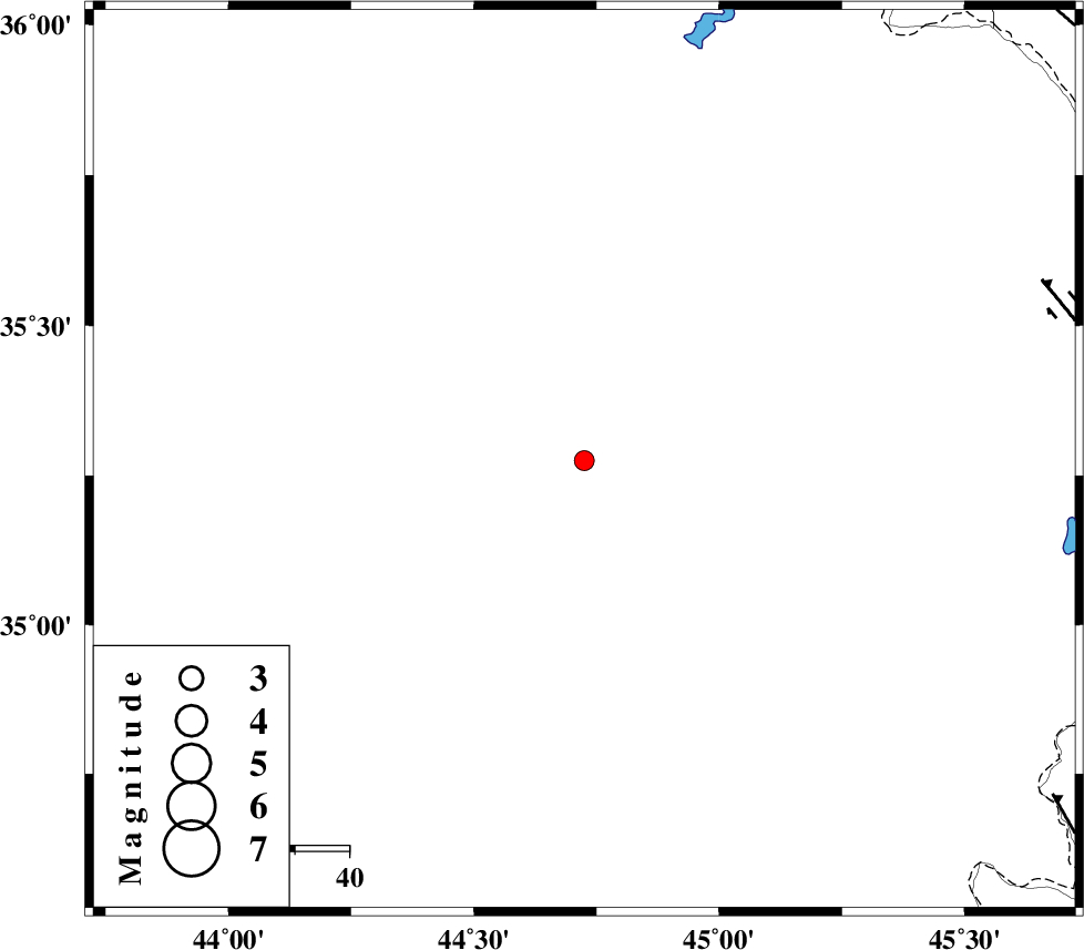
Magnitude |
:2.5 |
| Date & Time (UTC) | 2018-10-27 19:41:46.9 |
| Date & Time (Local) | 1397/8/5 23:11:46.9 |
| Location | Lat:35.275 Lon: 44.725 |
| Region | Iraq, 72 km South-West of Sulaymaniyah |
Nearest Cities |
|
| 72 km South West of Sulaymaniyah, Iraq Province | |
| 108 km North West of Tappeh rash, Kermanshah Province | |
| 114 km North West of Markhil, Kermanshah Province | |
| 114 km South West of Balekeh, Kurdistan Province | |
| 115 km North West of Qasr-E-Shirin, Kermanshah Province | |
| Depth | 14 km |
| Agency | |
Faults within 150 km: |
|
| HZF4 (Length: 492 km) , Distance to epicenter: 91 km | |
| MFF8 (Length: 48 km) , Distance to epicenter: 107 km | |
| PIRANSHAHR_F (Length: 253 km) , Distance to epicenter: 120 km | |
| Number of Phases | 6 |
| RMS | 0.3 |
| Number of Stations | 3 |
| Error in Latitude | >2.6 km |
| Error in Longitude | 7.8 km |
| Error in Depth | 9.3 km |
Download waveform in seisan format
to download seisan software Click here
to access information about IIEES stations Click here
Amplitude | ||||||||
| UID | Agency | Station | Component | Amplitude | Period | Arrival Time | Proccessing Time | Signal Clip |
| 138088 | IIEES | ILBA | E | 27.6 | 0.24 | 2018-10-27 19:42:53 | 2018-10-28 08:21:00 | n |
| 138089 | IIEES | ILBA | N | 30.3 | 0.42 | 2018-10-27 19:43:05 | 2018-10-28 08:21:00 | n |
Phase | ||||||||||||
| Agency | Station | Component | Phase Type | Phase Quality | First Motion | Observed Arrival Time | Time Residual | Loc. Flag | Input Weight | Distance | Azimuth | |
| IIEES | SRSL | Z | Pg | E | 2018-10-27 19:42:06 | -0.57 | y | 122 | 31 | |||
| IIEES | SRSL | N | Sg | E | 2018-10-27 19:42:22 | 0.29 | y | 122 | 31 | |||
| IIEES | ILBA | Z | Pn | E | 2018-10-27 19:42:23 | 0.37 | y | 228 | 143 | |||
| IIEES | ILBA | N | Sg | E | 2018-10-27 19:42:51 | -0.25 | y | 228 | 143 | |||
| IIEES | SNGE | Z | Pn | E | 2018-10-27 19:42:24 | 0.11 | y | 240 | 94 | |||
| IIEES | SNGE | N | Sg | E | 2018-10-27 19:42:54 | 0.04 | y | 240 | 94 | |||
کلیه حقوق مادی و معنوی این سایت متعلق به پژوهشگاه بین المللی زلزله شناسی و مهندسی زلزله می باشد.
