خانه / مشخصات زلزله
Magnitude |
:2.6 |
| Date & Time (UTC) | 2018-10-30 15:04:08.4 |
| Date & Time (Local) | 1397/8/8 18:34:08.4 |
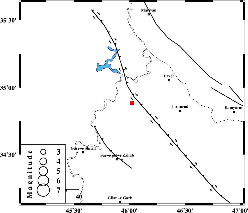
| Location | Lat:34.883 Lon: 46.023 |
| Region | Kermanshah Province, 22 km North-East of Tazehabad |
Nearest Cities |
|
| 6 km North of Dehsheykh, Kermanshah Province | |
| 11 km West of Mazran, Kermanshah Province | |
| 11 km of Bayangan, Kermanshah Province | |
| 22 km South of Markhil, Kermanshah Province | |
| 22 km North West of Qolqoleh, Kermanshah Province | |
| Depth | 15 km |
| Agency | |
Faults within 150 km: |
|
| HZF4 (Length: 492 km) , Distance to epicenter: 6 km | |
| MFF8 (Length: 48 km) , Distance to epicenter: 36 km | |
| PIRANSHAHR_F (Length: 253 km) , Distance to epicenter: 61 km | |
| Number of Phases | 7 |
| RMS | 0.4 |
| Number of Stations | 5 |
| Error in Latitude | >2.5 km |
| Error in Longitude | 4.1 km |
| Error in Depth | 6.3 km |
Download waveform in seisan format
to download seisan software Click here
to access information about IIEES stations Click here
Amplitude | ||||||||
| UID | Agency | Station | Component | Amplitude | Period | Arrival Time | Proccessing Time | Signal Clip |
| 138158 | IIEES | ILBA | E | 98.3 | 0.45 | 2018-10-30 15:04:53 | 2018-10-31 08:43:00 | n |
| 138159 | IIEES | ILBA | N | 120.4 | 0.35 | 2018-10-30 15:04:55 | 2018-10-31 08:43:00 | n |
Phase | ||||||||||||
| Agency | Station | Component | Phase Type | Phase Quality | First Motion | Observed Arrival Time | Time Residual | Loc. Flag | Input Weight | Distance | Azimuth | |
| IIEES | SNGE | Z | Pg | E | 2018-10-30 15:04:29 | -0.05 | y | 123 | 79 | |||
| IIEES | SNGE | N | Sg | E | 2018-10-30 15:04:44 | -0.18 | y | 123 | 79 | |||
| IIEES | ILBA | Z | Pg | E | 2018-10-30 15:04:31 | -0.77 | y | 141 | 173 | |||
| IIEES | ILBA | N | Sg | E | 2018-10-30 15:04:49 | 0.4 | y | 141 | 173 | |||
| IIEES | SRSL | Z | Pg | E | 2018-10-30 15:04:34 | 0.08 | y | 157 | 340 | |||
| IIEES | ASAO | Z | Pn | E | 2018-10-30 15:05:02 | 0.31 | y | 369 | 95 | |||
| IIEES | KHMZ | Z | Pn | E | 2018-10-30 15:05:04 | 0.32 | y | 384 | 108 | |||
کلیه حقوق مادی و معنوی این سایت متعلق به پژوهشگاه بین المللی زلزله شناسی و مهندسی زلزله می باشد.
